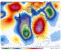
Kinda like my MVIS profitsThis one looks better. Too bad it's a million days away.View attachment 95729
-
Hello, please take a minute to check out our awesome content, contributed by the wonderful members of our community. We hope you'll add your own thoughts and opinions by making a free account!
You are using an out of date browser. It may not display this or other websites correctly.
You should upgrade or use an alternative browser.
You should upgrade or use an alternative browser.
Misc 2021-22 Fall/Winter Whamby Thread
- Thread starter jackendrickwx
- Start date
D
Deleted member 609
Guest
Hold the line ??Kinda like my MVIS profits
smast16
Member
Hows that different than any other day Rodney?Utterly useless for me to come to work today lol
smast16
Member
Oh, don't get fussy with me. You opened that door wide open. You had to know some smartass was gonna slide in and take it!
?
Webberweather53
Meteorologist
I'm working on giving a nice face lift to that teleconnection excel sheet on my website for ya @Ollie Williams (& others that are interested).
Had to develop a little code this morning to handle the daily indices more seamlessly, I added the MJO to it directly (so none of you have to) and I'm putting some additional storms in there I've recently analyzed to enhance it somewhat & give each one a hyperlink so it's easier to do your own quick-look analyses.
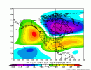
I'm also going to try my hand at developing a daily Tropical Northern Hemisphere (TNH) index (since there's none readily available) and add it into that sheet along with the daily AO, NAO, PNA, WPO, & EPO that are already present (back to 1948) so it that can give us an idea of how strong the Hudson Bay/SE Canada vortex is in conjunction w/ these other features in/around the times of winter storms here in the Carolinas. A strong Hudson Bay/SE Canada vortex (+TNH) has certainly seemed to be an important player for winter storms around here the last decade or so, especially in the deep south (south of I-40).
+TNH 500mb anomaly map

LickWx
Member
Solar noon continuing to get later and later in the day! About 3 weeks and sunsets get later ! Springs rapidly approaching, 2011 epo folks that’s all she wrote !
Ooo, let me know when the data gets added!I'm working on giving a nice face lift to that teleconnection excel sheet on my website for ya @Ollie Williams (& others that are interested).
Had to develop a little code this morning to handle the daily indices more seamlessly, I added the MJO to it directly (so none of you have to) and I'm putting some additional storms in there I've recently analyzed to enhance it somewhat & give each one a hyperlink so it's easier to do your own quick-look analyses.
I'm also going to try my hand at developing a daily Tropical Northern Hemisphere (TNH) index (since there's none readily available) and add it into that sheet along with the daily AO, NAO, PNA, WPO, & EPO that are already present (back to 1948) so it that can give us an idea of how strong the Hudson Bay/SE Canada vortex is in conjunction w/ these other features in/around the times of winter storms here in the Carolinas. A strong Hudson Bay/SE Canada vortex (+TNH) has certainly seemed to be an important player for winter storms around here the last decade or so, especially in the deep south (south of I-40).
+TNH 500mb anomaly map
View attachment 95731
Weirdo ?Oh, don't get fussy with me. You opened that door wide open. You had to know some smartass was gonna slide in and take it!
?
LickWx
Member
Development is good they say. Lol. Reminds me a lot of the environmental catastrophes much of the midwest and northeast faced in the 60s and 70s. Ohhhh got to love good ol greed. Sure does a number on things. @Bham 99
Like poop in your water? well, poop spills in charlottes catawba river are very common, this is one of the larger ones.
15.4 million gallons of poop in this spill ahah

 carolinapublicpress.org
How about this? People are looking at moving away as a result
/cloudfront-us-east-2.images.arcpublishing.com/reuters/5CE2OPLDKBOEBDZURODWDL6AYI.jpg)
 www.reuters.com
How about massive natural gas leaks? One of the largest in the history of the nation actually lol

 spectrumlocalnews.com
And lets not forget worst of all, the coal ash mixed in all the soil in huntersville/ Mooresville making it a cancer hot spot! Developers took it all willingly from duke to fill in roads and add dirt to lots.

 www.nbcnews.com
Like poop in your water? well, poop spills in charlottes catawba river are very common, this is one of the larger ones.
15.4 million gallons of poop in this spill ahah

The Catawba River: A vital artery under mounting pressure
As a rapidly growing population relies on the Catawba River, the pressures generated by human activity threaten the river's ecology and potentially public health.
How about this? People are looking at moving away as a result
/cloudfront-us-east-2.images.arcpublishing.com/reuters/5CE2OPLDKBOEBDZURODWDL6AYI.jpg)
Billionaire Kraft's paper mill causes pollution crisis in South Carolina
A South Carolina paper mill, whose foul smell has triggered more than 30,000 complaints, has become one of the dirtiest polluters in the United States since being acquired by an investment group led by Robert Kraft, the billionaire owner of the New England Patriots football team.
How about massive natural gas leaks? One of the largest in the history of the nation actually lol

Teenagers praised for discovering massive gas leak
Huff high schoolers uncovered it and sounded the alarm on a very large gas leak.
And lets not forget worst of all, the coal ash mixed in all the soil in huntersville/ Mooresville making it a cancer hot spot! Developers took it all willingly from duke to fill in roads and add dirt to lots.

One teen's cancer uncovers a widening mystery in North Carolina town
An area of Mooresville has seen a higher-than-expected rate of thyroid cancer. Susan Wind, whose daughter was diagnosed in 2017, believes there's a connection.
L
Logan Is An Idiot 02
Guest
Happy hour not so happy lol
HugeSnowStick
Member
Sorry double post..
Lol. whatever, I/we hope.

 www.yahoo.com
Lol. whatever, I/we hope.

Farmer's Almanac Predicts an Extra-Long, Extra-Cold Winter with 'Bone-Chilling' Temperatures
The Farmer's Almanac is warning the U.S. to gear up for a wintery season that could be one of "the longest and coldest that we've seen in years"
Sounds good. I confess I haven't done extensive research on which background states the ECMWF is, by a small statistical significance, too progressive or conservative for all of the various indexes, convective systems, tropical forcing mechanisms, stratospheric propagations, or H5 progressions. However, I have seen it, like the GFS, GEFS, CMC, and its own ensemble suite, frequently reverse on all of those things, especially beyond D5 or so.
Webber might be able to tell you that it has a 51% chance of being too progressive in a 2nd year La Nina, but Rain Cold can tell you that the European model is a hunk of junk at the end of its range."

Winter Storm Watch has been issued for Rowan
#FakeNewsWinter Storm Watch has been issued for Rowan
u know it a big dog when Rowan county goes under the gun nobody bats an eye if it’s Wilkes#FakeNews
I must be one of the few people going to work today
D
Deleted member 1449
Guest
Happy Thanksgiving everyone.
By the way--PW is now offering the 6Z and 18Z runs of the EC for paid suscribers. $10 a month for the next three months is probably well worth it.
By the way--PW is now offering the 6Z and 18Z runs of the EC for paid suscribers. $10 a month for the next three months is probably well worth it.
NoSnowATL
Member
Happy Thanksgiving Friends!
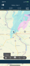
Nice virga! Congrats! ?Happy Thanksgiving View attachment 95778
NBAcentel
Member
If anyone deserves anything u know who it is, certainly not the Queen City
Hey I’m not that old yet! ?Nice virga! Congrats! ?
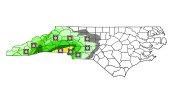
34 right now! Did CJ make this forecastGonna freeze my giblets offView attachment 95763
D
Deleted member 609
Guest
You want to fight?If anyone deserves anything u know who it is, certainly not the Queen City
LickWx
Member
On this wonderful day of thanks ! I give thanks to this wonderful forum and everyone in it . Yes even you Rodney! I love you guys ?
L
Logan Is An Idiot 02
Guest
P
let’s see If the GEFS agrees
Webberweather53
Meteorologist
Happy Thanksgiving folks! I want to say I'm thankful for the long range GFS! It's the only way I get snow!
What’s even sadder, it’s the only way I can get snow too! ?Happy Thanksgiving folks! I want to say I'm thankful for the long range GFS! It's the only way I get snow!
Should I add this to the archive thread?
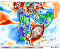
Euro impressive
View attachment 95826
Mr Golf, greatest low key troll on the board! All day, everyday
LickWx
Member
Anybody in concord rn .
NBAcentel
Member
Nope. In kannapolis!Anybody in concord rn .


