I'm sure it may eventually get posted somewhere but I believe the wave that may help form the system off of the SE coast started well into the tropics and followed Laura. It looks like at -72 hrs its near the yucatan, it also looks like some of the trough from Laura is mixed in as well. Good times
-
Hello, please take a minute to check out our awesome content, contributed by the wonderful members of our community. We hope you'll add your own thoughts and opinions by making a free account!
You are using an out of date browser. It may not display this or other websites correctly.
You should upgrade or use an alternative browser.
You should upgrade or use an alternative browser.
Tropical 2020 Atlantic Hurricane Season Discussion
- Thread starter Snowfan
- Start date
Henry2326
Member
9/9.....Everbody got something....


lexxnchloe
Member
Those are massive red highs.
Brent
Member
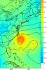
Special TWO on the Caribbean wave we have a race for Nana and Omar with the red circle off the east coast (this is the only invest of the bunch so far with 99L)
UPDATED: Showers and thunderstorms associated with a tropical wave
over the eastern Caribbean Sea are beginning to show signs of
organization. Recent satellite-derived surface winds also indicated
that a broad low pressure system has formed in association with the
wave. Additional development of this disturbance is expected over
the next few days, and a tropical depression could form during the
next couple of days while the system moves moves westward at about
15 mph across the Caribbean Sea. Interests in Jamaica, Honduras,
Belize, Guatemala and Yucatan should monitor the progress of this
disturbance.
* Formation chance through 48 hours...medium...50 percent.
* Formation chance through 5 days...medium...60 percent..png")
UPDATED: Showers and thunderstorms associated with a tropical wave
over the eastern Caribbean Sea are beginning to show signs of
organization. Recent satellite-derived surface winds also indicated
that a broad low pressure system has formed in association with the
wave. Additional development of this disturbance is expected over
the next few days, and a tropical depression could form during the
next couple of days while the system moves moves westward at about
15 mph across the Caribbean Sea. Interests in Jamaica, Honduras,
Belize, Guatemala and Yucatan should monitor the progress of this
disturbance.
* Formation chance through 48 hours...medium...50 percent.
* Formation chance through 5 days...medium...60 percent.
Gulf SSTs as of Fri 8/28, the day after Laura's landfall, showing a good 2-5 F cooling over much of the central and E GOM near and to the right of the track of the centers of Hs Marco and Laura. Before these storms, most of the Gulf was in the 30-31 C range (yellow). But even with this cooling, virtually the entire Gulf is still 82+ F, easily warm enough to sustain a major H that is not crawling plus it will almost immediately begin to warm back up (though maybe not getting to as warm as it was):

Last edited:

Here are my latest thoughts regarding the SE US:
1. Forget the red of course.
2. I'm also not worried about the orange, which will almost definitely stay well to the south of the SE states though I suppose TX (mainly S) still may need to watch.
3. I'm not really concerned about the yellow near 29W.
4. The only one of these four that I think could potentially threaten the SE US way on down the road is the far right yellow wave, which won't even leave Africa for a few days. IF that would even threaten, it wouldn't be for at least 2 weeks or so..say, 9/13-16ish. Also around then, assuming we get the bottom of that cool Canadian high around 9/9-12 (still favored by the 12Z EPS), and IF that aforementioned African wave doesn't actually threaten, we MAY have to worry about something homegrown possibly vaguely similar to Diana of 1984 due to a possibly similar setup to 1984.
Here's the 12Z EPS hour 360 H5/sfc, which shows a restrengthening WAR. Also, note the upward kink in the 1016 mb isobar off of Florida, indicative of locally lower pressure:

Here's the 12Z EPS 360 with TCs. All of those circles are from the aforementioned wave still over Africa:

So, in summary as of now, I'm thinking most likely a quiet Sep 1-12 tropical threat-wise for the SE (hopefully including a nice gift from Canada), followed by a "watch the tropics" period near midmonth.
Last edited:
BHS1975
Member
Para GFS shows 2 storms back to back for the SE.
Sent from my iPhone using Tapatalk
Sent from my iPhone using Tapatalk
Henry2326
Member
The first just pops out of no where....Para GFS shows 2 storms back to back for the SE.
Sent from my iPhone using Tapatalk
.gif")
Strong signal for OTS, at the moment.

Shaggy
Member
Strong signal for OTS, at the moment.
View attachment 47732
18z Gefs has a threat to NC/Virginia at the end. Havent compared it to 12z but it got some attention.
Attachments
That for the most part is just one strong member. OTS for the most part.18z Gefs has a threat to NC/Virginia at the end. Havent compared it to 12z but it got some attention.
18z

12z

Henry2326
Member
Consolidation at its finest.....

Henry2326
Member
00z CMC......in the gulf

BHS1975
Member
Para GFS still wants to run a TC up into the Carolinas at hour 216. Not quite fantasy land anymore.
Sent from my iPhone using Tapatalk
Sent from my iPhone using Tapatalk
Para GFS still wants to run a TC up into the Carolinas at hour 216. Not quite fantasy land anymore.
Sent from my iPhone using Tapatalk
Yeah, I'm pulling the trigger on it this morning on my page.
Henry2326
Member
12z Icon still liking the consolidation of 2 waves into one stronger storm on 9/8......and it stutters in place as if it trapped....

BHS1975
Member
This is a Hazel type setup as any TC caught in that would be hauling butt.

Sent from my iPhone using Tapatalk

Sent from my iPhone using Tapatalk
Yup that look is a problemThis is a Hazel type setup as any TC caught in that would be hauling butt.
Sent from my iPhone using Tapatalk
Dawgdaze22
Member
Yup that look is a problem
Why do all the ensembles gave everything OTS if all the setups look like landfalling storms?
Sent from my iPhone using Tapatalk
BHS1975
Member
Why do all the ensembles gave everything OTS if all the setups look like landfalling storms?
Sent from my iPhone using Tapatalk
You got me cause the Euro agrees with the GFS/para.

Sent from my iPhone using Tapatalk
Azores high is a little east so you have a weakness in the East/Central AtlanticWhy do all the ensembles gave everything OTS if all the setups look like landfalling storms?
Sent from my iPhone using Tapatalk
Henry2326
Member
Still there for Euro and GFS.....but not so much on CMC...Azores high is a little east so you have a weakness in the East/Central Atlantic


Henry2326
Member
Henry2326
Member
Henry2326
Member
Yikes.....12z GFS-P

I don’t understand the “yikes” as regards that 12Z Para GFS as those all recurve well OTS. However, I do think the following 18Z GEFS map deserves a bit of a “yikes” patternwise:

B
Brick Tamland
Guest
Models can't get a handle on anything this far out. Doesn't matter anymore if it's winter storms or hurricanes.
Yeah, definitely a more "yikes" look than some other models, if we get that height maxima over Quebec vs the Netherlands. Things could look a little worse for us in that scenario. Luckily, taking verbatim only one member looks threatening.I don’t understand the “yikes” as regards that 12Z Para GFS as those all recurve well OTS. However, I do think the following 18Z GEFS map deserves a bit of a “yikes” patternwise:
View attachment 47832


Henry2326
Member
12z CMC (2 runs) and 00z Icon (5th run) both consolidate 2 lows.....


Dawgdaze22
Member
12z CMC (2 runs) and 00z Icon (5th run) both consolidate 2 lows.....
View attachment 47846
View attachment 47847
That high pressure keeps it going west too doesn’t it?
Sent from my iPhone using Tapatalk
Henry2326
Member
CMC looks like it will be a recurve.....Icon seems to be running further south, so not sure.....That high pressure keeps it going west too doesn’t it?
Sent from my iPhone using Tapatalk
Henry2326
Member
00z Icon.....spinning them up on 9/8.

0Z GEFS: no member TC hits on the CONUS through entire run. Hard to beat that. But will it verify? We'll see.
Edit: 18Z Para GFS: puts a complete stop to the runs with threatening TCs to the SE.
This amazing season would get that much more amazing if we were to go from the memorable and very busy jly/August to the opposite in Sept. I'm not predicting that at all, but it is in the realm of possibilities given the latest model projections for the first half of Sep. If I get time, I'm going to hunt for La Nina seasons like this.
Edit: I couldn't find anything similar back to 1950. I'll go back further.
Maybe 1893: about the best analog I could find going way back to 1852:
Last edited:
accu35
Member
Let's hope these cold fronts saves us0Z GEFS: no member TC hits on the CONUS through entire run. Hard to beat that. But will it verify? We'll see.
Edit: 18Z Para GFS: puts a complete stop to the runs with threatening TCs to the SE.
This amazing season would get that much more amazing if we were to go from the memorable August to the opposite in Sept. I'm not predicting that at all, but it is in the realm of possibilities given the latest model projections for the first half of Sep. If I get time, I'm going to hunt for La Nina seasons like this.
I thought a hurricane outbreak was coming?0Z GEFS: no member TC hits on the CONUS through entire run. Hard to beat that. But will it verify? We'll see.
Edit: 18Z Para GFS: puts a complete stop to the runs with threatening TCs to the SE.
This amazing season would get that much more amazing if we were to go from the memorable and very busy jly/August to the opposite in Sept. I'm not predicting that at all, but it is in the realm of possibilities given the latest model projections for the first half of Sep. If I get time, I'm going to hunt for La Nina seasons like this.
Edit: I couldn't find anything similar back to 1950. I'll go back further.
Maybe 1893: about the best analog I could find going way back to 1852:
Henry2326
Member
12z Icon

Henry2326
Member
06z GFS Para......not anymore room to add one....a blind squirrel finds a hit occasionally.....meaning something is bound to hit .....

Brent
Member
06z GFS Para......not anymore room to add one....a blind squirrel finds a hit occasionally.....meaning something is bound to hit .....
View attachment 47866
Yeah that's more what I'm talking about ?
Henry2326
Member
If it does that again I'm gonna worry.....hahaYeah that's more what I'm talking about ?
Henry2326
Member
12z CMC
