LickWx
Member
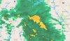
Dang my area looks dry ! At this rate I won’t even get any cold rain to wash away the salt they put on the roads .
Dang my area looks dry ! At this rate I won’t even get any cold rain to wash away the salt they put on the roads .
I love snow biased weather models lmao wish I coulda been around when the DGEX was in
Notice this only happens in winter and it only happens when snow is possible. If this were an entirely rain event with temps in the 40s, there would be no precip gaps anywhere.
We toss!!! It’s nowcasting time, anyways!!! We’ve spent days living and dying by the models, but now that we are close in and they should be the most accurate, let’s throw them all out and go by feel!!! modernweenie
Notice this only happens in winter and it only happens when snow is possible. If this were an entirely rain event with temps in the 40s, there would be no precip gaps anywhere.

I think either the track has been bumped slightly north, or the cold push just is not as good (or both) but it seems the models are showing a lot less snow in northern upstate than yesterday or the the day before unless you are right on the border 2000 ft plus. That's honestly the way it's been 19/20 times with this setup the past 15 years of so. Gotta be 2000 ft or north of the state line and it's a different ball game. I may have to chase to Caeser's Head this weekend, they could do well.Still trying to figure out what changed between this morning and now for GSP to take any and all mention of snow out of my point forecast
We just had one of the wettest years on record in 2020 and like 2” of snow to show for it, and I think just one accumulating snow event. We are bad at snow.Yeah...only we can precip hole in a setup like this. The past 60 days we've needed an ark.
View attachment 63995
I'm at bargaining tomorrow morning will push me to depression

I’m at acceptance now.I'm at bargaining tomorrow morning will push me to depression
View attachment 64007

Yep. Liberate youself and get rid of your towel man, it's way easier!Oh NOW the NAM folds.
Forecast has GSO 1-3, and, me 1 inch.
WelcomeThink I'll be visiting this thread often during the next 48 hrs ☹☹☹
I'm at bargaining tomorrow morning will push me to depression
View attachment 64007
We will seeThe NAMs were a real kick in the....
We will see

That's awesome. I think we see a precip breakdown similar to that but I think the models are underplaying the initial surge.At this point getting rain tomorrow will be considered a victory. How do we not get a winter storm out of this in early Jan. Nobody can screw this up...except us. I won't be happy until 0z run connects the 6-8" blob in PGV up to Roxboro.
View attachment 64040
This reminds me of this...
View attachment 64044
Well I see rah issued a wwa expect 0 or 3+ in wake and Harnett.At this point getting rain tomorrow will be considered a victory. How do we not get a winter storm out of this in early Jan. Nobody can screw this up...except us. I won't be happy until 0z run connects the 6-8" blob in PGV up to Roxboro.
View attachment 64040
This reminds me of this...
View attachment 64044
So much for the Jan. 15th-25th being a great pattern.Ah poop, we’re trending towards this same marginal pattern on the EPS View attachment 64036

I’ll be tickled pretty if we can pull off 1-2” in Durham. Seems a bit high to me, but what do I know. Then again, if I get an inch while my parents in Greensboro get 3”, maybe I won’t be so happy. modernweenie
WTF is this garbage? LMAO.At this point getting rain tomorrow will be considered a victory. How do we not get a winter storm out of this in early Jan. Nobody can screw this up...except us. I won't be happy until 0z run connects the 6-8" blob in PGV up to Roxboro.
View attachment 64040
This reminds me of this...
View attachment 64044
Still probably is, just gonna be a more marginal airmassSo much for the Jan. 15th-25th being a great pattern.
Venus fly trapWTF is this garbage? LMAO.
Initial band too warm, snow to my NW, backend too far south.... someone here has cursed me, don't think I don't know who you are

Don't the same conditions mostly apply to you?
Sent from my iPhone using Tapatalk
That's awesome. I think we see a precip breakdown similar to that but I think the models are underplaying the initial surge.
Saw my name mentioned. Your right this is not like me. I will go ahead and make it a Ga storm. ❄Nope. Going NE from there. This one is not a GA storm.
I'm really hating the south trend. It's going to cut down on totals for me eastward to @metwannabe