Review of the Feb26,-27 2004 Macdaddy ULL:


Review of the Feb26,-27 2004 Macdaddy ULL:


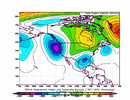
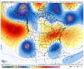
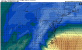
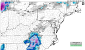
Piedmont isn't relying totally on top-down cooling for snow to reach the ground, as seen here.View attachment 132476View attachment 132477
I really don't understand KBCB sometimes. I can understand not mentioning snow at this time. But they are even pessimistic about precipitation period.NWS RKE not biting yet.
.LONG TERM /SUNDAY THROUGH TUESDAY/...
As of 220 AM EST Wednesday...
Drier and warmer for early next week...
On Sunday the closed low moving across the Deep South will skirt
our area to the south and move offshore Monday. This system
presents the best chance for precipitation over the next 7 days,
although most of the rain will mainly be over NC and eastern
VA.
There is colder/drier air to the north with the push from new england. 35 knot jet at 925mb is helping to cool the piedmont. It's the only reason they're getting snow on the GFS... if you can't see that, then I dunno what to tell you. We can argue how "legitimate cold" it is I guess. But it's clearly colder than locations west of the apps.No. All of that cooling is being driven by lift + dynamical cooling aloft from heavy precipitation. There's no legitimate cold air anywhere in sight for this upper low to tap into.
Despite all the pretty 10:1 SLR maps from the GFS suite, I'm still having a hard time seeing how this works out in a big way for areas outside the mountains. I still can see some snow for sure, but I think it's going to be a very sloppy, low-end event in the best case scenario here.
I can't find any really good examples where an upper low totally cut off from the mean flow like this & crushed the piedmont + coastal plain. Cut off upper lows are fine but you usually still need at least a little injection of cold air continuing to funnel into the ULL.
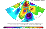
This is a composite of 15 upper low cases I could find since the 1950s that actually worked out for folks east of the mountains. Notice the ridge anomaly to the west of the cut-off over the Upper Midwest & southern Canada helping to keep some injection cold air going into the base of this cut-off upper low.
View attachment 132471
Notice in our setup however, the ridge completely comes over the top and basically shuts off the tap of cold air from the north & you're having to rely entirely on precipitation rates to cool the column to freezing. If you're hoping for a big snow outside the mountains, this pattern isn't a good one for setups like these.
View attachment 132470
There is colder/drier air to the north with the push from new england. 35 knot jet at 925mb is helping to cool the piedmont. It's the only reason they're getting snow on the GFS... if you can't see that, then I dunno what to tell you.
I'd disagree because every push south with the confluence over new england has lead to a shift south in temperature isotherms for the northern piedmont of NC. All of that helps even at mid levels.. colder 850's are good.That cold air over New England is not getting advected into the upper low. This cold air is leftovers from the midwest & OH valley.
I'd disagree because every push south with the confluence over new england has lead to a shift south in temperature isotherms for the northern piedmont of NC. All of that helps even at mid levels.. colder 850's are good.
Nobody is going to argue with you that this isn't a marginal setup with no decent cold air source. But it's the best opportunity we've had all year... we'll track and hope for the best. Mountains seem like a lock for a solid hit either way.
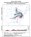
Spot on and that's what worry's me webb is where having to rely on surface temps to cool enough during precip to either make it or break it. Someone is going to get plastered while a few miles down the road it's a cold rain. I'd only be confident at this point if I was above 2500".Despite all the pretty 10:1 SLR maps from the GFS suite, I'm still having a hard time seeing how this works out in a big way for areas outside the mountains. I still can see some snow for sure, but I think it's going to be a very sloppy, low-end event in the best case scenario here.
I can't find any really good examples where an upper low totally cut off from the mean flow like this & crushed the piedmont + coastal plain. Cut off upper lows are fine but you usually still need at least a little injection of cold air continuing to funnel into the ULL.
This is a composite of 15 upper low cases I could find since the 1950s that actually worked out for folks east of the mountains. Notice the ridge anomaly to the west of the cut-off over the Upper Midwest & southern Canada helping to keep some injection cold air going into the base of this cut-off upper low.
View attachment 132471
Notice in our setup however, the ridge completely comes over the top and basically shuts off the tap of cold air from the north & you're having to rely entirely on precipitation rates to cool the column to freezing. If you're hoping for a big snow outside the mountains, this pattern isn't a good one for setups like these.
View attachment 132470
Don't derail this discussion guys please. Take it to whamby or PM one another, this personal "I know better than you" stuff needs to stop, it's not healthy discussion and it's not healthy for the site.
Thanks
They are always wait until last second campers, I remember one system we had that I myself thought we would get 2-4 inches and they had a trace for us. Then I was right and they were late to put out an advisory.NWS RKE not biting yet.
.LONG TERM /SUNDAY THROUGH TUESDAY/...
As of 220 AM EST Wednesday...
Drier and warmer for early next week...
On Sunday the closed low moving across the Deep South will skirt
our area to the south and move offshore Monday. This system
presents the best chance for precipitation over the next 7 days,
although most of the rain will mainly be over NC and eastern
VA.

Actually as the argument between two posters continues, it does derail the discussion... sometimes it best to make a point then move on from it. It isn't a competition in here.No one is derailing this discussion.
Actually as the argument between two posters continues, it does derail the discussion... sometimes it best to make a point then move on from it. It isn't a competition in here.
The ole Highway 25 cutoff is brutal. I've said for a long time that mountains of SC are nice to get some big snows like Caesar's Head but I still stand on that you want to live north of 85 and east of highway 25 in SC if you want to continually have good chances for snow or frozen in general. Oconee and Pickens get hit hard with downslope and are always fighting warm air in the valley as shown by that map. Routinely Eastern Greenville, Spartanburg, and Cherokee counties hold on CAD longer, tend to fight off warm noises more, and can get hit with downslope, it's not nearly as pronounced.The 925mb jet can crush the hopes and dreams of Oconee and Pickens county as seen here with that God awful snow hole. I've seen it happen before, but it's not set in stone yet. We need a further west track to avoid getting the turn towards NNE winds at this level. Not only does it cut off the Cold air feed from the Northeast, but as the winds turn more northerly we start downslope warming.
A track more like the ICON keeps that from happening until after the precip pulls out though.
View attachment 132481View attachment 132482
We’re in a crap spot for sure. It is what it is. I’ve come to terms with it over the last 30 years. We’ve actually done pretty well the last 3-4 years. We’re due for screw job.The ole Highway 25 cutoff is brutal. I've said for a long time that mountains of SC are nice to get some big snows like Caesar's Head but I still stand on that you want to live north of 85 and east of highway 25 in SC if you want to continually have good chances for snow or frozen in general. Oconee and Pickens get hit hard with downslope and are always fighting warm air in the valley as shown by that map. Routinely Eastern Greenville, Spartanburg, and Cherokee counties hold on CAD longer, tend to fight off warm noises more, and can get hit with downslope, it's not nearly as pronounced.
I'd disagree because every push south with the confluence over new england has lead to a shift south in temperature isotherms for the northern piedmont of NC. All of that helps even at mid levels.. colder 850's are good.
Nobody is going to argue with you that this isn't a marginal setup with no decent cold air source. But it's the best opportunity we've had all year... we'll track and hope for the best. Mountains seem like a lock for a solid hit either way.
Unless you are literally right on the mountains on the border in that county, it's extremely hard in Oconee and Pickens and even Anderson north of 85. Cold air just seems to bleed better east of Hwy 25. I've watched changeovers take place routinely bleed down western Spartanburg and Eastern Greenville counties. 0Z GFS from last night actually showed that for a frame. I never expect a global model to pick up on the microclimates, but it's just funny that the look you see below in SC is usually where the changeover starts and spreads east and that's why places like Campobello, Landrum, Greer, Inman, Fingerville do really well when we can get it to snow (on top of the elevation plusses in these towns).We’re in a crap spot for sure. It is what it is. I’ve come to terms with it over the last 30 years. We’ve actually done pretty well the last 3-4 years. We’re due for screw job.

Super tight a normal as you mentioned. In Rutherford places like caroleen down 120 back to 221 to Rutherfordton always has a tight line between the good the bad and the ugly.Unless you are literally right on the mountains on the border in that county, it's extremely hard in Oconee and Pickens and even Anderson north of 85. Cold air just seems to bleed better east of Hwy 25. I've watched changeovers take place routinely bleed down western Spartanburg and Eastern Greenville counties. 0Z GFS from last night actually showed that for a frame. I never expect a global model to pick up on the microclimates, but it's just funny that the look you see below in SC is usually where the changeover starts and spreads east and that's why places like Campobello, Landrum, Greer, Inman, Fingerville do really well when we can get it to snow (on top of the elevation plusses in these towns).
Congrats Augusta
Euro coming on board.
Sent from my iPhone using Tapatalk

Yes sir. Couldn't of said it better my self. Hopefully will be on the good side of this one. Your elevation will help you a little more than me in this one. It will be close if we can get the intense heavier rates to pull the cold air down from aloft. Least we have a shot at something the way things have been.Super tight a normal as you mentioned. In Rutherford places like caroleen down 120 back to 221 to Rutherfordton always has a tight line between the good the bad and the ugly.
Actually not that far south, I don't think I'm going to like this NAM run..... on to the next one lolFwiw, sure looks like the NAM going to close this off sooner, way south, but too soon for some of us that's for sure. Really would love to see the Ukie and Euro hold this longer on the 12z runs
