-
Hello, please take a minute to check out our awesome content, contributed by the wonderful members of our community. We hope you'll add your own thoughts and opinions by making a free account!
You are using an out of date browser. It may not display this or other websites correctly.
You should upgrade or use an alternative browser.
You should upgrade or use an alternative browser.
Cad Wedge NC
Member
Possibly seeing sleet and reporting it incorrectly.Someone just posted that it's snowing in South Catawba NC??
- Joined
- Jan 23, 2021
- Messages
- 4,602
- Reaction score
- 15,197
- Location
- Lebanon Township, Durham County NC
As in southern Catawba? I could’ve swore I saw some flakes my parents near Cherryville. Their house sits at 1010 ft so maybe?Someone just posted that it's snowing in South Catawba NC??
That 37 in S MS is pretty impressive.
Last edited:
Showmeyourtds
Member
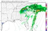
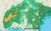
Maybe it’s one of those deals where there’s some kind of energy transfer to a new LP off the Atlantic coast, thus it essentially eroding the back end of the precipitation.So if the short range models are correct, that massive backend precip is going to basically die out and be light showers when it rolls through here? Based on the current radar, I shouldn't see that much more rain at all.
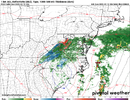
HRRR
View attachment 133060
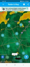
Current Radar
View attachment 133062
Darklordsuperstorm
Member
Snow or no snow. This is a hell of a system. The wind has been wild all day. Very dynamic upper level low.
40.5/38.7 had a brief period of heavy rain/wind mixed with some sleet a few mins ago. I could hear it pelting against my bedroom window, but I stepped outside for a moment to verify it. It’s tapering off now.
Where is this at? Location??sleet/ice sticking on cars and grounds
Maggie valleyWhere is this at? Location??
- Joined
- Jan 2, 2017
- Messages
- 1,566
- Reaction score
- 4,279
Some areas were in the mid 50's at the onset in Miss. Now nearly a 20 degree drop. Thats pretty impressive
Have fallen to 46/40 DP sux!
Drizzle Snizzle
Member
Surprised I don't see any pinks or whites on radar in Southern Mississippi. I figured with temps around 36 there may be some mixing.
Let’s see some pics Accu ? , for those of us looking at rain and 43.
gawxnative
Member
Still dropping... 38.6/36.4 ENE 16G31
Drizzle Snizzle
Member
Looking at a cam of Waynesville which is close to where Accu is, looks like just wet conditions.Let’s see some pics Accu ? , for those of us looking at rain and 43.

Waynesville, NC - Resort Cams
Located atop the Mast General Store in Waynesville, NC, this webcam gives a great look at the downtown area of this popular Smoky Mountain town.
Ron Burgundy
Member
I know, right? And gusts well over 50??what part of Atlanta are you in. I'm not seeing any reporting stations below 40.
SnowwxAtl
Member
Where is the low now?
Drizzle Snizzle
Member
He might be on top of Stone Mountain.I know, right? And gusts well over 50??
My family and I spend a lot of time in that area and I can tell you, I’ve seen a number of times that Waynesville will have rain while Maggie Valley has frozen precip.Looking at a cam of Waynesville which is close to where Accu is, looks like just wet conditions.

Waynesville, NC - Resort Cams
Located atop the Mast General Store in Waynesville, NC, this webcam gives a great look at the downtown area of this popular Smoky Mountain town.www.resortcams.com
Drizzle Snizzle
Member
Yeah it looks like Maggie Valley is a few hundred feet higher.My family and I spend a lot of time in that area and I can tell you, I’ve seen a number of times that Waynesville will have rain while Maggie Valley has frozen precip.
Main action will be early tomorrow morning and last through late afternoonLooking at a cam of Waynesville which is close to where Accu is, looks like just wet conditions.

Waynesville, NC - Resort Cams
Located atop the Mast General Store in Waynesville, NC, this webcam gives a great look at the downtown area of this popular Smoky Mountain town.www.resortcams.com
- Joined
- Jan 2, 2017
- Messages
- 1,566
- Reaction score
- 4,279
Kind of what I was thinking. Ive searched all over and haven't found any reports of sleet or mixing.Surprised I don't see any pinks or whites on radar in Southern Mississippi. I figured with temps around 36 there may be some mixing.
I hear thunder and see lightning southish of me. Probably Athens.
Showmeyourtds
Member
…that ain’t Atlanta…He might be on top of Stone Mountain.
Even then, I doubt you get that much of a temperature variance there with it being only an additional 700 ft or so higher than most of the surrounding areas
HugeSnowStick
Member
The air port had a gust to 47 ronnie and I am in a location that is usually colder,,Capice???I know, right? And gusts well over 50??
He might be on top of Stone Mountain.
Temp ranges from weather stations around northern Georgia.
800-1500' - 39-43F
1500-3000' - 35-38F
3000'+ - 33-34F
Just started as snow!
Is what I would be saying if it were colder instead 50 and rain
Is what I would be saying if it were colder instead 50 and rain
Jan88
Member
Thunder here alsoI hear thunder and see lightning southish of me. Probably Athens.
Ron Burgundy
Member
What part of Atlanta are you in?The air port had a gust to 47 ronnie and I am in a location that is usually colder,,Capice???
Drizzle Snizzle
Member
Looks like flakes are falling on the Waynesville, NC cam.
…that ain’t Atlanta…
Even then, I doubt you get that much of a temperature variance there with it being only an additional 700 ft or so higher than most of the surrounding areas
Its always interesting to see how much elevation is affecting temperatures in given weather situations, it definitely varies. With the kind of wind we are having, temperatures at similar elevations should be within .5 degrees of each other or less. Anything outside that range is certainly incorrect. There are two home weather stations on Sweat Mountain, 2.8 miles north of me, at around 1500-1600', both are 38.1F, 2.5F colder then me at 1135'.
His fridge because I have elevation and its still 39f here and 70 miles north,What part of Atlanta are you in?
Ron Burgundy
Member
Then tell us where you are at 36F with 50+ mph wind gusts. We are dying to know.being North does not always cut it sister, look at southern MS???
accu35
Member
Banter please, this thread is borderline disaster

