-
Hello, please take a minute to check out our awesome content, contributed by the wonderful members of our community. We hope you'll add your own thoughts and opinions by making a free account!
You are using an out of date browser. It may not display this or other websites correctly.
You should upgrade or use an alternative browser.
You should upgrade or use an alternative browser.
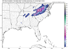
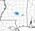
Bet ya money that bright red near Pineville/SC line is full of sleet
- Joined
- Jan 2, 2017
- Messages
- 1,566
- Reaction score
- 4,279
Down to 39 and mostly rain but there's def some flakes mixing in.
Six Mile Wx
Member
SnowwxAtl
Member
This wind is so crazy!!!
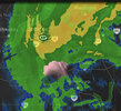
Place your bets View attachment 133050
$100 It’s snows 2-11 inches

Sent from my iPhone using Tapatalk
rburrel2
Member
Weather stations south of Jackson, ms have dropped to 36/37 and continue to crash… snow may be starting to reach the ground there.
Phil Connors
Member

The temps In Mississippi have fallen to mid 30s under this intense precip shield since 330. Just incredible that this environment is so much of a
Hindrance. Literally 2-3 degrees less across the entire south and we’d be talking 5-10” from
Southern Ms to bham
To Atlanta. Unreal
Sent from my iPhone using Tapatalk
rburrel2
Member
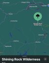
Problem with Maggie valley is it’s farther away from the cold pool. Will be raining there and snowing to the south for a while. They may still get smoked soon after though.Place your bets View attachment 133050
NBAcentel
Member
Rain/sleet
Drizzle Snizzle
Member
looks like 36-38 close to Hattiesburg and just north.Weather stations south of Jackson, ms have dropped to 36/37 and continue to crash… snow may be starting to reach the ground there.
Rainforrest
Member
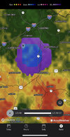
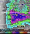
Yep that section of Transylvania and southern gonna get it.Pisgah jackpot. Somewhere between Maggie and Brevard gonna jackpot View attachment 133048
Temps dropped from 48 to 43 currently in the past 2 hours here in Birmingham
SWVAwxfan
Member
That would be quite a crush job for my area if it verifies.Pisgah jackpot. Somewhere between Maggie and Brevard gonna jackpot View attachment 133048
Cad Wedge NC
Member
75 percent sleet here some wet snow as well.
- Joined
- Jan 5, 2017
- Messages
- 3,775
- Reaction score
- 5,985
Left the house for some grub an hour ago, it was 45 now 42. Wind is intense!
Actually hearing a little bit of sleet ping up against the window… wasn’t really expecting that this evening. 46/35 right now
SWVAwxfan
Member
42/16 now.
Six Mile Wx
Member
rburrel2
Member
40.8/38.8 rain with a stiff NE wind. I was outside about 15 mins ago that gust of wind at the time was intense.
Edit: 40.6/38.7
Edit: 40.6/38.7
accu35
Member
sleet/ice sticking on cars and grounds
rburrel2
Member
A few stations down to 35.0 now in Southern MS... Seems like about one rural county has probably flipped to chicken feathers and is getting plastered at the moment. Hrrr not joking.
Drizzle Snizzle
Member
looks like near Collins, MS in Covington CountyA few stations down to 35.0 now in Southern MS... Seems like about one rural county has probably flipped to chicken feathers and is getting plastered at the moment. Hrrr not joking.
accu35
Member
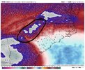
Looks like the axis on the ULL is further east on the 0z HRRR run. If so watch out!!
This does seem like a system that could drop a few splotches of accumulating snow if you’re one of the lucky few that get under the best rates/dynamics. Thinking something like April 2019, etc. But for most of us, it’ll be pain either way.
HugeSnowStick
Member
Not liking the rain falling g on cam in Waynesville NC at almost 2800ft elevation
Branch
Member
Ron Burgundy
Member
HugeSnowStick
Member
My power just went out,,,gusts well over 50,,,----. I am sitting at 36.2...
Yeah… it’s going to be wherever that core of coldest upper passes over and if there is enough precip.This does seem like a system that could drop a few splotches of accumulating snow if you’re one of the lucky few that get under the best rates/dynamics. Thinking something like April 2019, etc. But for most of us, it’ll be pain either way.
Drizzle Snizzle
Member
what part of Atlanta are you in. I'm not seeing any reporting stations below 40.My power just went out,,,gusts well over 50,,,----. I am sitting at 36.2...
Attachments
njbarrineau
Member
accu35
Member
Sitting at 39
- Joined
- Jan 2, 2017
- Messages
- 1,566
- Reaction score
- 4,279
Someone just posted that it's snowing in South Catawba NC??

