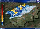
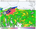
GSP early morning discussion:
.SHORT TERM /SATURDAY THROUGH SUNDAY NIGHT/...
As of 410 AM Friday: The complex weather system is still on track
for the area Saturday through Sunday night. Positively tilted
trough
and closed upper low starts along the TX/LA border, moves east along
the Gulf Coast Saturday, to the Central Savannah River Valley
Saturday night, to the
NC/SC coastal border Sunday, and off the
Cape
Hatteras coast Sunday night taking a somewhat negative
tilt through
time, but not as much as the previous model runs. At the surface,
high pressure tries to build in before the surface low associated
with the upper low moves into
srn GA on Saturday. The low reaches
the
NC/SC coastal border Saturday night. The low then moves along
the
NC coast Sunday before moving off shore Sunday night.
Moisture and precip begin to quickly ramp up from north to south by
Saturday afternoon as deep
moisture moves in on the east and
southeast
flow and forcing begins. Precip spreads across the area
Saturday night on the warm conveyor belt ahead of the upper low.
Precip continues Sunday morning as the deformation zone associated
with the upper low moves over. Precip then tapers off from south to
north as the zone moves away from the area. Precip ends Sunday night
as the system moves farther away. As previously mentioned, this set
up can be good for wintry precip, but the lack of cold air at onset,
even with an in-situ
CAD is the limiting factor.
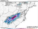
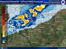
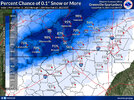
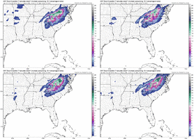
There continues to be good agreement on rain changing to snow across
the mountains. There even appears to be the potential for a brief
period of snow outside of the mountains late Saturday night/early
Sunday morning as the warm conveyor belt moves out and the freezing
level gets close to the surface. The
NC Foothills would be in a
transition zone where some accumulating snow is possible. The
GFS
has joined the
NAM showing the potential for a weak warm nose before
the deeper cold air moves in. Don`t expect any freezing rain, but
could be a transition to or mix with sleet before snow takes over.
Do have some sleet in the forecast over portions of the area, but
that doesn`t look to be significant for now. There is still some
uncertainty in the forecast, so after collaboration with neighboring
forecast offices, will hold off on a
watch for another cycle. If
trends hold, then a
Watch would be needed for the
NC mountains later
today. Of course, only small changes in surface temps or temp
profiles would potentially have a big change in the forecast.
Winds will also be a concern given the strength of the low pressure
systems. There`s also the potential for gravity waves to help force
stronger winds to the surface. Wind Advisories would be possible
outside of any Winter products. Again, this is uncertain and a
change in the forecast is possible.


