-
Hello, please take a minute to check out our awesome content, contributed by the wonderful members of our community. We hope you'll add your own thoughts and opinions by making a free account!
You are using an out of date browser. It may not display this or other websites correctly.
You should upgrade or use an alternative browser.
You should upgrade or use an alternative browser.
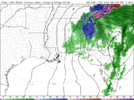
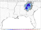
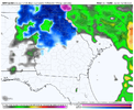
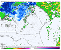
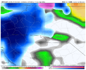
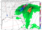
NAM is c o o k i n g.. this run is about to be the best yet for NGA/ATL!
I would have to imagine that that’s going to move north and a bit east and be perfect for upstate sc.
iGRXY
Member
Ron Burgundy
Member
Dang. Bullseye ~50 hours out. Feels…weird.
iGRXY
Member
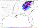
Sizable shift east. Want to see that continue
rburrel2
Member
- Joined
- Jan 5, 2017
- Messages
- 3,775
- Reaction score
- 5,985
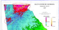
There is a max area of snowfall showing up now on almost all models. It is between Buchanan, Cedartown, Rockmart and Dallas, GA. NAM shows them switching over to snow earlier than other areas, around 10 pm Saturday. If that holds, they could see 5" to 6" maybe more. It's where the elevation jumps up a bit (over 1,000 ft and probably 1,100 to 1,200 on ridges). I'm at 850 so if it switches here, it's probably going to be one of the last spots in my area. I'll enjoy my digital hypothetical NAM'ing for a few more minutes!
LovingGulfLows
Member
- Joined
- Jan 5, 2017
- Messages
- 1,499
- Reaction score
- 4,100
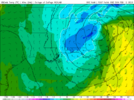
The upper level low is deepening so much its bringing down the troposphere on the NAM. Its really creating it’s own cold air. -4/-5c 850s in the heart of the storm. With those cold mid level temps and heavy precip, thats no doubt gonna be snow.
Alert: Being more adamant about removing banter from this thread. No offense.
Banter thread here: https://southernwx.com/community/threads/winter-22-23-whamby-and-banter-thread-part-2.1158/
Banter thread here: https://southernwx.com/community/threads/winter-22-23-whamby-and-banter-thread-part-2.1158/
rburrel2
Member
rburrel2
Member
I didn't see until now but the 18z JMA made a huge shift south and east at 18z when compared to 12z. Also colder at 850mb.
LukeBarrette
im north of 90% of people on here so yeah
Meteorology Student
Member
2024 Supporter
2017-2023 Supporter
Yes this run brought me from 0 to 7, certainty a huge differenceSizable shift east. Want to see that continue
D
Deleted member 609
Guest
How do we ? this east more? Speed it up? Impossible at this point?
- Joined
- Jan 23, 2021
- Messages
- 4,602
- Reaction score
- 15,197
- Location
- Lebanon Township, Durham County NC
It’s a delicate dance for now between it being strong enough to create dynamic cooling and being weak enough that it doesn’t go due northHow do we ? this east more? Speed it up? Impossible at this point?
lexxnchloe
Member
Would be awesome to see in a such a warm winter that these areas get a big snow. What is the Atlanta record for Feb snows?
There is a max area of snowfall showing up now on almost all models. It is between Buchanan, Cedartown, Rockmart and Dallas, GA. NAM shows them switching over to snow earlier than other areas, around 10 pm Saturday. If that holds, they could see 5" to 6" maybe more. It's where the elevation jumps up a bit (over 1,000 ft and probably 1,100 to 1,200 on ridges). I'm at 850 so if it switches here, it's probably going to be one of the last spots in my area. I'll enjoy my digital hypothetical NAM'ing for a few more minutes!
There is a lot of truth to this, and I've seen it so many times.
Snow_chaser
Member
Yes, a few years ago when this area of western Georgia got a foot of snow in that first week of December. I’m sure a totally different setup, but they weren’t calling for anything like that. Plus we’ve been known to get a decent snow or ice event on Super Bowl weekend lol
Drizzle Snizzle
Member
Very true. I think they were saying like an inch or two and then some areas got over 10". Seems like many of the best snows in GA kind of came as a surprise.Yes, a few years ago when this area of western Georgia got a foot of snow in that first week of December. I’m sure a totally different setup, but they weren’t calling for anything like that. Plus we’ve been known to get a decent snow or ice event on Super Bowl weekend lol
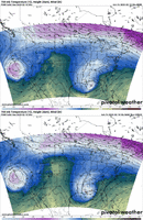
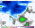
00z GFS


NBAcentel
Member
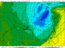
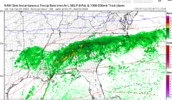
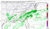
850mb Low and Temperatures on the GFS


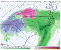
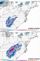
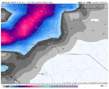
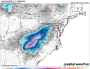
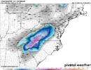
This would continue charlottes record of having measurable snow every year since records have been kept. I’m here for it. I’ll also be in Winston Salem and I’ll support this upper level low snow chaseNot mad at it, overall slightly better run the 18z, with slightly more snow east of the mountains View attachment 132862View attachment 132863View attachment 132864
ATLwxfan
Member
Dang. Bullseye ~50 hours out. Feels…weird.
Squinting for flakes in the cold rain for many of us. Feast or famine.
Sent from my iPhone using Tapatalk
Areas in ETN went from nothing to over a foot in one run rotfl
accu35
Member
Maggie Valley should do good with that lookNot mad at it, overall slightly better run the 18z, with slightly more snow east of the mountains View attachment 132862View attachment 132863View attachment 132864
Showmeyourtds
Member
Think I may chase this one a little. I'm willing to put my dog Ellie in the car and drive 30-40 miles for 6" if it doesn't set up nicely imby...This would continue charlottes record of having measurable snow every year since records have been kept. I’m here for it. I’ll also be in Winston Salem and I’ll support this upper level low snow chase
SimeonNC
Member
I know ensembles don't matter at this point but the GEFS is pretty good for the 77 corridor westward.
severestorm
Member
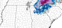
Brad's forecast map


LukeBarrette
im north of 90% of people on here so yeah
Meteorology Student
Member
2024 Supporter
2017-2023 Supporter
MMFS is coming in now.. already getting decent snow in the mountains by 2z! Shaping up to be a nice run.


ATLwxfan
Member
View attachment 132867
Old mean
View attachment 132868
New mean
Perhaps increased confidence in heavy snow making it into SW VA
I know we should be looking at mesoscale models right now but somehow the GEFS feels right.
Sent from my iPhone using Tapatalk

