- Joined
- Jan 23, 2021
- Messages
- 4,602
- Reaction score
- 15,197
- Location
- Lebanon Township, Durham County NC
This might finally be the time that Asheville is the jackpot in the entire mountains
I somehow doubt any forecaster is behind this. Probably completely computer generated based on some or whatever model they use.TWC is really conservative on the Blairsville forecast. Guess they are not buying into a stronger system?
View attachment 132800
Not always and especially will ULLs.In general if Atlanta area mentions snow, NC Piedmont does good. So I'm loving all the trends for GA!
Nope that will never happen downslope city. Now Hendersonville back toward Brevard and Highlands is where the jackpot will be. Take it to the bank.This might finally be the time that Asheville is the jackpot in the entire mountains
Do you think Brevard will do better than Waynesville ?Nope that will never happen downslope city. Now Hendersonville back toward Brevard and Highlands is where the jackpot will be. Take it to the bank.
Not a very good model if that's true. I haven't seen any not give at least some accumulation for that area or yours.I somehow doubt any forecaster is behind this. Probably completely computer generated based on some or whatever model they use.


Yeah cause in the End no one can predict what ULLs will do. They have minds of their own and can do crazy stuff. Even the Models will not pick up on every detail. Just sit back Sunday morning and watch the Fun begin!How about let's all agree to just let people enjoy whatever they find to enjoy regarding this possible storm.. this is a forum for everyone and I for one just like the child that snow brings out of people!!
Idk Waynesville has better elevation but Brevard is going to get more precip due to lift from BR. Highlands is where I'd go best of both u got elevation and lift for enhanced rates.Do you think Brevard will do better than Waynesville ?

RGEM isn’t that good so I’m not worriedRGEM probably closest to the reality of what we’ll see in NGa
Sent from my iPhone using Tapatalk
18z GFS has roughly the same snow footprint as 12z

The model that has been on an island while others are in a general direction favoring N GA, that doesn't seem to grasp dynamic cooling, and could very much be off might not be reality. Reality will set in when we verify and know if it was wrong or right.RGEM probably closest to the reality of what we’ll see in NGa. Temps are
Sent from my iPhone using Tapatalk


What exactly is the reason for the slow movement?? You wouldn’t expect that with no downstream blocking. Is the low in the 50/50 region really working that well?I find it noteworthy that the forecasted forward speed of the 500Mb low crawls across Ga. and S.C. It actually takes the better part of 24 hours to move from the SW Ga. border to the S.C. coast with a near stall over NE Ga. for 6-9 hours.
As I alluded to in an earlier post, the potential is there for this one to really overperform IF the NAM is right on the thermals.
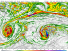
09Z:
View attachment 132816
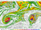
18 hours later!
View attachment 132817
It’s cutoff.What exactly is the reason for the slow movement?? You wouldn’t expect that with no downstream blocking. Is the low in the 50/50 region really working that well?
My read is it's a result of its complete detachment from the northern stream, and a response to the deepening coastal surface low.What exactly is the reason for the slow movement?? You wouldn’t expect that with no downstream blocking. Is the low in the 50/50 region really working that well?
I remember that satellite picture the day after that storm and you could see that strip that of bare ground while areas on either side had a few inches. I know that had to be frustratingI’m in Lenoir and feel like the adjacent foothills are bordering on an impactful event so close. Probably won’t know until go time. These upper lows always surprise you. March 09 was sickening in this area
Sent from my iPhone using Tapatalk
The 3K NAM is much further north into Alabama with the 500Mb low than the 12K NAM.


I’m in Lenoir and feel like the adjacent foothills are bordering on an impactful event so close. Probably won’t know until go time. These upper lows always surprise you. March 09 was sickening in this area
Sent from my iPhone using Tapatalk
What effect does this haveThe 3K NAM is much further north into Alabama with the 500Mb low than the 12K NAM.


She's a fickle little beast.
Possibly much less snow because youre starting off warmer in the atmosphere.What effect does this have
It’s cutoff.
The cliff note is the further west the track of the 500Mb low tracks, the further west the best snow will fall. A boulder of salt on both models at this range is in order too.What effect does this have
especially the 3k being at the end of its range but it is really good at this warm nose stuff.The cliff note is the further west the track of the 500Mb low tracks, the further west the best snow will fall. A boulder of salt on both models at this range is in order too.
