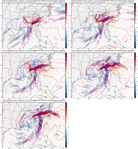
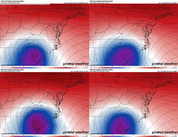
Pretty substantial shift south with the 850 low on the Euro as well
-
Hello, please take a minute to check out our awesome content, contributed by the wonderful members of our community. We hope you'll add your own thoughts and opinions by making a free account!
You are using an out of date browser. It may not display this or other websites correctly.
You should upgrade or use an alternative browser.
You should upgrade or use an alternative browser.
yeah thats the catch 22 with a quicker, weaker ull50 miles as the crow flies. Have to be careful though to make sure the shift doesn't come from a lot of weakening which will zap the dynamic cooling.
ATLwxfan
Member
I will bet my life a fraction of that accumulates
Sent from my iPhone using Tapatalk
One more of those and suddenly we back
Elevation is key imo look at Western Burke Eastern McDowell countys the 6 in line is where 1400" starts.
rburrel2
Member
True, but even before the cold pool moves in the NAM is way stronger with 925mb cold air supply. If you click on soundings pretty much everybody is well below freezing at 900-950mb Saturday night even with a well above freezing raging warm nose above that.If I were in your shoes the only thing that would really concern me about the NAM is that it's artificially collapsing the cold from the top down by being over amplified and too heavy with precip. That may not be the case but keep it in mind
If that low level cold air feed is real on the NAM it has big implications for snow reaching the ground and sticking when the cold pool moves over head Sunday morning.
Of course to some degree I think the stronger/more amped solution of the last NAM run goes hand in hand with strengthening that 925mb low level jet so it makes sense... but the NAM has been better/colder with it even on the runs that had a further Southeast and weaker low solution.
really like this one for the most part if you're in the mountains or have any sort of decent elevation, and should be a nice sugar rush for the ski resorts. these ratios will probably suck no matter how you cut it so take a solid 30% off or more off those snow maps
also don't discount whoever is directly below the cold core- that's where you'll find your surprises (ie atlanta picking up a slushy 2 or something like that)
for everyone else, don't think this is the storm for you, good luck next time (or next year)
also don't discount whoever is directly below the cold core- that's where you'll find your surprises (ie atlanta picking up a slushy 2 or something like that)
for everyone else, don't think this is the storm for you, good luck next time (or next year)
I'm probably stuck with heavy rain while the western part of the county may get in on some heavy snow. But definitely Fancy Gap will do good at 2000 feet. I would be happy if I could just see some huge snowflakes mix in, that would be a win in this awful winter!
rburrel2
Member
Euro is very close to having an all snow sounding from start to finish in the Northern Upstate. The weaker solution keeps the 700-800mb warm nose at bay before the cold pool moves. It's sketchy at best with the early precip out of ahead of the low with a near isothermal sounding all the way up to 700mb, but interesting none the less.
rburrel2
Member
Come on now frosty you've said this before and always come out ok. You'll definitely see some backend flakes Sunday morning.I'm probably stuck with heavy rain while the western part of the county may get in on some heavy snow. But definitely Fancy Gap will do good at 2000 feet. I would be happy if I could just see some huge snowflakes mix in, that would be a win in this awful winter!
rburrel2
Member
MichaelJ
Member
IN NC, all the accumulating snow will be 77 and West, anyone east of there may see some flakes for a time but no accumulation IMO. Far western SC and a small part of N Ga has a shot too
Blue_Ridge_Escarpment
Member
Through 36 hours on EPS more stream interaction
an issue is that there's not a single place with a lot of room for error since the preceding airmass is so mildReally not much disagreement with the 500mb low placement now. They just disagree a bunch on the strength/temp/precip details.
Euro is the furthest S/E model now.
View attachment 132781

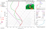
even on the colder GFS, this is not a sounding that inspires confidence for boone as things roll in. any adjustment to a weaker ull pushes this setup to even more marginal and narrows the snow window for a lot of folks.
just trying to keep expectations in line, even for the mountains we're going to be dealing with a lot of crosswinds (figuratively... and literally?) while trying to land this plane
Nice Euro run. Delicate situation we have here in the upstate. I’m not all in until I see chicken feathers in tree tops.
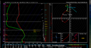
I actually hadn't looked at the NAM sounding for your location but after doing so this shot of WAA with the initial surge of lift is not what you are looking for as its likely to warm the 825-875 layer until the +2-4 range. Move this 50 miles to the SE toward the euro suite and you are golden otherwise it's rain/IP even with the colder 925sTrue, but even before the cold pool moves in the NAM is way stronger with 925mb cold air supply. If you click on soundings pretty much everybody is well below freezing at 900-950mb Saturday night even with a well above freezing raging warm nose above that.
If that low level cold air feed is real on the NAM it has big implications for snow reaching the ground and sticking when the cold pool moves over head Sunday morning.
Of course to some degree I think the stronger/more amped solution of the last NAM run goes hand in hand with strengthening that 925mb low level jet so it makes sense... but the NAM has been better/colder with it even on the runs that had a further Southeast and weaker low solution.

WSNC
Member
Blue_Ridge_Escarpment
Member
EPS and the euro control run definitely good for WNC. Moved everything SE a good bit.
mydoortotheworld
Member
Atlanta looking pretty good right now. Will be nice to see a first decent snowfall since Feb 8 2020. Assuming we don’t go to s*** model wise the next 48 hours
WSNC
Member
Ron Burgundy
Member
Kinda startling how much model agreement there is for NGA with such a borderline event ?
alfoman
Member
Still very skeptical we get accumulations unless we end up under an incrdibly heavy band at some point that can cool down the surface layer temperaturesAtlanta looking pretty good right now. Will be nice to see a first decent snowfall since Feb 8 2020. Assuming we don’t go to s*** model wise the next 48 hours
rburrel2
Member
Yea, there's no chance with the initial WAA driven precip shield on the NAM b/c it's way too amped up. Our time to make hay on the NAM is after the upper low moves through. The GFS and Euro are trying to thread a delicate balance on that first batch though.I actually hadn't looked at the NAM sounding for your location but after doing so this shot of WAA with the initial surge of lift is not what you are looking for as its likely to warm the 825-875 layer until the +2-4 range. Move this 50 miles to the SE toward the euro suite and you are golden otherwise it's rain/IP even with the colder 925sView attachment 132784
I have zero faith that we score on the initial round of precip... but i'll continue to monitor it just in case. lol.
olhausen
Member
I’m glad the euro shifted east and with it any shot this area had at snow. Much harder to watch just 1HR or less to your east get plastered while you get rain. Good luck to everyone out east!
How much have you gotten so far this season? It seems like better than most areas.I’m glad the euro shifted east and with it any shot this area had at snow. Much harder to watch just 1HR or less to your east get plastered while you get rain. Good luck to everyone out east!
You are probably fine with the wrap around stuff if I lived there I'd be pretty optimistic about it snowing with maybe an inch or 2 being doableYea, there's no chance with the initial WAA driven precip shield on the NAM b/c it's way too amped up. Our time to make hay on the NAM is after the upper low moves through. The GFS and Euro are trying to thread a delicate balance on that first batch though.
I have zero faith that we score on the initial round of precip... but i'll continue to monitor it just in case. lol.
UNCSC
Member
Why do some members only comment when model runs are looking rough, but go silent when runs are looking not too bad. Are they just here to ruin the weenies day?
LovingGulfLows
Member
- Joined
- Jan 5, 2017
- Messages
- 1,499
- Reaction score
- 4,100
Id feel confident if I lived like 30 miles northeast of Atlanta…say an area around Gainesville, then north and northeast from there up through Upstate SC and foothills of NC and ofc the mountainous areas. Outside of that, its much more lottery based. It looks like a more marginal March 2009 to me which probably won’t bold well for my backyard.
olhausen
Member
2.6 inches of snow and a little over a quarter of an inch of freezing rain. It’s not a ton but still enough to completely cover the ground twice in a few days around Christmas plus a couple of dustings.How much have you gotten so far this season? It seems like better than most areas.
Honestly, as of right now, any direction within 50-100 miles of Atlanta could jackpot this one. It all depends on the path and strength of the ULL. We won't truly know until mping reports start rolling in.Id feel confident if I lived like 30 miles northeast of Atlanta…say an area around Gainesville, then north and northeast from there up through Upstate SC and foothills of NC and ofc the mountainous areas. Outside of that, its much more lottery based. It looks like a more marginal March 2009 to me which probably won’t bold well for my backyard.
Crazy this has a snow mean to near mcn. I'm guessing the individual members have some epic foot prints
My goal this winter has been reduced to getting the mulch white and officially avoiding a shutout, which has never happened. Im one hiccup away from success or failure. Jury is still hanging in the balance. Sucks boiled eggs seeing a surface low deepening off the GA coast in Feb. Use to be money in the bank herePretty substantial shift south with the 850 low on the Euro as well
iGRXY
Member
Actually looks like there is more N/S interaction even in the very early stage of the NAM
ForsythSnow
Moderator
With how runs have been today, unless something drastic happens, I think N GA up through the mountains is moderately safe to at least see snow fall.Honestly, as of right now, any direction within 50-100 miles of Atlanta could jackpot this one. It all depends on the path and strength of the ULL. We won't truly know until mping reports start rolling in.
Avalanche
Member
TRUTH!!!!My goal this winter has been reduced to getting the mulch white and officially avoiding a shutout, which has never happened. Im one hiccup away from success or failure. Jury is still hanging in the balance. Sucks boiled eggs seeing a surface low deepening off the GA coast in Feb. Use to be money in the bank here
Iceagewhereartthou
Member
I would allow myself to get excited now if I was in WNC; I suspect many of them will see at least some snow and many areas could get a good bit. WNC is defintely the best area in this part of the country with the most chances. As an Upstater (and particularly western Upstate) I have almost no confidence is seeing any real snow with this. The boundary layer looks way to warm to me; so that even if we were able to get some snow falling it would likely just melt on contact. Need the SE trends to continue, but even then there just isn't enough cold outside the mtns for most. I think NE Upstate will have the best chance here in SC; East of Greenville and North of 29. Give me a colder March 09 and that would be HUGE for many; a warmer March 09 will be wet for many.Id feel confident if I lived like 30 miles northeast of Atlanta…say an area around Gainesville, then north and northeast from there up through Upstate SC and foothills of NC and ofc the mountainous areas. Outside of that, its much more lottery based. It looks like a more marginal March 2009 to me which probably won’t bold well for my backyard.
iGRXY
Member
NAM will likely be good from a track standpoint. It's holding off closing longer and has more stream interaction. Have to watch the dynamics once it get closer here in a few minutes, but we are at least trending back towards a slightly weaker S/W and more N/S interaction


