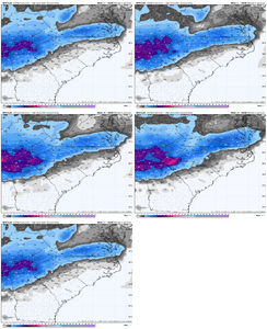
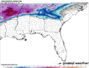
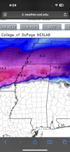
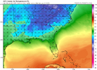
You know we aren't going to stop looking at models...I have better chance of telling my teenager to get off the ticky tock.Models are kinda pointless at this point as its time to look out the window . With that said that gfs run was sick for the upper south
-
Hello, please take a minute to check out our awesome content, contributed by the wonderful members of our community. We hope you'll add your own thoughts and opinions by making a free account!
You are using an out of date browser. It may not display this or other websites correctly.
You should upgrade or use an alternative browser.
You should upgrade or use an alternative browser.
Wintry 1/9-12 Winter Potential Great Dane or Yorkie
- Thread starter SD
- Start date
Benholio
Member
Why not? (not being facetious, truly curious about your optimism)I'm expecting a correction midday tomorrow from them or early. No way we go that low.
Definitely for you guys. It’s knocking on the door. GL back that wayModels are kinda pointless at this point as it’s time to look out the window . With that said that gfs run was sick for the upper south
albertwilsonjr
Member
Snow is overperforming throughout Texas
Sent from my iPhone using Tapatalk
Sent from my iPhone using Tapatalk
NoSnowATL
Member
TWC says Rome gets 3-5in. TWC vs NWSI'm expecting a correction midday tomorrow from them or early. No way we go that low.
I think there is a bust potential in this area either way on snow/sleet totals. We are riding a thin line from about 18z-4z where we could see more snow or sleet than forecast but we have deep dry layer that could eat all of the initial precip leaving us largely with a freezing rain event as the main area of lift and forcing arrive after the column has been warmed. Let me preface this though with when I say bust I'm not talking getting 6 when expecting around 1 I'm not talking getting 2 or 3 when expecting 1
ForsythSnow
Moderator
Lack of model support and current verification is closet to snowier models here. Worst case we still get a heavy band that drops more than an inch over a few hours.Why not? (not being facetious, truly curious about your optimism)
- Joined
- Jan 23, 2021
- Messages
- 4,602
- Reaction score
- 15,197
- Location
- Lebanon Township, Durham County NC
High Res canadian keeps North of 85 as almost all snow with just a T of sleet.
JHS
Member
The gfs has the low center very far inland too. A major red flag. It goes from north of Atlanta to west of Colombia.
drfranklin
Member
- Joined
- Dec 1, 2016
- Messages
- 511
- Reaction score
- 760
e-learning for tomorrow.Greenville county schools closed tomorrow already!
good call as precip is expected to begin mid-morning and stick to anything.
rburrel2
Member
18z GFS came in a good bit colder at the surface. Major freezing rain storm incoming for midlands of SC and Eastern NC.
We aren’t Texas. We need obs from upstate SC to over perform near Clemson to Rock Hill. Getting this moisture over the mountains is a different ball game for us. Texas is wide open to the Gulf of America.
Agreed. 1-2" is our most likely zone. One thing for sure, soil temps won't be an issue. About as good as we can get it from every perspective as far as antecedent conditions.I think there is a bust potential in this area either way on snow/sleet totals. We are riding a thin line from about 18z-4z where we could see more snow or sleet than forecast but we have deep dry layer that could eat all of the initial precip leaving us largely with a freezing rain event as the main area of lift and forcing arrive after the column has been warmed. Let me preface this though with when I say bust I'm not talking getting 6 when expecting around 1 I'm not talking getting 2 or 3 when expecting 1
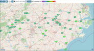
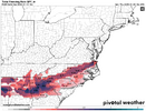
The GFS has lower snow/sleet totals for areas like ours, but this would still be a bad winter storm coming towards us:I think there is a bust potential this this area either way on snow/sleet totals. We are riding a thin line from about 18z-4z where we could see more snow or sleet than forecast but we have deep dry layer that could eat all of the initial precip leaving us largely with a freezing rain event as the main area of lift and forcing arrive after the column has been warmed. Let me preface this though with when I say bust I'm not talking getting 6 when expecting around 1 I'm not talking getting 2 or 3 when expecting 1
Makeitsnow
Member
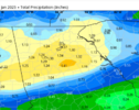
Yet another model run with an increase in totals over ga and the upstate. Gfs.now with a 1.43 max near Monroe. Not bad lolAll models today increasing precip into the Carolina's....GFS latest...which is a icy mess for Raleigh. I wonder if we see that trend continue into tomorrow.
View attachment 161995
Alright so… let’s freeze this moment in time because we about to entire hour 12 of good friends. Let’s not flip this over the next hour or so…
NBAcentel
Member
ForsythSnow
Moderator
RAP doing better for N GA versus 15Z. Still good trends. 4 to 5 inches widespread including downtown
GFS has some backside snow in North Georgia. First time I've really seen that explicitly shown from it.
thanksgivingbrown
Member
Yeah I’m not buying that. In a few frames it goes from Pensacola directly to Rome, down to Atlanta. Wonky if you ask meThe gfs has the low center very far inland too. A major red flag. It goes from north of Atlanta to west of Colombia.
Chris Justus is going extremely bullish. 2-4” extending into the southern part of the upstate with up to 8” in the northern parts of the counties and a 12” lollipop up towards Bryson city
LET HIM COOK
LET HIM COOK
albertwilsonjr
Member
Chris Justus is going extremely bullish. 2-4” extending into the southern part of the upstate with up to 8” in the northern parts of the counties and a 12” lollipop up towards Bryson city
LET HIM COOK

Where do you see this
Sent from my iPhone using Tapatalk
rburrel2
Member
It was just on the5 o’clock news. Not on socials yetWhere do you see this
Sent from my iPhone using Tapatalk
albertwilsonjr
Member
Sent from my iPhone using Tapatalk
Less bad if more falls as sleet and cold rain.Here's the latest GFS... Every bit of this falls as frozen precip from Lake Lanier up I -85 to Charlotte.
That's a lot of frozen liquid, no matter which form it falls as. This could be really high impact in terms of roads and power outages, like really bad.
View attachment 162001
Those GFS ice totals posted eariler from the latest run are worrisome for people in the RDU area and areas south/east. Those totals are probably inflated but even cutting them in half would cause some tree damage and power outages.
Good luck NC/SC/VA looks like the fate of my location is going to be a Snow/Sleet/Freezing Rain deal. I'm really hoping for more sleet than ice. I've heard the magic number for destructive ice is about .75". The totals keep creeping higher towards that .75"
LovingGulfLows
Member
- Joined
- Jan 5, 2017
- Messages
- 1,499
- Reaction score
- 4,100
Good luck NC/SC/VA looks like the fate of my location is going to be a Snow/Sleet/Freezing Rain deal. I'm really hoping for more sleet than ice. I've heard the magic number for destructive ice is about .75". The totals keep creeping higher towards that .75"
Atlanta area is honestly overdue for a crippling ice storm. I feel like it used to happen a lot more often. This could be the one.
Temps will rise after midnight changing over to cold rain for many on this board outside of North Carolina.  That should help prevent a lot of power issues and help Saturday rebound quicker with Sunshine and temps above freezing to start. Yes there will be snow/sleet/zr but cold rain is also part of this storm so enjoy it Friday before it melts.
  ️
️
Benholio
Member
No, no. You are way too NC-centric. The skies have not healed enough over your house. You speak in too many absolutes which makes you who you are and normally wrong.Temps will rise after midnight changing over to cold rain for many on this board outside of North Carolina.That should help prevent a lot of power issues and help Saturday rebound quicker with Sunshine and temps above freezing to start. Yes there will be snow/sleet/zr but cold rain is also part of this storm so enjoy it Friday before it melts.
️
Snowflowxxl
Member
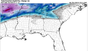
Snow depth maps are trash
GFS early Saturday. 32-33+ would be cold rain. Major icing would not be on the fringe areas. Melting actually does start overnight due to track of the low.No, no. You are way too NC-centric. The skies have not healed enough over your house. You speak in too many absolutes which makes you who you are and normally wrong.
JLL1973
Member
Natedogg25
Member
So how is she looking compared to where she should be at this point?

