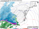
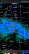
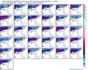
hate to be the bearer of bad news but in my experience 1/3 of an inch of ice is when smaller branches start breaking, power starts flickering, and you begin to have a bad timeGood luck NC/SC/VA looks like the fate of my location is going to be a Snow/Sleet/Freezing Rain deal. I'm really hoping for more sleet than ice. I've heard the magic number for destructive ice is about .75". The totals keep creeping higher towards that .75"
-
Hello, please take a minute to check out our awesome content, contributed by the wonderful members of our community. We hope you'll add your own thoughts and opinions by making a free account!
You are using an out of date browser. It may not display this or other websites correctly.
You should upgrade or use an alternative browser.
You should upgrade or use an alternative browser.
Wintry 1/9-12 Winter Potential Great Dane or Yorkie
- Thread starter SD
- Start date
RTRwx
Member
Those temps are based on the GFS model's snow depth. Models that show ice/rain in N. GA instead of snow have temps 10 degrees warmer in that region on Sunday morning.Roads will be extremely hazardous most all weekend, especially tomorrow afternoon into late night, and again Saturday night into Sunday (when low temps will reach the teens for Athens and the upper corner of SC and into NC)
View attachment 162006
Pops
Member
If we get half that I'll be stoked!!Rap absolutely crushes north ms
Pops
Member
And gonna need updates from you later cause what u get I get bout an hour or so later..lol!If we get half that I'll be stoked!!
SnowwxAtl
Member
My heart is telling me that it won't be bad in ATL. Dallas is really struggling with their thermals.
The NW flow along the TN/NC border up in NW NC looks to hang around all day Sat? That should add an inch or three right?
I hate to speak in absolutes but nowhere is gonna see 0.75” ice in GA, SC or NC. Follow the experts like the NWS and WPC. They have the most extreme ice chance of 0.25” at 10-20% chance north-east of Atlanta, GA. Cold rain does not mean ice. That’s called freezing rain.
rburrel2
Member
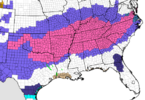
Every county in NC under WWW or WWA except for New Hanover and Brunswick, which doesn't happen too often. 2/3rds of SC isn't too shabby either.
And I reckon congrats Tenn for the entire state being under a warning.
I wonder if the entire states of OK, AR, TN, and KY have ever been under winter weather products at the same time before.
CNCsnwfan1210
Member
Looks likes a shift south in NC too
Sent from my iPhone using Tapatalk
packfan98
Moderator
Maybe because the above freezing warm nose is close to the ground it doesn’t have time to refreeze?
BufordWX
Member
Yeah...I think your right. That's going to suck so bad.Maybe because the above freezing warm nose is close to the ground it doesn’t have time to refreeze?
NWMSGuy
Member
Currently on I-269 in Desoto County. Nothing falling yet. Watching it closely though!
StormStalker
Member
https://hazcams.com/station/florenc...ther-com.us23.cdn-alpha.com/index.php/skycam/
Live camera and current conditions from Florence, AL
Live camera and current conditions from Florence, AL
Yea, all of those at same time is tough to pull off--that's a lot of mileage west to east.I wonder if the entire states of OK, AR, TN, and KY have ever been under winter weather products at the same time before.
I'd bet $$ TN and KY are the most common states to be under products simultaniously. (at least of those you mentioned)
Stormsfury
Member
You're in danger using the GFS model using temps on a depiction of a SFC low cutting well inland thru an in-situ wedge.GFS early Saturday. 32-33+ would be cold rain. Major icing would not be on the fringe areas. Melting actually does start overnight due to track of the low. View attachment 162004
I wouldn't call that exactly prudent
- Joined
- Jan 2, 2017
- Messages
- 1,566
- Reaction score
- 4,279
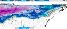
Man I'm right on the 4-8 line. Prob drive 5 miles north for that. I posted a while back that mtn rest, long creek, Salem and walhalla will get crushed. Looking to be dead onPardon me I took with photo with a gameboyView attachment 162013
NWMSGuy
Member
Nomanslandva
Member
I agree. This system seems too fast to accumulate that much ice. Good luck folks!I hate to speak in absolutes but nowhere is gonna see 0.75” ice in GA, SC or NC. Follow the experts like the NWS and WPC. They have the most extreme ice chance of 0.25” at 10-20% chance north-east of Atlanta, GA. Cold rain does not mean ice. That’s called freezing rain.
billyweather
Member
BHS1975
Member
That 3k NAM is concerning. Beefy warm nose?Lets see who wins...the american models are solidly north of RGEM/Euro for NC.
View attachment 161997
It’s been almost 6 years since the Atlanta airport recorded 1 inch or more of snow. Hope everyone is sending good mojo this way 

I've waited a long time to see an ensemble like that!
The NAM is either taking all this storm, or continue to be the meme model…I have my thoughts/hopes on which one is true.That 3k NAM is concerning. Beefy warm nose?
BufordWX
Member
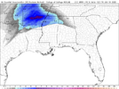
Most likely virga for now. Lots of dry air in front of the system. Once the atmosphere moistens, it’s game on.Not sure if any of this is reaching the ground:
View attachment 162015
BHS1975
Member
How is it doing so far in TX?The NAM is either taking all this storm, or continue to be the meme model…I have my thoughts/hopes on which one is true.
Yeah I think this overall uptick in qpf has pushed us from a pretty Saturday morning into I'm worried about power outages. The good thing is with no good CAD feed the freezing rain should limit itself the bad thing if we substantially wet bulb it might be a long climb to 32.1The GFS has lower snow/sleet totals for areas like ours, but this would still be a bad winter storm coming towards us:
View attachment 161998
How reliable is it in this range?
How ever many years of tracking these and seeing the NAM with a giant warm nose and i still don't fully buy it. Broad SW flow in the mid levels makes me think the warm nose wins eventually for a lot of people, lack of a well defined strong mid level low makes me wonder if the NAM verifies too warm aloft. More snow/sleet to start vs the NAMs, probably more sleet/freezing rain getting north than some of the other models would be my guessLets see who wins...the american models are solidly north of RGEM/Euro for NC.
View attachment 161997
I’m not a met, so please take what I say with a grain of salt. But it does appear to be initializing warmer than what the real time is producing. They appear to have sleet/ice where cold rain was the Nam’s plan. But for real, there are better people to ask than me. Anyone else care to help? I’m interested too in the answer from the more trained folk.How is it doing so far in TX?
FWIW - the NAM was definitely too warm last weekend with the VA storm. It had the snow line a good bit further north than the RGEM and Euro. Now that it appears the NAM was off it's rocker with the solution from 00z, it's most likely safe to assume it is at least somewhat too warm here.How ever many years of tracking these and seeing the NAM with a giant warm nose and i still don't fully buy it. Broad SW flow in the mid levels makes me think the warm nose wins eventually for a lot of people, lack of a well defined strong mid level low makes me wonder if the NAM verifies too warm aloft. More snow/sleet to start vs the NAMs, probably more sleet/freezing rain getting north than some of the other models would be my guess
One of my meteorology major friends told me this morning he is from Atlanta. He said he said he was upset at the prediction that they were going to see more than Raleigh. Hopefully for your sake it works out… but not for my sakeIt’s been almost 6 years since the Atlanta airport recorded 1 inch or more of snow. Hope everyone is sending good mojo this way
It's about time for the bad model runs to start trickling in the way things have gone this week. Bad in evenings, better in morningsFWIW - the NAM was definitely too warm last weekend with the VA storm. It had the snow line a good bit further north than the RGEM and Euro. Now that it appears the NAM was off it's rocker with the solution from 00z, it's most likely safe to assume it is at least somewhat too warm here.
JP152
Member
I would say yes definitely for Kentucky.I wonder if the entire states of OK, AR, TN, and KY have ever been under winter weather products at the same time before.
Well, the drying trend on some of these foreign models isn't all that encouraging to me.It's about time for the bad model runs to start trickling in the way things have gone this week. Bad in evenings, better in mornings

