-
Hello, please take a minute to check out our awesome content, contributed by the wonderful members of our community. We hope you'll add your own thoughts and opinions by making a free account!
You are using an out of date browser. It may not display this or other websites correctly.
You should upgrade or use an alternative browser.
You should upgrade or use an alternative browser.
Wintry 1/9-12 Winter Potential Great Dane or Yorkie
- Thread starter SD
- Start date
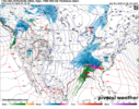
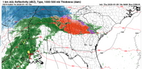
The mets on here can say if I’m wrong, but you would think that if a model is initiating wrong on current conditions based on actual observations, then it would be a major red flag to the solutions it is putting outIt's snowing where the NAM has rain right now. I have 0 understanding on this model and just want to see how absurd it gets. Still a mess on it at hour 12. Hour 3 literally has rain in S AR.
NBAcentel
Member
This NAM run is a pretty large jog south with the 700mb warm nose. Big step in the right direction
NEGaweather
Member
NAM fold in progress. See you 00z
Sent from my iPhone using Tapatalk
Sent from my iPhone using Tapatalk
Tsappfrog20
Member

This is Wral. At least they are finally on board now!!
Sent from my iPhone using Tapatalk
Twister
Member
But yet NWS has 1-3" in the WSW. What he$$ They thinkingMan if we can get the Hrrr to just tick colder one more time at 700mb then the upstate is easily all snow for the whole event. We're able to fight off any warm nose around 850mb from the residual cold pool. Just need that crest of that 750-800mb nose to tink one tiny click south.
BMX has updated their WS Warning:
URGENT - WINTER WEATHER MESSAGE
National Weather Service Birmingham AL
206 PM CST Thu Jan 9 2025
ALZ011>015-017>021-024-026-100600-
/O.CON.KBMX.WS.W.0001.250110T0600Z-250111T1200Z/
Marion-Lamar-Fayette-Winston-Walker-Blount-Etowah-Calhoun-
Cherokee-Cleburne-Jefferson-St. Clair-
Including the cities of Double Springs, Hoover, Centre, Hamilton,
Gadsden, Pell City, Heflin, Jasper, Fayette, Moody, Sulligent,
Birmingham, Anniston, Vernon, and Oneonta
206 PM CST Thu Jan 9 2025
...WINTER STORM WARNING REMAINS IN EFFECT FROM MIDNIGHT TONIGHT TO 6
AM CST SATURDAY...
* WHAT...Heavy mixed precipitation expected. Total snow and sleet
accumulations up to two inches and ice accumulations up to two
tenths of an inch.
* WHERE...Blount, Calhoun, Cherokee, Cleburne, Etowah, Fayette,
Jefferson, Lamar, Marion, St. Clair, Walker, and Winston Counties.
* WHEN...From midnight tonight to 6 AM CST Saturday.
* IMPACTS...Roads, and especially bridges and overpasses, will
likely become slick and hazardous. Plan on slippery road
conditions. The hazardous conditions could impact the Friday
morning and evening commutes.
PRECAUTIONARY/PREPAREDNESS ACTIONS...
If you must travel, keep an extra flashlight, food, and water in
your vehicle in case of an emergency.
Persons should consider delaying all travel. Motorists should use
extreme caution if travel is absolutely necessary.
dsaur
Member
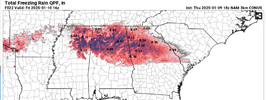
Hope they have some good hills. 4 inches of sleet is the best thing going.Look at those sleet totals back in southern Arkansas. 3.5-4”. I’m not sure I’ve ever seen that much sleet modeled.
packfan98
Moderator
Last call map from Allan.
dsaur
Member
45 here with a warm sun, and frozen ground.The NAM is on its own island with this system so far. That's all I need to know. Now, if it fits someones else's narrative, they will argue until they are blue in the face.
37F/15F Here right now.
Mahomeless
Member
Mixed precip already being reported just west of Jackson, MS.
Snowflowxxl
Member
I think the FFC needs to evaluate the timestamps for the warning. 7am is not early enough.
FFC's callout with "over-perform" seems a bit of a punt. I can't shake the shuttering thought of ice storm feeling. Not cool.
rburrel2
Member
rburrel2
Member
- Joined
- Jan 2, 2017
- Messages
- 1,566
- Reaction score
- 4,279
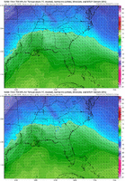
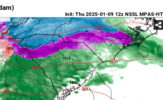
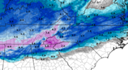
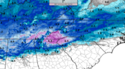
Looks very similar to the Hrrr to me.I have no idea what the NSSL model is, other than it looks like really hi-resolution. But I LIKE IT! Just one more data point that says the NAM is off it's rocker.
View attachment 161968View attachment 161969
CNCsnwfan1210
Member
I have no idea what the NSSL model is, other than it looks like really hi-resolution. But I LIKE IT! Just one more data point that says the NAM is off it's rocker.
View attachment 161968View attachment 161969
Sorry if it’s banter, but it’s part of the CAMs, using HRRR data
Sent from my iPhone using Tapatalk
Makeitsnow
Member
The 18z name precip totals made a huge increase vs the Last few runs.I have no idea what the NSSL model is, other than it looks like really hi-resolution. But I LIKE IT! Just one more data point that says the NAM is off it's rocker.
View attachment 161968View attachment 161969
Pops
Member
Good to see Nam little cooler hopefully it continues
Mahomeless
Member
Sleet reports coming out of Northern LA
Last call map from Allan.
He moved the bottom portion NORTH after todays guidance? What tha.
ITUSETOSNOW
Member
Massive ice storm for Atlanta,,,yuk.
Tsappfrog20
Member
He moved the bottom portion NORTH after todays guidance? What tha.
This is what he said….

Sent from my iPhone using Tapatalk
Some discussion about dry air and precip not reaching the ground -- correct me if I'm wrong, has been years since I've had a reason to be on these boards a lot, but model QPF outputs already account for that.
Almost now cast time for half of the board. I hope the NAM is on its rocker. But normally it has a cold bias so it has me concerned. The best the Foothills can hope for at this point is a blend of model runs and the front end overpreforms. Ground temps won't be an issue whatever falls will stick. Enjoy my friends it's been a long time since we've seen a board wide hit regardless of p-type.
Last edited:
Yes, the model output accounts for it.....or tries toSome discussion about dry air and precip not reaching the ground -- correct me if I'm wrong, has been years since I've had a reason to be on these boards a lot, but model QPF outputs already account for that.
Dallas, Ga
37.4. / -2.2
37.4. / -2.2
| 09 | 15:35 | Calm | 10.00 | Fair | CLR | 37.4 | -2.2 | 18% |
So, Roddy, not sure your "methodology" or "wishcasting" ability but you have stuck by your guns and the models seem to be trending your way. What part of N Bama do you live? That will give some perspective.Sleet reports coming out of Northern LA
Tsappfrog20
Member
Well Wake County Schools joined the party.

Sent from my iPhone using Tapatalk

Sent from my iPhone using Tapatalk
JLL1973
Member
Memphis has lowerd my totals to 1-3 inches. i dont understand that logic at all.
beanskip
Member
18z ICON: Steady as she goes ....


