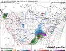
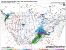
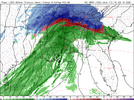
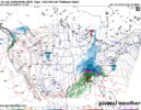
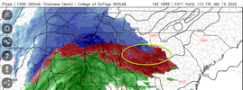
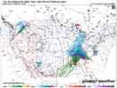
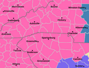
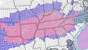
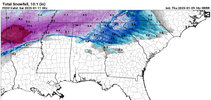
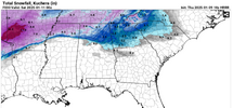
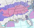
The orientation of that band across CLT metro is a classic look for putting down heavy snow across the whole metro area. Also the low placement is about as good as you can get.If the RGEM is correct with that deathband through the Charlotte metro @wxbradley is going to be in shambles come Saturday morning. Rooting for y’all View attachment 161898
-
Hello, please take a minute to check out our awesome content, contributed by the wonderful members of our community. We hope you'll add your own thoughts and opinions by making a free account!
You are using an out of date browser. It may not display this or other websites correctly.
You should upgrade or use an alternative browser.
You should upgrade or use an alternative browser.
Wintry 1/9-12 Winter Potential Great Dane or Yorkie
- Thread starter SD
- Start date
Kirk Mellish is another old timer who keeps things real: https://medium.com/@melhuishMany of you Georgia folks remember Ken Cook. He was the Atlanta Met on Channel 5 for several years. I respected Ken because he was conservative, calm, and even keel in his forecasts ... he was not one to hype events too much. He posts on Facebook (https://www.facebook.com/KenCookATL) and here is his latest post from just a little while ago. It is a good overview of where we are:
…..The Potential for a Significant Ice Storm is Looming Larger for Georgia, Alabama and the Carolinas…..
I believe that residents of northern Georgia, central and North Alabama, north and Central South Carolina, Southwestern to Eastern North Carolina should be prepared for a potential ice storm Friday and Friday night.
While the major meteorological forecast models: the NAM, (North American model), the GFS, the (Global Forecast model, and the ECMWF (European model) vary greatly with the potential of snowfall amounts across northern Georgia and Alabama, they do not vary much when it comes to the potential for significant icing.
The NAM is the stingiest with snowfall from only a dusting to minor amounts from Birmingham to Atlanta to Athens to Charlotte and northward, except for possible one to 3 inch amounts in far North Georgia and 3 to 6”+ amounts in the Tennessee and North Carolina Carolina mountains.
The European model has the most snow: with 1 to 3 inches starting along I-20 going northward, stretching from Birmingham to Atlanta to Augusta to Greenville to Charlotte and to Raleigh, North Carolina. Going northward from Birmingham to the north Atlanta suburbs to Gainesville to Toccoa, and to Northwest South Carolina, and Western and Northern North Carolina, 3 to 6”+ could fall. The GFS model favors the European model.
To me, I see too much warm air coming in at 2,000–4,000 feet above the ground to maintain much snow, so I’m leaning toward much more freezing rain, mixed with some sleet at times, rather than a lot of snow. The actual snow amounts will probably end up between the two extremes.
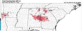
The three maps shown with this post showed the total amount of freezing rain possible ending at 7 AM on Saturday morning. They are from the three mentioned models, and all of them point to the same possible result – significant icing in the amount of .25 inch to .50 inch or even more in some spots. The lightest freezing rain starts in the pink color with 0.05” and ranges to 0.50” with the black color, and potentially up to 0.75” in the blues. Should this happen, it would put a considerable amount of ice on trees, power lines, bridges and even roads, leading to downed trees, downed power lines, and frozen roads and bridges.
This icing would start Friday morning, generally along and north of I-20 in Alabama and Georgia. As the day goes on, this freezing rain could spread rapidly northward to most of Alabama north of I- 20, and in Georgia, freezing rain could be accumulating from near LaGrange to southern Metro Atlanta, north to Rome and then east of Atlanta to Augusta. The forecast models have the icing getting worse Friday night as the freezing rain spreads farther northward and northeastward to include South Carolina north of Augusta, Columbia, and Florence, and along a 100 mile wide band centered on I-85 in North Carolina.
This potential heavy icing situation is looking more serious to me at this time, and I would not recommend any extensive travel in the shown areas on the maps after 3 AM Friday in Northern Alabama along I-20, and after 6 AM in Georgia along and near I-20. The travel problems become worse later in the afternoon Friday and Friday night as the snow and ice spread north and northeastward into the Carolinas.
This situation remains fluid and more changes or possible later. I’ll have more for you later this afternoon.
Thank you,
Ken Cook
Mahomeless
Member
Guys....this thing is staying way more positive tilt resulting in a classic Miller A with very little WAA
Mahomeless
Member
FFC FINALLY pulled the trigger.
URGENT - WINTER WEATHER MESSAGE
National Weather Service Greenville-Spartanburg SC
213 PM EST Thu Jan 9 2025
GAZ010-017-018-NCZ035>037-056-057-068>070-502-504-506-508-510-SCZ008-
101>106-108-100400-
/O.UPG.KGSP.WS.A.0002.250110T1200Z-250111T1200Z/
/O.NEW.KGSP.WS.W.0002.250110T1200Z-250111T1200Z/
Rabun-Habersham-Stephens-Alexander-Iredell-Davie-Catawba-Rowan-
Cleveland-Lincoln-Gaston-Greater Caldwell-Greater Burke-Eastern
McDowell-Greater Rutherford-Eastern Polk-Cherokee-Oconee
Mountains-Pickens Mountains-Greenville Mountains-Greater Oconee-
Greater Pickens-Central Greenville-Northern Spartanburg-
Including the cities of Clarkesville, Morganton, Dysartsville,
Glassy Mountain, Duncan, Marion, Landrum, Pine Mountain,
Gastonia, Rocky Bottom, Clemson, Lincolnton, Spindale, Demorest,
Shelby, Wellford, Seneca, Statesville, Pleasant Grove, St.
Stephens, Forest City, Mountain City, Salisbury, Mountain Rest,
Hiddenite, Greenville, Greer, Gaffney, Mooresville, Tryon,
Millersville, Advance, Farmington, Mocksville, Inman, Cornelia,
Clayton, Crouse, Easley, Mill Spring, Kings Mountain,
Fingerville, Lyman, Toccoa, Hickory, Fork Church, Glenwood,
Oakway, Walhalla, Westminster, Boiling Springs Sc, Hollywood,
Nebo, Fero, Taylorsville, Lenoir, Berea, Kings Creek, Sawmills,
Newton, Taylors, Baldwin, Valdese, Rutherfordton, Dacusville,
Granite Falls, Columbus, Boydville, Ellendale, Stony Point, and
Bethlehem
213 PM EST Thu Jan 9 2025
...WINTER STORM WARNING IN EFFECT FROM 7 AM FRIDAY TO 7 AM EST
SATURDAY...
* WHAT...Heavy mixed precipitation expected. Total snow and sleet
accumulations between 1 and 3 inches and ice accumulations around
two tenths of an inch.
* WHERE...Portions of northeast Georgia, Piedmont and western North
Carolina, and Upstate South Carolina.
* WHEN...From 7 AM Friday to 7 AM EST Saturday.
* IMPACTS...Snow and ice accumulations will make many roads
treacherous and impassable. The weight of the snow and ice on tree
limbs and power lines could produce scattered outages. The
hazardous conditions could impact the Friday morning and evening
commutes.
PRECAUTIONARY/PREPAREDNESS ACTIONS...
Monitor the latest forecasts for updates on this situation.
Slow down and use caution while traveling.
If you must travel, keep an extra flashlight, food, and water in
your vehicle in case of an emergency.
&&
$$
wow
Member
This 18z HRRR run is about to be wild.
The HRRR will break your heart and drop a shoot load of sleet on you in the end.
iGRXY
Member
That’s the old run
Mahomeless
Member
NC going to get crushed if this continues....
I think GSP should have kept the foothill counties separate from the rest 1-3 just seems too low to me. Especially for Marion, Morganton, to Lenoir. I think 2-4 is a better call.
Agreed but with RAH backing off their higher totals we might just end up with a WWA
GAZ001>009-011>016-019>025-027-030>039-041>060-100600-
/O.UPG.KFFC.WS.A.0001.250110T1200Z-250111T1200Z/
/O.NEW.KFFC.WS.W.0001.250110T1200Z-250111T1200Z/
Dade-Walker-Catoosa-Whitfield-Murray-Fannin-Gilmer-Union-Towns-
Chattooga-Gordon-Pickens-Dawson-Lumpkin-White-Floyd-Bartow-
Cherokee-Forsyth-Hall-Banks-Jackson-Madison-Polk-Paulding-Cobb-
North Fulton-Gwinnett-Barrow-Clarke-Oconee-Oglethorpe-Wilkes-
Haralson-Carroll-Douglas-South Fulton-DeKalb-Rockdale-Walton-
Newton-Morgan-Greene-Taliaferro-Heard-Coweta-Fayette-Clayton-
Spalding-Henry-Butts-Jasper-Putnam-
Including the cities of Ellijay, Douglasville, Carrollton,
LaFayette, Crawfordville, Winder, Dahlonega, Marietta,
Lawrenceville, Atlanta, Cleveland, Summerville, Cartersville,
Washington, Franklin, Riverdale, Bremen, Crawford, Madison,
Jasper, Hiawassee, Griffin, Newnan, Stockbridge, Eatonton,
Monticello, Comer, Decatur, Fort Oglethorpe, Conyers, Cedartown,
Trenton, Woodstock, Greensboro, Dallas, Calhoun, Jackson, Dalton,
East Point, Commerce, Rome, Dawsonville, Watkinsville,
Chatsworth, Blairsville, Peachtree City, Gainesville, Blue Ridge,
Monroe, Athens, Cumming, Covington, and Homer
214 PM EST Thu Jan 9 2025
...WINTER STORM WARNING IN EFFECT FROM 7 AM FRIDAY TO 7 AM EST
SATURDAY...
* WHAT...A mix of multiple winter precipitation types are expected.
Total snow and sleet accumulations up to 3 inches and ice
accumulations up to one third of an inch are possible.
* WHERE...Portions of central, east central, north central,
northeast, northwest, and west central Georgia.
* WHEN...From 7 AM Friday to 7 AM EST Saturday.
* IMPACTS...Roads, and especially bridges and overpasses, will
likely become slick and hazardous. Significant ice accumulation on
power lines and tree limbs may cause widespread and long-lasting
power outages. Plan on slippery road conditions. The hazardous
conditions could impact the Friday morning and evening commutes.
* ADDITIONAL DETAILS...Ice accumulations have been increased across
portions of the I20 and I85 corridors. Additional changes to ice
and snow amounts are possible with future forecast updates.
PRECAUTIONARY/PREPAREDNESS ACTIONS...
If you must travel, keep an extra flashlight, food, and water in
your vehicle in case of an emergency. The latest road conditions for
the state you are calling from can be obtained by calling 5 1 1.
Persons should consider delaying all travel. Motorists should use
extreme caution if travel is absolutely necessary.
beanskip
Member
Some folks on this board may need to try and do the same thing!I swear you watch the 18z will be the NAM of all NAM runs back to snow.... It will try and sneak into the room like it never left!!!
Makeitsnow
Member
Mahomeless
Member
The 278 corridor in AL is on hour 6 of 0.5" - 1.0" per hour rates and its still puking.....
tjed73
Member
Half of Iredell and Catawba also kinda fall in this boat. You could almost divide Iredell in half every time one of these storms hit.I think GSP should have kept the foothill counties separate from the rest 1-3 just seems too low to me. Especially for Marion, Morganton, to Lenoir. I think 2-4 is a better call.
Wulfer
Member
N Ga. finally pulled the trigger Winter Storm Warning in effect for all of N. Ga.!
You can divide Wake into tenths.Half of Iredell and Catawba also kinda fall in this boat. You could almost divide Iredell in half every time one of these storms hit.
NBAcentel
Member
This ain’t really a trend from thermals alone on the HRRR either. It’s because the main trough is becoming more + tilt, which is resulting in a lower ceiling for stout Warm air advection. This is a trend from something more synoptically influencing it
lj0109
Member
CAE Issues WWA:
URGENT - WINTER WEATHER MESSAGE
National Weather Service Columbia SC
216 PM EST Thu Jan 9 2025
...IMPACTFUL WINTER STORM ANTICIPATED ACROSS PORTIONS OF CENTRAL
SOUTH CAROLINA AND EAST-CENTRAL GEORGIA FRIDAY EVENING AND FRIDAY
NIGHT...
GAZ063>065-SCZ027>031-037-038-135-136-100730-
/O.NEW.KCAE.WW.Y.0001.250110T1500Z-250111T0900Z/
McDuffie-Columbia-Richmond-Lexington-Richland-Lee-Aiken-Sumter-
Calhoun-Clarendon-Northwestern Orangeburg-Central Orangeburg-
216 PM EST Thu Jan 9 2025
...WINTER WEATHER ADVISORY IN EFFECT FROM 10 AM FRIDAY TO 4 AM EST
SATURDAY...
* WHAT...Mixed precipitation expected. Total snow/sleet
accumulations up to one-half inch and ice accumulations around two
tenths of an inch.
* WHERE...Portions of east central Georgia and central South
Carolina.
* WHEN...From 10 AM Friday to 4 AM EST Saturday.
Makeitsnow
Member
For the majority of ga the precip starts with temps already below freezing...can't express enough how awesome that is.
Mahomeless
Member
All I can say is buckle up....we are trending towards something really really nice!
BufordWX
Member
37 / -2
It’s dry out here
It’s dry out here
Mahomeless
Member
The longer range of the 18z HRRR gets a little squirrely for the NC folks, but I have zero concern for you guys. The trends should continue with the trough, resulting in an almost all snow event there.
Ron Burgundy
Member
What’s the hourly snow accumulation rate for that heavy band?
If the NAM backs off on the warm nose, BUCKLE THE FREAK UP.
She's a beaut Clark!!! Not everyday you see that in the south. Now let's keep the trends until go time!!!!Haven’t seen a map like this one in a long time. Gonna be a good one folks.View attachment 161935
I am telling you the NAM will be completely Cutter to Chicago or it will be NAM of all NAMs the other way no in betweenIf the NAM backs off on the warm nose, BUCKLE THE FREAK UP OFF.
I just dug into cloud forecast overnight here. Cant hardly draw it up any better. We stay clear till 4 -430 before they start rolling in. Will be completely covered, solid cannopy by 830ish.
Tonights low under ideal radiational cooling is 17.
20z (3pm) is rough estimate start time, consensus models.
Usually you get going a few hours earlier, but who knows. So between noon-4pm snow should start breaking out. Expierence would advise closer to noon than 4pm.
Tonights low under ideal radiational cooling is 17.
20z (3pm) is rough estimate start time, consensus models.
Usually you get going a few hours earlier, but who knows. So between noon-4pm snow should start breaking out. Expierence would advise closer to noon than 4pm.
NBAcentel
Member

