-
Hello, please take a minute to check out our awesome content, contributed by the wonderful members of our community. We hope you'll add your own thoughts and opinions by making a free account!
You are using an out of date browser. It may not display this or other websites correctly.
You should upgrade or use an alternative browser.
You should upgrade or use an alternative browser.
Wintry 1/9-12 Winter Potential Great Dane or Yorkie
- Thread starter SD
- Start date
Many of you Georgia folks remember Ken Cook. He was the Atlanta Met on Channel 5 for several years. I respected Ken because he was conservative, calm, and even keel in his forecasts ... he was not one to hype events too much. He posts on Facebook (https://www.facebook.com/KenCookATL) and here is his latest post from just a little while ago. It is a good overview of where we are:
…..The Potential for a Significant Ice Storm is Looming Larger for Georgia, Alabama and the Carolinas…..
I believe that residents of northern Georgia, central and North Alabama, north and Central South Carolina, Southwestern to Eastern North Carolina should be prepared for a potential ice storm Friday and Friday night.
While the major meteorological forecast models: the NAM, (North American model), the GFS, the (Global Forecast model, and the ECMWF (European model) vary greatly with the potential of snowfall amounts across northern Georgia and Alabama, they do not vary much when it comes to the potential for significant icing.
The NAM is the stingiest with snowfall from only a dusting to minor amounts from Birmingham to Atlanta to Athens to Charlotte and northward, except for possible one to 3 inch amounts in far North Georgia and 3 to 6”+ amounts in the Tennessee and North Carolina Carolina mountains.
The European model has the most snow: with 1 to 3 inches starting along I-20 going northward, stretching from Birmingham to Atlanta to Augusta to Greenville to Charlotte and to Raleigh, North Carolina. Going northward from Birmingham to the north Atlanta suburbs to Gainesville to Toccoa, and to Northwest South Carolina, and Western and Northern North Carolina, 3 to 6”+ could fall. The GFS model favors the European model.
To me, I see too much warm air coming in at 2,000–4,000 feet above the ground to maintain much snow, so I’m leaning toward much more freezing rain, mixed with some sleet at times, rather than a lot of snow. The actual snow amounts will probably end up between the two extremes.
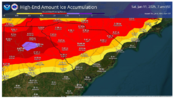
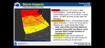
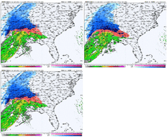
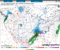
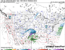
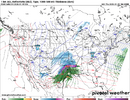
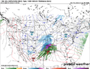
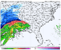
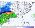
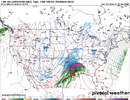
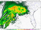
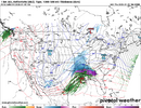
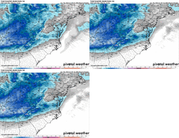
The three maps shown with this post showed the total amount of freezing rain possible ending at 7 AM on Saturday morning. They are from the three mentioned models, and all of them point to the same possible result – significant icing in the amount of .25 inch to .50 inch or even more in some spots. The lightest freezing rain starts in the pink color with 0.05” and ranges to 0.50” with the black color, and potentially up to 0.75” in the blues. Should this happen, it would put a considerable amount of ice on trees, power lines, bridges and even roads, leading to downed trees, downed power lines, and frozen roads and bridges.
This icing would start Friday morning, generally along and north of I-20 in Alabama and Georgia. As the day goes on, this freezing rain could spread rapidly northward to most of Alabama north of I- 20, and in Georgia, freezing rain could be accumulating from near LaGrange to southern Metro Atlanta, north to Rome and then east of Atlanta to Augusta. The forecast models have the icing getting worse Friday night as the freezing rain spreads farther northward and northeastward to include South Carolina north of Augusta, Columbia, and Florence, and along a 100 mile wide band centered on I-85 in North Carolina.
This potential heavy icing situation is looking more serious to me at this time, and I would not recommend any extensive travel in the shown areas on the maps after 3 AM Friday in Northern Alabama along I-20, and after 6 AM in Georgia along and near I-20. The travel problems become worse later in the afternoon Friday and Friday night as the snow and ice spread north and northeastward into the Carolinas.
This situation remains fluid and more changes or possible later. I’ll have more for you later this afternoon.
Thank you,
Ken Cook
NoSnowATL
Member
Briefing video up now.
Smart, take the low end and play it out. Works 6/10 times in most storms.
For NC looks to me like all guidance is trending up with QPF, considering most areas will remain below freezing for the duration of the event going to be high impact. Now if we can get more sn and less ice that would be great.
The NBM up to about large area of .4, that will equate to warning criteria I feel certain. Also nice little shift south with the snow axis, thanks to all but the NAM suites being colder through the column
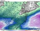
The NBM up to about large area of .4, that will equate to warning criteria I feel certain. Also nice little shift south with the snow axis, thanks to all but the NAM suites being colder through the column


Fountainguy97
Member
ForsythSnow
Moderator
Cold air really showing its dominance so far. Keep this up and more snow is likely I'd say. I really think 18Z is going to have a story to tell.
That front end thump is doing its job cooling the column! I have a feeling this will bold well for many in the upstate of South Carolina and Western North Carolina along and west of 77.
Haha... I suspect they are very subconscious and as others mentioned here FFC is a very proudful office. A few years back we had a event that was supposed to be wide spread 2-3 inches form I-20 north and it BUSTED really really bad due to WAA. They took alot of egg on face for it too. I personally believe they are about to take some more egg to face on the other end IMO but hey people are more forgiving on a being conservative misstep at least.
This 18z HRRR run is about to be wild.
Mahomeless
Member
They won't be if they are stuck on the highway for days like 2014Haha... I suspect they are very subconscious and as others mentioned here FFC is a very proudful office. A few years back we had a event that was supposed to be wide spread 2-3 inches form I-20 north and it BUSTED really really bad due to WAA. They took alot of egg on face for it too. I personally believe they are about to take some more egg to face on the other end IMO but hey people are more forgiving on a being conservative misstep at least.
NEGaweather
Member
KATL says they will upgrade watches this afternoon
Sent from my iPhone using Tapatalk
Sent from my iPhone using Tapatalk
Here's something I view as at least a small positive...
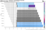
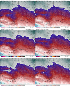
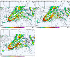
Here is the last 13 runs of the Euro for 4AM EST tomorrow. Notice how the mega nasty ridging out ahead of the 'baja' low along the Red River in OK/TX is trending less amplified. This is our trouble area on the NAM. Gives at least a little credence that the NAM could be smoking a bit of something. Also, the heights thru the SE aren't rising any there.

Here's another way to view it via the 48hr linear forecast trend on Tropical Tidbits

Here is the last 13 runs of the Euro for 4AM EST tomorrow. Notice how the mega nasty ridging out ahead of the 'baja' low along the Red River in OK/TX is trending less amplified. This is our trouble area on the NAM. Gives at least a little credence that the NAM could be smoking a bit of something. Also, the heights thru the SE aren't rising any there.

Here's another way to view it via the 48hr linear forecast trend on Tropical Tidbits

MichaelJ
Member
Currently we sit at 32/5
Mahomeless
Member
No Watch straight to Winter Storm Warning 
 Mount Airy Dobson Wilkesboro Elkin Boone Yadkinville
Stormsfury
Member
Carolinas dewpoints in the lower 10s and plenty of single digits. Charleston currently running 41 over 9. (25% RH). Lots of dry air to overcome which should lead to substantial cooling of the column initially. Some areas I feel definitively should have warning level ice accretions tomorrow across parts of the SC Midlands
Last Call. Gonna bump up to 3-5. 4 is my magic # final call. Have no doubt we will get a minimum of 3 now, even if the sleet gets involved. High end is if we stay all snow and some of the .475-.5 qpf verefied.Sticking with my 2-4 incher for my immediate area. All Snow as ptype. I have more confidence in ending up closer to the 4 than the 2 this morning. Things look as good as they ever had for the Triad and NW NC , as they have the whole time tracking this thing all this week. Should be able to net .4-.5 qpf and hopefully keep warm nose out. See how we look after all the 12Z comes in latter today.
Hopefully everyone on here over performs
Im throwing the Nam out. No way we see .7+ qpf. Its on an island with that. IT wrecks thermals to quickly and has high qpf, because it goes bonkers with storm , which increases more WAA.
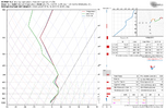
Under heavy enough rates should be mostly snow. I don't have myEuro sounding for 6z Sat morning...height of precip rolling through RDU...this don't look like freezing rain
View attachment 161909
Mahomeless
Member
Up to 5” with locally heavier amounts expected WSW wording. I believe the threat it starting to shift from Asheville and south west NC up into the northern foothills and Virginia up to 10”
Mahomeless
Member
If we can keep that warm nose at Bay we're golden! The trends are our friend today no doubt!Up to 5” with locally heavier amounts expected WSW wording. I believe the threat it starting to shift from Asheville and south west NC up into the northern foothills and Virginia up to 10”
iGRXY
Member
Mahomeless
Member
Makeitsnow
Member
Mahomeless
Member
Mahomeless
Member
iGRXY
Member
HRRR is already significantly better in Mississippi and Alabama thru 16 vs 12z
Hrrr colder at hr 16, will be a good one
NBAcentel
Member
ForsythSnow
Moderator
HRRR seems to be declining the warm nose impact earlier. More all snow east could follow?
Mahomeless
Member
iGRXY
Member
That’s the 12z

