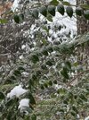
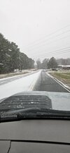
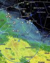
Radar really lighting up around clt on radar, moistening the column.
-
Hello, please take a minute to check out our awesome content, contributed by the wonderful members of our community. We hope you'll add your own thoughts and opinions by making a free account!
You are using an out of date browser. It may not display this or other websites correctly.
You should upgrade or use an alternative browser.
You should upgrade or use an alternative browser.
Wintry 1/9-12 Winter Potential Great Dane or Yorkie
- Thread starter SD
- Start date
Snowflowxxl
Member
Steady ZR. Definitely could see it becoming an issue if temps stay below 32. Modeling had them getting to 33-34
No snow for you
Member
- Joined
- Dec 28, 2016
- Messages
- 583
- Reaction score
- 890
What a fun Storm to track and seeing a good board wide snow from it.
Webberweather53
Meteorologist
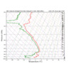
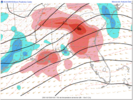
This is one of those storms where I can see the front end thump over performing, especially down in GA, but the warm nose on the back end also over performs as well.
Here, I explain one of the main reasons why I suspected this morning's snow would over perform in Georgia.
Somewhat counter intuitively, it actually comes down to not properly handling/underestimating the strength of the warm nose & warm advection aloft.
While a stronger warm nose/warm advection aloft eventually leads to a wider area transitioning from snow to sleet, it also often favors greater snowfall rates prior to that transition via frontogenesis enhancement from melting snow partially offsetting warm advection.
Other processes like adiabatic ascent, latent heat release from greater snow production in the DGZ aren't mentioned here but are worth noting.
I'm going 3" mby yard now, HRRR trends have me sold (I'm sure I'll regret it lol). Those rates just before we flip to sleet will be fun, haven't seen anything like that in 3 yrsMy final forecast for MBY (N Chapel Hill) is 2-3”, ~2” at RDU, 1-2” in Raleigh-proper, and 3-4” at @BullCityWx’s winter wonderland in N Durham (). Could easily see more, or less. Tough forecast and I’m not a met lol. All areas get snow, but all mix with IP/ZR with more mixing towards Raleigh. Don’t see more than 0.1” ice accrual, and probably not even that much.
Also 3-4” for GSO and 1-2” for CLT.
On your point and click or ...?NWS GSP really bumping up total in the piedmont of NC
- Joined
- Jan 2, 2017
- Messages
- 1,566
- Reaction score
- 4,279
Solid dusing and fatties starting!
Light/moderate ZR now mixed with stray mangled flake and a ping. Everything is coated in ice now
WolfpackHomer91
Member
NWS GSP really bumping up total in the piedmont of NC
Pic? I can’t find it on Twitter
Sent from my iPhone using Tapatalk
D-Ray
Member
Light snow has started !!!
I think there'll be a transition between snow/sleet for a couple hours.back to all sleet again lol
lj0109
Member
This concrete isn't going anywhere anytime soon. Back to 50/50 snow and sleet here. No glaze yet.Light/moderate ZR now mixed with stray mangled flake and a ping. Everything is coated in ice now
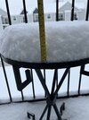
Moderate snow with 1.5” so far
- Joined
- Jan 2, 2017
- Messages
- 1,566
- Reaction score
- 4,279
WolfpackHomer91
Member
On your point and click or ...?
Yea, they went up to 1-3” in Iredell today / 1-3” tonight
Sent from my iPhone using Tapatalk
ITUSETOSNOW
Member
Some Mets in ATL say this could now be a massive ice storm..On top of 2-6 inches of snow.
ITUSETOSNOW
Member
Some Mets in ATL say this could now be a massive ice storm..On top of 2-6 inches of snow.
NEGaweather
Member


Sent from my iPhone using Tapatalk
Baby flakes reported from my sister northside Greenville sc
Webberweather53
Meteorologist
RTRwx
Member
Snowfall rates are ramping up in Chattanooga. If we can keep the p-type as snow for the next 4-5 hours, I could easily see the lower elevations getting ~4". Lookout and Signal could see ~5"+.
ITUSETOSNOW
Member
People are skiing and snowboarding in Piedmont Park.
Light snow now. It wants to crank
RGEM showed it fighting this pretty well I think. Gonna be lapping at our shoreline for a whileLots of work to do around hereView attachment 162409
Sctvman
Member
ChattaVOL
Member
Will the snow pack from the south from the front end thump help with temps at all?
Sent from my iPhone using Tapatalk
Sent from my iPhone using Tapatalk
Big ol flakes in Clemson per a friend
chuckhendo
Member
Got about 10 min of decent snowfall here and now it has seemingly transitioned to mostly IP. Wasn’t expecting much here but was hoping for at least some accumulation given the over performance elsewhere
Up to 32 and melting has commenced. Ice storm on top of snow canceled for here.
Three inches that stuck to everything this morning as the sun rose. Best winter storm for me since 2014.
Three inches that stuck to everything this morning as the sun rose. Best winter storm for me since 2014.
Yep, I can see that!Some Mets in ATL say this could now be a massive ice storm..On top of 2-6 inches of snow.
ForsythSnow
Moderator
1.5" snow/sleet as the sleet boundary fights
matt
Member
ChattaVOL
Member
1.5” in Chattanooga
Sent from my iPhone using Tapatalk
Sent from my iPhone using Tapatalk
But it is still below freezing. that will cause an ice storm?Up to 32 and melting has commenced. Ice storm on top of snow canceled for here.
Three inches that stuck to everything this morning as the sun rose. Best winter storm for me since 2014.

