NorthGaWinter4
Member
This would be some HEAVY snow if sleet wasn’t mixingFighting the line still, the line may be winning but not sure how long.
I'm with you here in Taylors on the side of Paris mountain in the Pebble Creek area haven't seen anything yet!Patiently waiting here in the northern Upstate with two snow starved little ones. If we bust it may cost me a trip to Disney, haha. They are so excited about seeing some snow. I am glad that those of you in Birmingham, Southern Atlanta, Augusta, even in the low country are seeing some winter weather. Great event for the board.
Models have been suggesting 850 temp will improve from west to east up this way, but not seeing it so far.Fighting the line still, the line may be winning but not sure how long.
It’s slowed way down. Getting some sleet now.Still ripping ?
Sent from my iPhone using Tapatalk
We've been going back and forth from ripping fatties to 50/50 sleet and snow.Fighting the line still, the line may be winning but not sure how long.
Definintely would be. The surge has slowed with Forsyth halved in it but mixing issues are back and forth here.This would be some HEAVY snow if sleet wasn’t mixing
We haven’t even got to the heavy stuff yet… what do you think we end with?
Sent from my iPhone using Tapatalk
Still just hammering here . Not a believer the warm nose makes it to the Tennessee bsma line . Cold north wind is battling hard . Still snowing down in Central bama
Hopefully we will get more soon. We have been in a long period of dry slotStill just hammering here . Not a believer the warm nose makes it to the Tennessee bsma line . Cold north wind is battling hard . Still snowing down in Central bama
Dude can we legit trend more qpf while simultaneously trending colder right as we are approaching take off? I think .5 as a general average across NC with most if not all as frozen is major, especially considering the antecedent conditions.
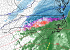
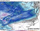
Yep just checked that and it continues to come in a touch colder each run.This 14Z HRRR run is really dropping that sleet/snow line further south in NC
25 miles south of CAE in Calhoun County. Heavy sleet/snow mix earlier, transitioned to FZRA/Sleet mix and 29.5FStaying just south of CAE.
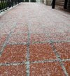
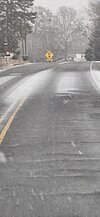
And now mostly frozen rain with a little sleet. Confirmed that it is accumulating on trees. My temp has been steady at 30-31 for several hours.Transition from moderate snow to moderate ice pellets happened about 15 min ago here 10 miles north of Augusta.
We're in that dry slot rnHopefully we will get more soon. We have been in a long period of dry slot
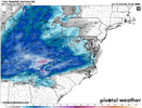
Yeah I’m beginning to think I’m walking to the state unc gameThere was a shift south with the "snow line". The 1.6" & 1.9" showing in Charlotte and Raleigh would be a frozen mixed concrete.
View attachment 162398
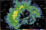
Hopefully the virga slows down the warmingGonna be hard to watch the slow advance of virga this morning and afternoon. Trust the process!
it is very light rain here. I see ice and water dripping from the tree limbs.30 degrees with freezing rain. Or should I say melting rain? Melting has commenced with the overcast daylight. I think any accumulating ZR will be at the tree-top levels until late afternoon if it manages to stay sub freezing.