D
Deleted member 609
Guest
1 inch snow mean out to Wilmington. Love to see that.
1 inch snow mean out to Wilmington. Love to see that.
Oh lord my heart be still. This is the board wide Big Dog we’ve been waiting for.The WPC is already highlighting day 7.
View attachment 106045
EPS is firing warning shots loud and clear. 3” mean to the coast this far out is amazing.
February 1973?Not many times a day 6-7 Euro run has shown this for Augusta. ?
Wonder if Augusta has ever had 8-10” snow.
View attachment 106061
From my eye just the strong cold push. WAR can push back. Little sketchyWhat is causing the suppression during the D7 time frame?
Not many times a day 6-7 Euro run has shown this for Augusta. ?
Wonder if Augusta has ever had 8-10” snow.
View attachment 106061
TPV around the lakes/SE CanadaWhat is causing the suppression during the D7 time frame?

That is exactly what we want to seeGEFS is gonna nearly lose the system this run. Two thirds less QPF so far.
Yeah but this looks like more reinforcing CAD this time than retreating. Surely don't need a wind up LP to get pulled in/up early which is more or less is what we call the old northwest trend.I dont want to be that guy but this look has so much potential to turn into a Miller B setup, all it takes is the TPV in SE Canada/the NE to lift off faster, and higher heights to squeeze in between it, and the system to dig even further SW. this go around looks very cold tho and the source region for the northern stream wave is even colder then the one tomorrow so it would probably be associated with a deep, cold CAD once again View attachment 106081
If it's not being directed south by a huge western ridge or pushed/blocked south by a west-based -NAO, it won't be that far south. I haven't seen the H5 maps yet for the Euro, so idk.TPV around the lakes/SE Canada
Think the key from a suppression standpoint is that at the beginning of the loop at day 2, we already have an eastern trough established. Then, we get the Aleutian low moving in from the west that gives us the ridge spikes along the British Columbia coast, sending our storm waves south into the southern Plains. Aleutian Low / +PNA is running the show, but without the eastern trough already established, the wave would cut too much. Not a far fetched scenario IMO, but heck, it's 6-7 days off. We need to keep going in the right direction between now and day 4 to have a chance.If it's not being directed south by a huge western ridge or pushed/blocked south by a west-based -NAO, it won't be that far south. I haven't seen the H5 maps yet for the Euro, so idk.

If it's not being directed south by a huge western ridge or pushed/blocked south by a west-based -NAO, it won't be that far south. I haven't seen the H5 maps yet for the Euro, so idk.
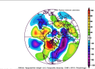
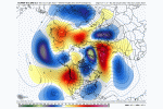
Voodoo and the PV being in MichiganWhat is causing the suppression during the D7 time frame?
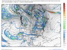
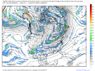
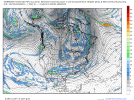
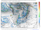
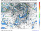
Yeah, I think there's a lot that can go wrong, but the GFS is more than likely showing its progressive bias right now.Was reviewing the H5 evolution and it seems the GFS is on an island by itself. It leaves a large portion of the shortwave parade diving down the backside of the east Pacific ridge, almost in Rex block fashion, trapped underneath it by hour 132.
View attachment 106118
Then you have the UKMET and the ICON, which both leave some of the energy behind further east in the 4 corners where it descends into Mexico.
View attachment 106116
View attachment 106117
Then you have the Euro/CMC and yes, the Korean, which bring all the energy out.
View attachment 106113
View attachment 106114
Indeed. IMO there is remarkable consistency through D5-6 overall.Yet all of them bring some sort of LP off the SE coast or near vicinity next weekend right?
You have the individual eps ensembles?Yeah, I think there's a lot that can go wrong, but the GFS is more than likely showing its progressive bias right now.
that didn’t take longI dont want to be that guy but this look has so much potential to turn into a Miller B setup, all it takes is the TPV in SE Canada/the NE to lift off faster, and higher heights to squeeze in between it, and the system to dig even further SW. this go around looks very cold tho and the source region for the northern stream wave is even colder then the one tomorrow so it would probably be associated with a deep, cold CAD once again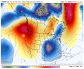
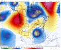
It's thing of beauty. However it's already too far west for all snow in the Midlands on the 18Z GFS. I already cocnerned that the track will shift even futher west and this at some becomes more of a western Deep South/Mid South Mid Atlantic storm when we get to the 3 day range. As MyFrotho said as well,this could also become more of miller A/B hybrid as we get closer. I love the trends,but I also hate the trends, knowing most storms trend west as we get closer to go time.GFS goes boom. Too clowe for comfort already.
View attachment 106171
While the GFS did shift way west, it just aligned itself with all the other models. All the major globals are actually showing the exact same thing
It didn't really shift west. It's actually at the same position the Euro is, and east of the CMC. It just doesn't dig as much to pull the wave further south with the cold air.While the GFS did shift way west, it just aligned itself with all the other models. All the major globals are actually showing the exact same thing
