D
-
Hello, please take a minute to check out our awesome content, contributed by the wonderful members of our community. We hope you'll add your own thoughts and opinions by making a free account!
You are using an out of date browser. It may not display this or other websites correctly.
You should upgrade or use an alternative browser.
You should upgrade or use an alternative browser.
Wintry 1/20 - 1/23 Winter Storm
- Thread starter packfan98
- Start date
GeorgiaGirl
Member
Y’all are playing with fire putting this suppression stuff into the universe with the cold air that’s coming.
Well, to be fair, I thought the storm that is going to happen today/tomorrow was going to be a bit suppressed because of what I remember from one of the last La Nina's, and yet...
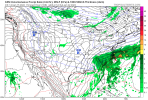
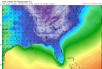
The CMC has me with a HIGH below 32 on Saturday next week.
Crazy.
Downeastnc
Member
Local office here also forecasting rain next Friday but it is a week out so I am sure if the models keep threatening snow they will change up....
Friday
A chance of rain. Partly sunny, with a high near 39. Chance of precipitation is 30%.
The overall look is great for central and eastern NC, this is how we get our bigger snow's here.....really from Jan 19-25th there could be a low that gives us a storm....we gonna need it after getting goose egged tomorrow....though I will gladly exchange ice for a pure snow event...
whatalife
Moderator
D
Deleted member 609
Guest
Snowed In
Member
Already temp issues; no thanks.
D
Deleted member 609
Guest
- Joined
- Jan 23, 2021
- Messages
- 4,602
- Reaction score
- 15,197
- Location
- Lebanon Township, Durham County NC
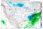
GEFS isn’t even suppressed, there isn’t much of anything for anybody.
Snowed In
Member
whatalife
Moderator
ForsythSnow
Moderator

- Joined
- Jan 23, 2021
- Messages
- 4,602
- Reaction score
- 15,197
- Location
- Lebanon Township, Durham County NC
I feel you but my biggest worry is another January 2018 where it’s snowing on King St in Chas and it’s partly sunny here.Eh, we have a winter storm in the 20s coming up tomorrow. no -NAO could mean amplification/NW trends, bring on suppression
D
Deleted member 609
Guest
19 at disneyworld. Looks realistic
To be fair, it had not much of anything for this upcoming storm at this same range.GEFS isn’t even suppressed, there isn’t much of anything for anybody.
D
Deleted member 609
Guest
Eh. Rather this then showing a storm along thr coast already. If I get missed southeast, it is what it is. I'm tired of it missing me northwest.I feel you but my biggest worry is another January 2018 where it’s snowing on King St in Chas and it’s partly sunny here.
Hypsometric
Member
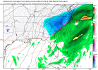
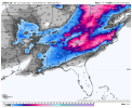
FWIW the 12z CMC was very similar to many of the 00z EPS members that I looked at that had hits.
In first with a : it looks like Jan 2000
The last time I can recall being in the "bullseye" zone for a snowstorm 7 days out and it worked out was in February 2010. The other times (and there have been numerous) I've been in the bullseye 7 days or so out; it hasn't worked out.
I love the pattern and the energy in the atmosphere, but I've been burnt too many times lately in this scenario. Color me (extremely) cautiously optimistic.
I love the pattern and the energy in the atmosphere, but I've been burnt too many times lately in this scenario. Color me (extremely) cautiously optimistic.
To me, the 12Z CMC looked more like Feb 1899, Feb 1914, or some of these really crazy runs we saw in last Februay before the Models went to crap for areas east of the Mountains.In first with a : it looks like Jan 2000
Looks identical to the Jan 2014 overruning event with the CMC.
bingcrosbyb
Member
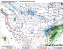
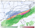
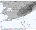
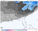
She’s a beaut Clark. 2M temps in mid 20s are fantastic.24 hour snow totals.
View attachment 105965
That would be definitely some higher snow ratio. Like a 15:1.She’s a beaut Clark. 2M temps in mid 20s are fantastic.
Yea I’m done with anything outside of 3 days. Been years and I mean years since we’ve seen snow modeled 7 days outThe last time I can recall being in the "bullseye" zone for a snowstorm 7 days out and it worked out was in February 2010. The other times (and there have been numerous) I've been in the bullseye 7 days or so out; it hasn't worked out.
I love the pattern and the energy in the atmosphere, but I've been burnt too many times lately in this scenario. Color me (extremely) cautiously optimistic.
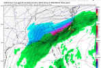
The difference between the GFS and CMC is that the CMC wants to dig the wave, while the GFS doesn't. After the last storms, you all know that models tend to underestimate the amplification and digging, but I'm not holding my tongue.
Hypsometric
Member
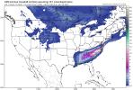
Just curious if that is all because the op CMC was still going strong at 180.The CMC Ensembles don't look bad.
View attachment 105983
Downeastnc
Member
This setup is how we snow big in central and especially eastern NC for sure, gotta keep the pingers out of it or at least only deal with them for a few hrs.....back in Dec 2000 we had pingers at the height of the storm but I mean half dollar flakes and BB size pingers raining down with almost no vis was AWESOME lol.....I will take that anytime...this isnt fantasy range either inside of 7 days almost...just need that cold press to be legit.....the setup would give a good 3-5 days window for something to come along and give us a storm.
January for the ages setting up. Unreal
Which is so good, I’m more interested in this storm than the one occurring tonight and tomorrow it will be more snow and cold air to work with up there to bring down.Keep in mind that the snow in the NE is from another system beforehand.
View attachment 105987
I have no idea how this is going to end up but would be shocked at an LP track like we are going to see tomorrow.Which is so good, I’m more interested in this storm than the one occurring tonight and tomorrow it will be more snow and cold air to work with up there to bring down.
One analog stands above the others with that look and everyone will love it, 2/12/10.
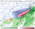
The GEM/CMC look was just spectacular. UKMet was going in that direction at the end of it's run at 168, though not as boldly. So, GFS is hitting on the first wave dropping down, the CMC and UKMet with a second waveAvert your eyes...GEM
Hypsometric
Member
I think the ICON was also in the CMC/UKMET camp.The GEM/CMC look was just spectacular. UKMet was going in that direction at the end of it's run at 168, though not as boldly. So, GFS is hitting on the first wave dropping down, the CMC and UKMet with a second wave

