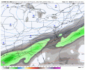
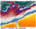
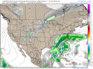
Not throwing in with the euro just yet unless gfs and cmc move that way. Also tomorrow we should know the story more or lessSuch big differences in Op runs at day 3-4. Usually you would blend them but I think Euro is likely right.
View attachment 107356
-
Hello, please take a minute to check out our awesome content, contributed by the wonderful members of our community. We hope you'll add your own thoughts and opinions by making a free account!
You are using an out of date browser. It may not display this or other websites correctly.
You should upgrade or use an alternative browser.
You should upgrade or use an alternative browser.
Wintry 1/20 - 1/23 Winter Storm
- Thread starter packfan98
- Start date
Chattownsnow
Member
Doesn’t the Euro have a bias of holding energy back in the southwest and the GFS a bias of being to progressive with s/w’s? It’s like there biased are roll reversed when comparing the models
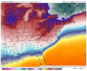
Yeah so these maps are a bit crude, but this was the 850mb low track with tempsSo my guess plot on that current 12z euro run modeled track for the 850 is about right?

Personally, I much prefer the EURO over ANY model. I believe the GFS and it's new physics make it a much better model from previous years, but the EURO is still the go to model and is superior. Like Grit said, it looks like there is going to be another significant winter storm for the SE, but the details need to be ironed out.
Another In-situ CAD event ? so marginal it hurtsVery marginal event here, might crack 33 View attachment 107341
NBAcentel
Member
Stormlover
Member
Very much so. The track/and if it amps up more would do that.For some our Mets. So what would it take to get this to cover out west?? And is this actually possible at this stage on the system??
When the EURO is honking, then you better listen. Of course, it would be nice to have the others on board, but they really aren't that far off from one another. Fun times, indeed.
This backs EXACTLY what I was saying earlier. Thanks for sharing.
If the euro ensembles support the op it will be interesting to watch play out. Very short lead time for such differences in op models
Sent from my iPhone using Tapatalk
They pretty much do with more snow than 0Z EPS as well as plentiful ice/sleet in some areas:
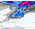
Snow portion 12Z EPS: big hit much of NC/VA/upstate SC/E TN!
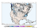
What phase MJO are we in during this perceived hit? Wonder if our hot streak in good phases is supported through this solutionThey pretty much do with more snow than 0Z EPS as well as plentiful ice/sleet in some areas:
Snow portion 12Z EPS: big hit much of NC and upstate SC!
View attachment 107359
If you want less ice and more snow you need to have a less vigorous system, plain and simple. The EURO is amped, thus pumping a ton of moisture and warmer air over top the cold air mass.
I was thinking the exact same thing, actually. I don't really like the comparison due to the hyperbole aspect of it. That event was modeled to be a late bloomer off the coast. But the arctic boundary came through and helped create an unstable environment for an undermodeled thunderstorm complex moving eastward along the Gulf, which essentially ejected energy that infused with the developing coastal and developed it more rapidly and much farther inland than forecast.I have NO IDEA what's going to happen this weekend, but somebody is going to be happy. Could 1 wave hit, could it be 2? Anyone's guess at this point. This actually reminds me of Jan 2000 with an arctic front and a lot of energy flying around. The models were keying in on one wave and it was another that snuck in and leading to the Carolina crusher.
When I saw that trailing wave rolling down south on one of the charts somebody posted above, I thought about 2000. Many of us would like to experience that kind of a surprise again, though our models are better now, and I don't know if it's possible to see that anymore.
NoSnowATL
Member
CODWhat phase MJO are we in during this perceived hit? Wonder if our hot streak in good phases is supported through this solution
Hypsometric
Member
I also agree with this. If the euro was locked in with a stable solution that would be one thing, but there’s still large changes in the second wave timing that could throw off what it is currently showing. If anything, the CMC has probably been the most consistent over the past couple days and that’s pretty telling.Not throwing in with the euro just yet unless gfs and cmc move that way. Also tomorrow we should know the story more or less
What phase MJO are we in during this perceived hit? Wonder if our hot streak in good phases is supported through this solution
Based on best I can tell, likely inside the circle on the left side though the Euro disagrees. It hasn’t been doing well lately with the MJO, however.
Oh and I'm good with where the Euro is rn. Let that big goober do what it's going to do. It'll stumble on in eventually.
It's solution is possible but it's only one of many on the table. I'm glad we have quite a few still off to the east.
It's solution is possible but it's only one of many on the table. I'm glad we have quite a few still off to the east.
NBAcentel
Member
NBAcentel
Member
lexxnchloe
Member
So much for this storm. Anymore NW and its Izzy 2.0View attachment 107328
Hmmm where have we seen trends like this before
I will gladly take that eps. Will be interested to see the individual member charts here in just a little while.
But I thought it had been king lately. Just goes to so, always nod to the Euro if you had to make a bet
Snownut
Member
This looking like a carbon copy of the storm that just passed.
Sent from my SM-A526U using Tapatalk
Sent from my SM-A526U using Tapatalk
It's a completely different setup, but we'll have to see what transpires on the ground in the endThis looking like a carbon copy of the storm that just passed.
Sent from my SM-A526U using Tapatalk
Snownut
Member
Oh yeah I know it's different setup I'm just talking in lines of where the snow vs Ice, where 850 line is ect...It's a completely different setup, but we'll have to see what transpires on the ground in the end
Sent from my SM-A526U using Tapatalk
Cary_Snow95
Member
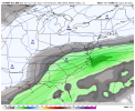
I notice the snow orientation is more west to east rather than the op which was sw to neEPS looks great, slightly better then last run in fact by snow mean standards View attachment 107360View attachment 107361View attachment 107362
Not quite ..totally different in terms of evolution and would put a footprint much larger and much deeper in terms of amounts of winter precipThis looking like a carbon copy of the storm that just passed.
Sent from my SM-A526U using Tapatalk
Oh yeah I know it's different setup I'm just talking in lines of where the snow vs Ice, where 850 line is ect...
Sent from my SM-A526U using Tapatalk
What? The surface temperatures are much colder.. the high is much stronger... my local office is putting the progged high in the 97th percentile..... strength wise.
NBAcentel
Member
Well at least we know where this one is headed, get ready 85-northwest for a big dawg
Lol just joking but this ain’t exactly to Ideal
Different setup but I see what you’re saying as far as snow/ice footprint goes. Looks like the usual suspects..againThis looking like a carbon copy of the storm that just passed.
Sent from my SM-A526U using Tapatalk
If the storm went negatively tilt sooner than what the Euro showed,this could've easily have been another Miller A/B hybrid. At the rate we are going with Euro,the Midlands of SC and Eastern NC will be begging for a last minute NW trend,since it appears we might be too warm at 850 to snow or even sleet,but cold enough for a heavy Ice storm. Heavy freezing rain with temperatures in the upper 20s isn't fun. So much for a good overrunning event that had the cold front stalled in Central Florida with a very weak low pressure system riding along it.This looking like a carbon copy of the storm that just passed.
Sent from my SM-A526U using Tapatalk
Last edited:
I don't know if some of you remember but I was hugging me some GFS with this past storm. It consistently laid down pretty blue colors all over my backyard (I ended up with 1 inch of backend stuff). Invariably, the NAM actually did better and the EURO as well. Once I realized Birdman was honking the GFS, I knew hugging the GFS was folly. This is the type of setup that can do really well in N and C GA as well as back into AL. Curious to see if the midnight run holds serve.
Already temp issues; no thanks.
If the storm went negatively tilt sooner than what the Euro showed,this could've easily have been another Miller A/B hybrid. At the rate we are going with Euro,the Midlands of SC and Eastern NC will be begging for a last minute NW trend,since it appears we might too warm at 850 to snow or even sleet,but cold enough for a heavy Ice storm. Freezing rain with temperures in the upper 20s isn't fun So much for good overruning event that had the cold front stalled in Central Flordia with a very weak low pressure system riding along it.
I still agree with my assessment. Temp issues were showing even early on Saturday for snow. This is unfolding exactly as expected for CAE.
- Joined
- Jan 23, 2021
- Messages
- 4,602
- Reaction score
- 15,197
- Location
- Lebanon Township, Durham County NC
5.5 snowfall mean this run. Guess I’ll go be mad about that.
Updated thoughts from Tate at WPC...
Extended Forecast Discussion
NWS Weather Prediction Center College Park MD
216 PM EST Mon Jan 17 2022
Valid 12Z Thu Jan 20 2022 - 12Z Mon Jan 24 2022
...Snow/ice are possible along the Eastern Seaboard late this week
and weekend on the eastern periphery of an Arctic high...
...The 00Z and incoming 12Z ECMWF are generally on the western side of the model spread with these features, leading to more precipitation over the Eastern Seaboard, while the GFS runs have been suppressed farther east into the Atlantic. The 00Z cluster analysis and ensemble member low plots showed that the GEFS and EC ensembles followed their operational runs, with GEFS members farther east than EC ensemble members. Tended to favor a position for the surface low near the 00Z EC ensemble mean as somewhat of a compromise, which was not too far off from the 00Z CMC position, but the 12Z CMC is now showing a more suppressed pattern. This forecast approach led to a trend west of the previous WPC forecast with the surface low and frontal placement, but not nearly to the western extent of the ECMWF runs.
...On the southern and eastern periphery of this high, moist air spilling into the cold air could lead to wintry weather on the northern periphery of precipitation spreading across the Gulf Coast states and then possibly up the Eastern Seaboard. Once again, uncertainty with the evolution of shortwaves and surface lows leads to low confidence in placement of wintry precipitation and precipitation type in some locations at this time, but the current forecast shows the potential for notable snow, sleet, and freezing rain particularly in the Carolinas and southern portions of the Mid-Atlantic for the latter part of the week, with some chance of spreading into the Northeast this weekend.
Tate

