packfan98
Moderator
Especially with the track of that low. I agree.Euro is exceptionally close to more snow than ice based on H5
Especially with the track of that low. I agree.Euro is exceptionally close to more snow than ice based on H5

Yeah, there's no way very much of that is ZR. 70% of that is sleet.
For the euro tho. Gfs is completely the opposite directionI was being sarcastic when I said this would end up in Cleveland....??
Deja vu to yesterday. This is is what the snow maps looked like 5 days out for yesterday.
Looks like CAE is going to get another chance at decimating their power grid. Mother Nature was just waiting on @Storm5 to get home from Gatlinburg.
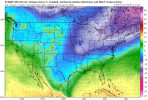
Euro 850 low track and temperatures

Second wave screams marginal. I’m all in on wave 1 with a true cold source
Euro 850 low track and temperatures


How about dews?Very marginal event here, might crack 33 View attachment 107341

View attachment 107340
I am sure I am wishcasting here, but still am puzzled why 850s are that warm with a 1042 high over New York. I cannot remember ever seeing that before with such a huge difference with the cold surface and 925 temps.
View attachment 107340
I am sure I am wishcasting here, but still am puzzled why 850s are that warm with a 1042 high over New York. I cannot remember ever seeing that before with such a huge difference with the cold surface and 925 temps.
Single digit dews into Greensboro. Early warning shots.It’s not climo bro View attachment 107348View attachment 107349
SleetIt’s not climo bro View attachment 107348View attachment 107349
Regardless cold air is there whether it’s the surface or above and this system looks like it could be much more long duration vs the other one. Will bode not good for anyone who sees any type of ice or even snow build up for that longEuro 850 low track and temperatures

View attachment 107340
I am sure I am wishcasting here, but still am puzzled why 850s are that warm with a 1042 high over New York. I cannot remember ever seeing that before with such a huge difference with the cold surface and 925 temps.
Yeah the mid levels don't care what's going on at the surface. This phases and goes negative tilt just a bit too early, and too far NW for southeastern side areas for snowAnd the low pressure doesn't seem that strong either, and it's off the coast. I guess it's going too neutral/negative too soon with the phase? With the phase modeled, I'm tossing and will wait to see ensembles. Euro smoking something.

Havent looked but 850 low probably running down southern NC?Yeah the mid levels don't care what's going on at the surface. This phases and goes negative tilt just a bit too early, and too far NW for southeastern side areas for snow

Grit, but it doesn't pull the slp inland. Is it that pesky 850 you showed earlier doing that?Yeah the mid levels don't care what's going on at the surface. This phases and goes negative tilt just a bit too early, and too far NW for southeastern side areas for snow

Looks like the 850 tracks Atlanta, GSP, Charlotte, Rocky Mount, NorfolkHavent looked but 850 low probably running down southern NC?
Any chance that both miss with just a sliver of the Far East being impacted? This is serious cold I see I believe there won’t be much moisture involved for most on the board.
Don't think so...just because there is cold air, it's usually relatively low level, while copious amount of moisture can easily override the cold air mass.Any chance that both miss with just a sliver of the Far East being impacted? This is serious cold I see I believe there won’t be much moisture involved for most on the board.
For some our Mets. So what would it take to get this to cover out west?? And is this actually possible at this stage on the system??
Yes, that's what I should have stated....the sfc low and mid level lows don't always line up how you want them to be in terms of temperatures aloft for snow. For RDU-CLT snow, we'd want that 850 low closer to the coast, but the 500mb wave evolution doesn't allow itGrit, but it doesn't pull the slp inland. Is it that pesky 850 you showed earlier doing that?
This. A blend of the UKMET and Euro would be gold for the RDU to I-95 NC crowd IMO. That’s not an impossibility either.Yeah the mid levels don't care what's going on at the surface. This phases and goes negative tilt just a bit too early, and too far NW for southeastern side areas for snow

Overall, a super blend of the op and ensemble runs right now gives us a winter storm in the SE...details to be ironed outThis. A blend of the UKMET and Euro would be gold for the RDU to I-95 NC crowd IMO. That’s not an impossibility either.
We’ll not be using logic around here, sir.Overall, a super blend of the op and ensemble runs right now gives us a winter storm in the SE...details to be ironed out
So my guess plot on that current 12z euro run modeled track for the 850 is about right?Yes, that's what I should have stated....the sfc low and mid level lows don't always line up how you want them to be in terms of temperatures aloft for snow. For RDU-CLT snow, we'd want that 850 low closer to the coast, but the 500mb wave evolution doesn't allow it
