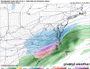
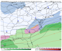
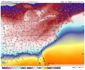
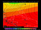
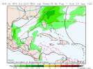
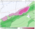
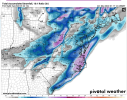
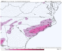
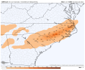
Yep you can't lose the polar wave if you want the first system to work unless you pull the wave to its SW out and start interacting but then you open the bag of ptype concerns creeping NW. This setup was clean the other day a strong polar wave digging deep and giving us a nice Miller A. Now it's a convoluted caveat driven messView attachment 107263Really not a great trend
-
Hello, please take a minute to check out our awesome content, contributed by the wonderful members of our community. We hope you'll add your own thoughts and opinions by making a free account!
You are using an out of date browser. It may not display this or other websites correctly.
You should upgrade or use an alternative browser.
You should upgrade or use an alternative browser.
Wintry 1/20 - 1/23 Winter Storm
- Thread starter packfan98
- Start date
UKMET? Use to be king of sniffing out pahses
WXinCanton
Member
A lot going on out there. Lower than usual confidence with all the energy flying around. So hug whichever model shows the most snow for you lol
I feel like even the bad evolving models have printed a winter storm most of the time .. I feel like that should already be reeled in at this point now we just figure out who sleets and who snowsthere’s honestly just many reasons to be skeptical about this storm with certain things
and we’re seeing why, we saw the perfect runs a couple days ago so didn’t have a great idea on what could go wrong, now we’ve seen both ways
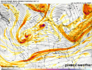
The one time we need the polar wave to slow(like they always do) it speeds up.View attachment 107263Really not a great trend
NBAcentel
Member
Stormsfury
Member
The run to run consistently is like trying to gauge if you're about to fart or shart...and you have 30 seconds to decide to hightail it to the bathroom...
The GFS op and basically guidance are having issues keying in on energy just flying around in the atmosphere.
The GFS op and basically guidance are having issues keying in on energy just flying around in the atmosphere.
Cary_Snow95
Member
The trailing wave is what screws everything up. It pushes down on the flow and stretches the main vort back to the sw. Someone correct me if I’m wrong, but the window to trend back to a vort tucked underneath the main Ns vort is diminishing. We’re only 60-72 hours from the energy in the southwest elongating
NBAcentel
Member
It ----- with our ridging behind the main polar wave that would help it digThe trailing wave is what screws everything up. It pushes down on the flow and stretches the main vort back to the sw
NBAcentel
Member
I’m not even concerned tho. Someone here will get wintry wx later this week/next weekend, these exact struggles happened February 2014 as well
Gawx speacil


iGRXY
Member
Still think models are having a hard time latching onto which piece of energy. Odds are things get more amped and you get much more precip back to the west. Just depends on what the upper levels look like because cold at the surface looks legit.
- Joined
- Jan 23, 2021
- Messages
- 4,603
- Reaction score
- 15,199
- Location
- Lebanon Township, Durham County NC
LovingGulfLows
Member
- Joined
- Jan 5, 2017
- Messages
- 1,499
- Reaction score
- 4,100
The run to run consistently is like trying to gauge if you're about to fart or shart...and you have 30 seconds to decide to hightail it to the bathroom...
The GFS op and basically guidance are having issues keying in on energy just flying around in the atmosphere.
That's certainly an interesting way to describe it. I'm worried the cold air mass simply won't verify as deep which means the whole thing moves NW.
iGRXY
Member
UK also has a suppression bias in the LR. See yesterday’s storm as an example.
I guess good luck figuring it all out. The first wave might swing and miss, but we need the high to really press in...Then wave #2 behind it for the weekend...which one works, which one doesn't....DOC up next.
- Joined
- Jan 23, 2021
- Messages
- 4,603
- Reaction score
- 15,199
- Location
- Lebanon Township, Durham County NC
brendan123
Member
Unless we pull a crazy NW tend (which certainly is possible, we saw what happened with yesterday’s storm), I think Central & NE North Carolina along with SE Virginia are sitting in the sweet spot right now. Weak, late blooming Miller A’s/overunning events tend to give us our biggest storms.
- Joined
- Jan 23, 2021
- Messages
- 4,603
- Reaction score
- 15,199
- Location
- Lebanon Township, Durham County NC
I’m telling y’all, I wouldn’t be surprised to see this end up with a January 2002 footprint.
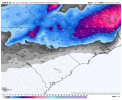
This looks good to me at day 4...?
Southern energy is further east past few runs.
View attachment 107282
This is not far off from what the majority of interior SE want to see. Good timing/tilt it would seem.... too bad the UKMET was one of the last models to catch up with the last event...
No changes from me from my post a few days ago. Moisture is the problem. I hope someone way down east can score tho.there’s honestly just many reasons to be skeptical about this storm with certain things
and we’re seeing why, we saw the perfect runs a couple days ago so didn’t have a great idea on what could go wrong, now we’ve seen both ways
This is not far off from what the majority of interior SE want to see. Good timing/tilt it would seem.... too bad the UKMET was one of the last models to catch up with the last event...
It was to progressive until it got inside day 4 and then got a clue.
iGRXY
Member
Sitting in the sweet spot at day 4 is the kiss of death. Every single time.Unless we pull a crazy NW tend (which certainly is possible, we saw what happened with yesterday’s storm), I think Central & NE North Carolina along with SE Virginia are sitting in the sweet spot right now. Weak, late blooming Miller A’s/overunning events tend to give us our biggest storms.
Brad seems more interested in the second wave for our chances in clt.
If we trend things SW from here,this would actually be a really good look for CSRA, Midlands of SC, Central/NE NC and SE VA. Too bad other models,espically the CMC look worse and delays the cold for areas south of NC.Gawx speacil

brendan123
Member
Yeah, I meant that seeing the GFS/ICON/UKMET set up the main axis of snow along the outer banks is good news for those areas. It is somewhat concerning though to see the Canadian, Euro, and the ensembles setting up the snow over Central NC and Southeast Va though. Doesn’t leave much margin for error.Sitting in the sweet spot at day 4 is the kiss of death. Every single time.
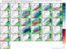
Here’s the mean from the 12Z GEFS for wave #2: will it do the typical NW shift from here? We’ll see. If it didn’t, this would be near the ideal track for coastal SE snow.
View attachment 107273
View attachment 107275
Further to the above, here’s the track of the individual members. I couldn’t have drawn a better member map for a typical surface low track for a rare SE coastal winter storm. But alas, we know that there’s a bias that means a NW shift is more likely than not:
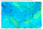
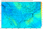
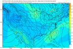
The WPC noted in their last discussion that they are basically refraining from "chasing waves" in this pattern that would knock their forecast all around. They're trying to stick to continuity.. so wouldn't be surprised to see their products potentailly not matching up with the models at times for our back yards. FWIW.
Here is their current Day 4:
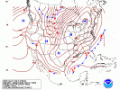
Here is their current Day 4:

NoSnowATL
Member
Brad seems more interested in the second wave for our chances in clt.
I believe that’s correct, local PRO Mets are thinking the same way and I don’t blame them, past events have done the same and they are always too light on totals until the event actually starts and they play the caught up game like they did with this past system.
Kind of funny, the CMC pulls off this move back to back. At least we have a central and eastern trough with chances, and aren't talking SE ridges, MJO Phase 5, and bathtub sloshing ?Yep you can't lose the polar wave if you want the first system to work unless you pull the wave to its SW out and start interacting but then you open the bag of ptype concerns creeping NW. This setup was clean the other day a strong polar wave digging deep and giving us a nice Miller A. Now it's a convoluted caveat driven mess

lexxnchloe
Member
Im just happy we have 2 weeks of possibilities.
If we're looking for some weak impulses riding along the arctic boundary creating mischief, this looks pretty good to me.


