-
Hello, please take a minute to check out our awesome content, contributed by the wonderful members of our community. We hope you'll add your own thoughts and opinions by making a free account!
You are using an out of date browser. It may not display this or other websites correctly.
You should upgrade or use an alternative browser.
You should upgrade or use an alternative browser.
Wintry 1/20 - 1/23 Winter Storm
- Thread starter packfan98
- Start date
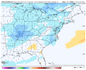
What’s up with Iowa?Damn another “when my grandpa was alive” CAD coming back from the old days ? View attachment 107162
NBAcentel
Member
I’m not to concerned yet about this, models wanted to play with wave spacing with our last system with it separating and getting caught up with that low off cali, especially the euro and nam. this was very noticeable in the mid-short range around the day 4-5 window
Jessy89
Member

With low like that ice wouldn’t be that far north. It would probably even be snow down to Lauren’s
Sent from my iPhone using Tapatalk
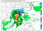
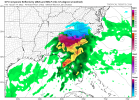
Looks like the 12z GFS destroys me with IP/ZR wow!!
When the lights went out in GA....the GFS is no joke with this! Wow! Hopefully for the metro area it would be sleet. The GFS is not joke though! Geez!!There a Reba McEntire song for what just went down in GA on GFS.... geez
Cbmatt2408
Member
Yeah here in LaGrange, GA. The GFS can try again, I’m not ok with that run.
NBAcentel
Member
Truly not a fan of that GFS evolution tho, that secondary wave doesn’t sit right with me I dunno
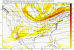
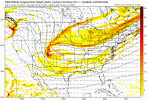
I'm seeing signs on these low resolution maps of our High slipping away already with the second deal. I don't have NH charts right now thoughTruly not a fan of that GFS evolution tho, that secondary wave doesn’t sit right with me I dunno
- Joined
- Jan 23, 2021
- Messages
- 4,603
- Reaction score
- 15,199
- Location
- Lebanon Township, Durham County NC
Same. I’ll take the euro and Canadian evolutions tyvm.Truly not a fan of that GFS evolution tho, that secondary wave doesn’t sit right with me I dunno
I'm supposed to be arriving in Jacksonville, NC by car. I will be coming up to that area through Augusta, GA, up I-95. Will my best bet for safe roads be to hug the coast with the current storm trends?
With most models having the MJO within the circle, the chance of a major ATL ZR/IP is enhanced somewhat by climo as the last 9 in ATL had the MJO like that. That’s my biggest concern for them.
Also, late January has had the highest frequency of major ZR at Atlanta since the late 1800s. Since 2000, 3 of the last 5 were in late January.
We have no idea. Thank you for contacting SouthernWX your premier travel advisory website.I'm supposed to be arriving in Jacksonville, NC by car. I will be coming up to that area through Augusta, GA, up I-95. Will my best bet for safe roads be to hug the coast with the current storm trends?
Stormlover
Member
From Hun NWS:
We will also be monitoring the threat for another winter storm
during the period from late Thursday night-early Saturday morning.
We will also be monitoring the threat for another winter storm
during the period from late Thursday night-early Saturday morning.
??Yeah, too many moving pieces still. I'll probably just plan my route as I go according to nowcasting. That's always best with these winter events anyway. Thanks.We have no idea. Thank you for contacting SouthernWX your premier travel advisory website.
GeorgiaGirl
Member
Just about logged in to say that the weekend setup honestly looked like a no to me as it honestly looked as if the energy was gonna be buried (but I'm on my phone and only looked at one energy map, I can't help myself).
Now I did to say that I'm confused. Which is it going to be, Friday or the weekend?
I don't see the high for the CAD with the weekend btw.
Now I did to say that I'm confused. Which is it going to be, Friday or the weekend?
I don't see the high for the CAD with the weekend btw.
- Joined
- Jan 23, 2021
- Messages
- 4,603
- Reaction score
- 15,199
- Location
- Lebanon Township, Durham County NC
Just noticed the ICON was cold from the top down. When you’re at -6 at the 850 level and at the surface, you’re going to do better than any clown map.
Cary_Snow95
Member
Second wave screams marginal. I’m all in on wave 1 with a true cold sourceTruly not a fan of that GFS evolution tho, that secondary wave doesn’t sit right with me I dunno
NBAcentel
Member
Storm5
Member
Ugh temps would be a problem for many of n the second system . Boarder line for many 5 days out hardly ever works
Sent from my iPhone using Tapatalk
Sent from my iPhone using Tapatalk
NBAcentel
Member
Slowly but surely the precipitation types are getting closer to what GEFS mean was doing with the last system as the OP GFS amped more and more with other modeling following. What I see this time around are other OP models amping before the GFS to an extent.
We actually have no idea what's going to happen and we are what? Approaching 90 hours out from the setup or even less?
The only sure thing looks like an arctic front coming through.. everything agrees there...
NBAcentel
Member
This GEFS run looks good for areas east vs areas west, less overrunning more weak Miller A
Cary_Snow95
Member
“weak Miller A”This GEFS run looks good for areas east vs areas west, less overrunning more weak Miller A
I think we all know how that will end up 9/10 ?
I'm willing to take my chances with the second wave provided the first delivers too. The table is set for exactly that possibility too.Second wave screams marginal. I’m all in on wave 1 with a true cold source
“weak Miller A”
I think we all know how that will end up 9/10 ?
The GFS is splitting things up. I admit I feel okay with that look given how the GFS performed around this lead time last event. Can we just meet in the middle and have a nice Miller-A that gets the whole SE and up/ further off the coast for Eastern NC too?
NBAcentel
Member
NBAcentel
Member
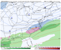
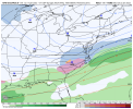
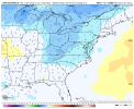
Ok now that’s badView attachment 107263Really not a great trend
Cary_Snow95
Member
Everyone worried about amping an hour ago. I’ve been concerned about this stretching out since yesterday. Euro starting to be on an island
Cary_Snow95
Member
NAM is even more elongated than cmc
Z
Zander98al
Guest
This last event had everything pulling away from the euro solution, and then the euro actually was more sane than the rest, and they ended up caving back to the euro if I remember correctly. I think it coincided with the system getting samplesdEveryone worried about amping an hour ago. I’ve been concerned about this stretching out since yesterday. Euro starting to be on an island
Snowflowxxl
Member
Everyone should still be concerned about amping and temps
Cary_Snow95
Member
NBAcentel
Member
there’s honestly just many reasons to be skeptical about this storm with certain things
and we’re seeing why, we saw the perfect runs a couple days ago so didn’t have a great idea on what could go wrong, now we’ve seen both ways
and we’re seeing why, we saw the perfect runs a couple days ago so didn’t have a great idea on what could go wrong, now we’ve seen both ways

