-
Hello, please take a minute to check out our awesome content, contributed by the wonderful members of our community. We hope you'll add your own thoughts and opinions by making a free account!
You are using an out of date browser. It may not display this or other websites correctly.
You should upgrade or use an alternative browser.
You should upgrade or use an alternative browser.
Wintry 1/20 - 1/23 Winter Storm
- Thread starter packfan98
- Start date
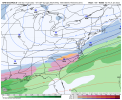
This ones gonna sneak up on a lot of folks. This is the kind of system that gives Atlanta/north-central Ga major issues.
I don’t want to get my hopes up to much yet. Lol. However you are super right. This is how much of middle GA, and usually NGA scores big wins with wintry precip and cold temps for sure.This ones gonna sneak up on a lot of folks. This is the kind of system that gives Atlanta/north-central Ga major issues.
Do you think this the one for central midlands of SC finally??EPS with a 1040 high and with a bug snow pack just put down. This upper low can’t slow down and come 24 hours later, screws everything up.
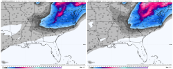
View attachment 107175
It’s an anonymously cold airmass…would think so.Do you think this the one for central midlands of SC finally??
FFC-
LONG TERM /Tuesday Night through Sunday/...
Progressive weather pattern continues into the extended period
with the first of many features approaching the state midweek.
Extended models are in agreement with cold front moving into the
Thursday with moisture axis remaining positioned over the state
through early Friday. At onset of this event, there is a
possibility of a light wintry mix over north Georgia early
Thursday where the moisture and colder temperatures combine, but
the big forecast concern continues to be the winter precip
potential for mainly Friday.
The extended models only seem to agree on the potential for winter
precip, but solutions continue to diverge with respect to Friday
timing and precip type. Each seems to struggle with how to resolve
surface low's warm, moist advection and wedge feature. The 00Z
GFS, which at this time seems to have the best run- to- run
consistency with producing winter precip, shows a combination
SN/FZRA event playing out over the eastern half of the state,
centered generally along I-20. The 00Z Euro, after showing a non-
event in the 12Z run, is back to showing a more robust FZRA event
unfolding in the Carolinas and down into eastern Georgia and
higher snow totals over north Georgia (including all of the ATL
metro).
Given the high forecast uncertainty, have continued to mention
RA/SN mixed precip in the grids for late Thursday through early
Saturday with periods of all SN over generally north Georgia.
Euro is slower than GFS to exit moisture on Saturday, but
consistent with other extended models with showing chilly sub-
seasonal temperatures in the 20s Sunday morning to keep whatever
winter impacts lingering through the weekend.
This has the potential to be a big event, but without a
convergence in model solutions and better run-to-run consistency,
messaging timing, amounts, and impacts will be challenging.
The forecast will certainly change over the coming days, so stay
tuned.
raine1212
Member
GM, how far south is the snow line, Augusta I hope just a little would be nice.
rburrel2
Member
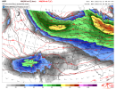
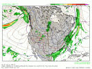
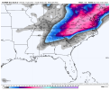
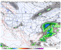
06z Rgem incorporates the southern wave. Matches up with the 00z Euro/Canadian.
As of now we have: 06z Rgem, 00z CMC, 00z Euro incorporating the southern wave and having a signficant winter storm
00z Ukmet doesn't incorporate as much and has a glancing blow
06z GFS doesn't incorporate at all and has a glacing blow to eastern sections
06z Icon misses but took a huge step toward the Euro/CMC camp
NBAcentel
Member
This is our February 2021 comeback
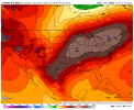
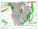
Gfs ens, matches euro map to a tee. Reading back through last night post. I stand to be corrected if im seeing these wrong. Also time looks like Thurs night into Friday morning?
lexxnchloe
Member
This is what WXrisk is saying now
lexxnchloe
Member
Hopefully this low goes east of hatteras and not over richmond, lol
BHS1975
Member
Wow cold ATL finally see some accumulating snow for once with how this system is trending
This is one of the few ways ATL can get more than an inch.
Sent from my iPhone using Tapatalk
Snownut
Member
This one has the potential to be a big one for alot more people. Especially if you a get just a bit further NW track. The Rates will be higher with this storm it looks like. The whole state of SC Could see winter weather with this one
Sent from my SM-A526U using Tapatalk
Sent from my SM-A526U using Tapatalk
The biggest key that I’m seeing right now is the consistency in the models of a strong push of Arctic air both out of the Plains, and CAD reinforcing it east of the Apps. There is a widespread snow pack put down now so it’s easy to see why there wouldn’t be much moderation of this airmass. That’s the biggest reason to me why so many more areas are in play… it’s rare to see a mountains to coast winter storm in the Carolinas, but this has all the makings of one
packfan98
Moderator
6z Euro looked pretty similar to 0z to me. In fact, most modeling is surprisingly similar with the setup. Drastically different results depending on if the sw energy gets broken up or all comes out together. I’d lean towards the energy staying more consolidated and come out a bit faster. We should know tomorrow after everything is sampled, and then we can focus on what happens in our region as a result.
From RAH (nothing we don't know):
Thu night through Sun: There continues to remain uncertainty in this
timeframe with the deterministic guidance wavering back and forth on
the overall synoptic pattern and timing of mid-level and surface
features. While the GFS/CMC/ECMWF have come into better agreement on
isentropic ascent atop the arctic cold front in the Fri-Sat period
with a surface wave, the previous GFS/ECMWF were dry. To add to
that, the models still disagree on the placement of a potential
Miller-A surface low. The uncertainty likely lies in how the mid-
level pattern will evolve, where guidance indicates a northern
stream shortwave tracking southeast from the upper Midwest Thursday
night into the western Atlantic by late Saturday. At the same time,
the models show a secondary shortwave over the southwest US tracking
east into the lower MS valley Fri. It remains to be seen whether or
not the northern and southern stream shortwaves will merge, which
will impact the downstream pattern and where a resultant surface
wave develops along the arctic front, also influencing precipitation
types (rain, snow, or a mixture). Have kept low chance PoPs as the
suite of ensembles continues to indicate the potential for snow.
Nevertheless, a trend to colder temperatures is forecast. The arctic
airmass will bring some of the coldest air so far this season with
temperatures 10-20 degrees below normal for the upcoming weekend.
&&
Not liking the trends for the Midlands area. We need it further offshore to the East or more northern stream interaction. Freezing rain is gonna be a pain, esp. if we keep seeing a NW trend.
For the Midlands of SC and the CSRA, we should basically hope we see a solutuion that's in between what the Euro shows and what the GFS shows if we want to see pure snow? The SW Energy that isn't too consolidated like the Euro, but isn't too weak like the GFS and ICON?6z Euro looked pretty similar to 0z to me. In fact, most modeling is surprisingly similar with the setup. Drastically different results depending on if the sw energy gets broken up or all comes out together. I’d lean towards the energy staying more consolidated and come out a bit faster. We should know tomorrow after everything is sampled, and then we can focus on what happens in our region as a result.
BHS1975
Member
6z Euro looked pretty similar to 0z to me. In fact, most modeling is surprisingly similar with the setup. Drastically different results depending on if the sw energy gets broken up or all comes out together. I’d lean towards the energy staying more consolidated and come out a bit faster. We should know tomorrow after everything is sampled, and then we can focus on what happens in our region as a result.
These kinds of setups can really put it down hard and fast with the death bands that setup and train.
Sent from my iPhone using Tapatalk
Hypsometric
Member
Just took a look too - to my eyes the 6z Euro was just a tick better with digging the northern wave in at 90 but overall similar timing. It was vastly further southwest with the northern stream wave than the 6z GFS.6z Euro looked pretty similar to 0z to me. In fact, most modeling is surprisingly similar with the setup. Drastically different results depending on if the sw energy gets broken up or all comes out together. I’d lean towards the energy staying more consolidated and come out a bit faster. We should know tomorrow after everything is sampled, and then we can focus on what happens in our region as a result.
So more the northern wave digs,the more cold air is involved,correct? If we see trend towards more of the northern wave digging, could this increase the chance that the Midlands of SC and the CSRA sees pure snow as opposed to sleet or freezing rain?Just took a look too - to my eyes the 6z Euro was just a tick better with digging the northern wave in at 90 but overall similar timing. It was vastly further southwest with the northern stream wave than the 6z GFS.
NEGaweather
Member
Must say this one has the makings of exactly what you need to get big snow I20 north in Georgia the up into central and North SC
Sent from my iPhone using Tapatalk
Sent from my iPhone using Tapatalk
I hate to say it for you, because you guys are as overdue as me for a purely snow event as I am but I think the Midlands are going to have to deal with some mixing issues with this. The good news is that I don’t think y’all will anything in the neighborhood of the amount of ZR that these maps are showing… you would be dealing with a good deal of sleet, and you should get to see things changing over to accumulating snow as the storm progressesFor the Midlands of SC and the CSRA, we should basically hope we see a solutuion that's in between what the Euro shows and what the GFS shows if we want to see pure snow? The SW Energy that isn't too consolidated like the Euro, but isn't too weak like the GFS and ICON?
Last edited:
bigstick10
Member
Very strong wording from KFFC-Atlanta
This has the potential to be a big event, but without a
convergence in model solutions and better run-to-run consistency,
messaging timing, amounts, and impacts will be challenging.
The forecast will certainly change over the coming days, so stay
tuned.
This has the potential to be a big event, but without a
convergence in model solutions and better run-to-run consistency,
messaging timing, amounts, and impacts will be challenging.
The forecast will certainly change over the coming days, so stay
tuned.
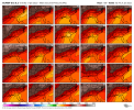
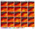
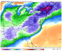
Hey guys something to keep in mind with the ZR maps we’ve seen is important to remember, especially for some of the folks down east that didn’t follow this last storm once they were out of the game… those maps will very likely not come close to verify. 48 hours we were seeing maps that were showing CLT up to the Triad getting absolutely crippled from ice buildup, even though the soundings were strongly favoring sleet. If you pull up the soundings on these models and see that the column is below freezing from 925mb down to the surface, then that is a sounding strongly favoring sleet to be the predominant precip type
NBAcentel
Member
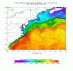
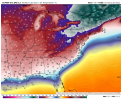
Look at those SSTs over the Gulf Stream. Lots of warm water to tap for moisture and also set up a strong baroclinic zone. My only fear with it here in Raleigh is the potential for warmer upper level mixing, as demonstrated by last nights Euro run. We definitely need a more positive tilt to this thing so we get more west to east winds. With the amount of energy though someone is going to get pounded.
Showmeyourtds
Member
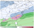
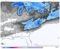
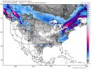
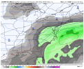
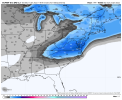
Which ones are you looking at?These models seem way north of atl for snow or are these a different day?
Loganville Winter
Member
Gray is a color too. It shows around an inch for Atlanta. I’ll take that anytime.The ones linked above, but they could be a different day than what would hit atl

