-
Hello, please take a minute to check out our awesome content, contributed by the wonderful members of our community. We hope you'll add your own thoughts and opinions by making a free account!
You are using an out of date browser. It may not display this or other websites correctly.
You should upgrade or use an alternative browser.
You should upgrade or use an alternative browser.
Wintry 1/20 - 1/23 Winter Storm
- Thread starter packfan98
- Start date
NCSNOW
Member
- Joined
- Dec 2, 2016
- Messages
- 9,551
- Reaction score
- 19,011
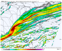
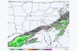
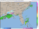
The 6z suite and short range models with less westward qpf/drier are weaker looking with the northern stream and not hooking up with the southern stream as well, compared to the GFs & RDPS
Heres the RAP, then the latest GFS and RDPS


Heres the RAP, then the latest GFS and RDPS


CAE is likely to upgrade to Winter storm warnings Northeast of Columbia. Met from the office just mentioned it.
06z nam dropped totals for cae to 0.7 (a lot of sleet instead)
06z gfs upped totals to around 8 inches with ratios as high as 22:1 (hah yeah right)
Hm.
edit: Closer looks shows almost 2in an hr rates for a couple hours. No wonder why nws cae basically said heavier banding might mess with the forecast
06z gfs upped totals to around 8 inches with ratios as high as 22:1 (hah yeah right)
Hm.
edit: Closer looks shows almost 2in an hr rates for a couple hours. No wonder why nws cae basically said heavier banding might mess with the forecast
iGRXY
Member
At this point I feel good that most people east of the apps are going to see snow. Just a matter of how much.
Fountainguy97
Member
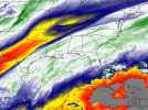
Everything looks right on track this morning. Notice the little "hump" in water vapor forming in TX and Louisiana. That is our seeding moisture enhancement from the interaction of the ULL that will ultimately grow upstream into the precip shield later today.
Looks great and having WV all the way back into Eastern TN is a good sign that the precip shield will be pretty expansive.
Looks great and having WV all the way back into Eastern TN is a good sign that the precip shield will be pretty expansive.

Tarheel17
Member
Good lord I don't envy public-facing forecasters this morning. Reading the GSP discussion sounds like they agree it could bust high but without run-to-run consistency they will hedge for now.
Not concerned about the hrrr/rap drying tbh
L
Logan Is An Idiot 02
Guest
Not concerned about the hrrr/rap drying tbh
Me either. Webb thinks it’s way too dry as well. Also it looked like the soundings supported snow but the models didn’t depict anything
Sent from my iPhone using Tapatalk
Not concerned about the hrrr/rap drying tbh
I am to an extent at least this far west. The NAM looks anemic saturation wise versus something like the GFS in bufkit... and RGEM did tap back a bit with moisture. I don't expect the GFS to handle small features well; so that may or may not be a good thing in this case. we shall see.
Showmeyourtds
Member
Well I’ll be damned- there’s a glaze of ice on the deck. Nearly busted my tail when I went to let the hound out.
Still holding at 30.9
Still holding at 30.9
Downeastnc
Member
Folks also got to remember that there is going to be a sizable lull this morning into afternoon.....and the real show does not start till after dark if the models have timing right....the HRRR is about the faster and it starts to break out from south to north around 3pm....not that that will stop the endless radar to dry or "where is the snow" post.....
Yeah… it’s very confusing. I looked at the sounding up your way on the RAP and it’s a clear moderate snow sounding when the surface reflection is dryMe either. Webb thinks it’s way too dry as well. Also it looked like the soundings supported snow but the models didn’t depict anything
Sent from my iPhone using Tapatalk
iGRXY
Member
I’ll be honest the models outside of the RGEM have been BAD. This really is just going to be a nowcasting thing and watching the radar more than models.
Wx4life
Member
That was my takeaway as well.Good lord I don't envy public-facing forecasters this morning. Reading the GSP discussion sounds like they agree it could bust high but without run-to-run consistency they will hedge for now.
Cbmatt2408
Member
A freezing mist is falling in Marietta, GA this morning. 29 Degrees and holding too.
It's a snow sky. This is is the way it's supposed to look and feel before a snowfall. Cold and a uniformly white sky. It's going to snow.

