-
Hello, please take a minute to check out our awesome content, contributed by the wonderful members of our community. We hope you'll add your own thoughts and opinions by making a free account!
You are using an out of date browser. It may not display this or other websites correctly.
You should upgrade or use an alternative browser.
You should upgrade or use an alternative browser.
Wintry 1/20 - 1/23 Winter Storm
- Thread starter packfan98
- Start date
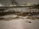
Asphalt is starting to cover, concrete is now white.
Sctvman
Member
D
Deleted member 609
Guest
Finally getting a light snow here in Lewisville (west of Winston) in the past 15 minutes. It's been showing on radar for a couple hours but not reaching the ground. It's now starting to coat everything with white goodness. ?
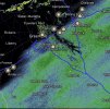
Interesting considering the HRRR has zilch out past Greensboro. Good news, I’d suggest!Finally getting a light snow here in Lewisville (west of Winston) in the past 15 minutes. It's been showing on radar for a couple hours but not reaching the ground. It's now starting to coat everything with white goodness. ?
jtgus
Member
Sticking to the street here in eastern Guilford county/Gibsonville NC
Light dusting here and good returns on radar...maybe an inch or so when all is done. I expect a good swath of snow towards Raleigh and east, though.
8miles
Member
Very light snow falling on the west side of Statesville. Wasn’t expecting much so it’s a nice surprise
Heelyes
Member
Sitting in the warm house looking out it's hard to tell it's snowing but when I go outside it sticks to my face. Breezy light snow at 25 is a treat.
GaSnowhound
Member
I actually have more accumulation than last weekend here?Snowed here in the south metro for the last 2 hours. Glad I drove down here
JHS
Member
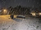
Starting to stick to roads here now. Coming down nicely.
Only a half inch so far
MYR Maniac
Member
raine1212
Member
Very fine light snow coming down sidewalk and steps already coated. The bad news is it took to the back edge before it ever started reaching the ground. So it will be over with soon, good luck down east!

Sent from my iPhone using Tapatalk

Sent from my iPhone using Tapatalk
Heelyes
Member
So 5 or 6 hours of this? Sounds good to me.
It’s having a lot harder time fully covering the asphalt out in front than I expected given the conditions. Decent rates now, too. I hate being on a south facing hill lol.
Snow on roads here and we weren’t even under any kind of advisory
Only?! Show some respect the banding going on out west is only going to continue to develop as it head into our area .. HRRR had an additional 3.5 on top of stuff nowOnly a half inch so far
Shaggy
Member
Doesn't seem to be crashing south too fast. This is so frsutrating
Finally snowing in West Columbia, SC!
Ground now coated with a crunchy layer of ice. Driveway still wet. Temp down to 30, light freezing rain continues.
@Myfrotho704_ that band about to pass over you will be thrilling
Tells me system little stronger or closer to coast, bad news initially for you guys but better for us west of there. Rates increasing here, really hope you get that changeover soon and it ripsDoesn't seem to be crashing south too fast. This is so frsutrating
NBAcentel
Member
raine1212
Member
Snow just starting here fine with a few bigger flakes
So there are some savvy winter storm people there with their windshield wipers sticking out? Hmm. I like it.
Parrothead
Member
Dusting in northern Davidson County, just south of W-S. Asphalt driveway is covered now.
Steven_1974
Member
Hopefully we can get some heavier rates of snowfall here.
Nice big flakes here in Cola town! Thank you, finally!
Going to have to pick up the pace to get to 3". 1/4" per hr isn't going to get it done.Only?! Show some respect the banding going on out west is only going to continue to develop as it head into our area .. HRRR had an additional 3.5 on top of stuff now

