Linden, just north of Fayetteville
-
Hello, please take a minute to check out our awesome content, contributed by the wonderful members of our community. We hope you'll add your own thoughts and opinions by making a free account!
You are using an out of date browser. It may not display this or other websites correctly.
You should upgrade or use an alternative browser.
You should upgrade or use an alternative browser.
Wintry 1/20 - 1/23 Winter Storm
- Thread starter packfan98
- Start date
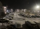
Starting to pick up here. The asphalt is starting to cover up. Not really wet but it’s just been light enough that it hasn’t really taken yet. Keep in mind I live on a south facing hill and the resulting more direct sun angle usually keeps the road warmer than it otherwise would be, so sometimes it takes longer to stick (compared to across the street which is north-facing). Probably won’t matter much tonight with as cold as it is, though.
Drscottsmith
Member
Pretty heavy here now. Too bad I don’t think it will last too much longer. Sticking to elevated surfaces.
Duncan, SC
31.6/18.7
Duncan, SC
31.6/18.7
Snowflowxxl
Member
Snowed here in the south metro for the last 2 hours. Glad I drove down here
L
Logan Is An Idiot 02
Guest

Sent from my iPhone using Tapatalk
Heelyes
Member
Everything is covered. What the flakes lack in size they make up for in numbers.
Wind whipping at times, 24F
Good to hear that it’s still going back that way… still more moisture to work in for those of us down streamSnowed here in the south metro for the last 2 hours. Glad I drove down here
Teach Lesley
Member
Last band came through. Finally started to snow good 15 minutes got a quick dusting and it’s over. Always nice to watch.
Stephenb888
Member
Well iv gotten a nice little dusting on my cars. More than I expected here. On to the next.
NBAcentel
Member
Heelyes
Member
25 degrees and a radar like that is rareGrassed completely covered and so is roads. Kids out playing in it…very nice event.
View attachment 109402
Is there any good way to tell how ratios are verifying so far? From the pixie dust nature of it, it seems high ratio.
- Joined
- Jan 2, 2017
- Messages
- 1,566
- Reaction score
- 4,279
I'm gonna start calling u Jackpot Jimmy!
Congrats buddy and to all getting snow.
Christian T Murray
Member
Heelyes
Member
SimeonNC
Member
This is insane lol

Sent from my LM-Q730 using Tapatalk

Sent from my LM-Q730 using Tapatalk
Definitely snow mixing in NE Columbia.
We are at least a half an inch here now .. snow going super mode right now Raleigh by the PNC arena .. can’t make a snow ball for my life but plenty of snow covering the ground
Cucking Warm nose's I wanna bloody Those cucks (sry) Banter..
Current Obs..
30F
Freezing/Light drizzel/frizzel/fog..
(ROADS) are actually trying too ( DRY!).. dry air at the lower surface Layer..
What makes it through is freezing..
Freezing on elevated surfaces..
Roads are still ok above ground temp freezing levels..
Problems w/black ice tomorrow...
I WANT MY .01 SNOW!
snowlover91
Member
- Joined
- Jan 23, 2021
- Messages
- 4,602
- Reaction score
- 15,197
- Location
- Lebanon Township, Durham County NC
Roads covered up here in 15 minutes. So dang efficientIs there any good way to tell how ratios are verifying so far? From the pixie dust nature of it, it seems high ratio.
- Joined
- Jan 23, 2021
- Messages
- 4,602
- Reaction score
- 15,197
- Location
- Lebanon Township, Durham County NC
The roads have that blowing snow look to them when I see a car pass. You don’t get that often.
Sctvman
Member
ZR pretty much has made it to downtown CHS per WunderMap reports. 33 right now. Very very light here
rusrius
Member
Waited 5 years for this. Snow coming heavier now. Deck and steps covered and ground turning white.
Iceagewhereartthou
Member
No flakes here, rate was never high enough to reach the ground. Congrats to Jimmy and Shetley and everyone to my south and east; enjoy!
Me too! I need some hopeI love all the obs, but man I miss the rap and hrrRRrR updates. I wanna see things come in better!
Snow is sticking to the patio. It’s so dry that the wind is blowing my layer of snow on the table off. Many small flakes.
norcarolinian
Member
Drscottsmith
Member
Jimmy keep sending it up this way! Deck is recovered and may just keep going.
Here in Duncan SC
30.7/19.2
Here in Duncan SC
30.7/19.2
Drscottsmith
Member
D
Deleted member 609
Guest
Ripping now. Car covered.
Forevertothee
Member
1/2 inch of snow. Still snowing. Clinton, SC. South of 85 snow shield deactivated.
packfan98
Moderator
Very light dusting here so far. Rates are picking up a bit. Hoping to get an inch. However, this is very cool to get snow on snow leftover from last weekend. A true rarity around here. Enjoy everyone!

