-
Hello, please take a minute to check out our awesome content, contributed by the wonderful members of our community. We hope you'll add your own thoughts and opinions by making a free account!
You are using an out of date browser. It may not display this or other websites correctly.
You should upgrade or use an alternative browser.
You should upgrade or use an alternative browser.
Wintry 01/28-29/2022 Winter Weather Potential
- Thread starter weather nerd
- Start date
Nomanslandva
Member
mattwis519
Member
It’s snowing, and every flake is sticking. Fun surprise.
buckinbronco
Member
Ripping fatties in west Forsyth Co, GA
Hope no one gets struck by lightening from all this convective snow.
Snow and sleet mixing with rain in West Columbia SC Not sticking as ground is wet from rain.
jay.p
Member
Peachtree city and Atlanta about to get in on a nice band of large flakes
Sent from my iPhone using Tapatalk
Sent from my iPhone using Tapatalk
Back building makes me think we actually might still see a white ground .. wishful thinking maybe
Snowflowxxl
Member
Ripping now, sticking to roads
ForsythSnow
Moderator
I think the mountains blocked me from getting the best potential this time around. Best I've seen is a nice light snow and powder sugar. Onto the next event I guess.
Down to a drizzle now, rates fell off a cliff. Radar doesn’t look bad, what’s up with that?
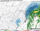
Taking a quick look at regional radar sites, FCX, GSP, MRX, and in particular CAE, you can see the lee side wave slowly intensifying as it heads toward a Myrtle Beach exit. This aids in the cyclone bombing which is just beginning well off HAT.Back building makes me think we actually might still see a white ground .. wishful thinking maybe
buckinbronco
Member
I’m a little south of you and got lucky to get stuck in one of those bands, got a dusting-.25” so farI think the mountains blocked me from getting the best potential this time around. Best I've seen is a nice light snow and powder sugar. Onto the next event I guess.
Barely anything in Burlington.
Snowflowxxl
Member
We need a WWA, roads already not safe
I’m seeing some light snow falling now.
Maybe KATL can get .7” and get close to the monthly average! Probably not, but glad to see it make it down there.
- Joined
- Jan 5, 2017
- Messages
- 3,773
- Reaction score
- 5,983
It's coming down pretty good here! Could get .5" possibly. Ground is already turning white.
Wow, ground, cars, and roof is already turning white! The snow is really coming down heavy right now.
The ground is very white!!Wow, ground, cars, and roof is already turning white! The snow is really coming down heavy right now.
jtgus
Member
I'm in Gibsonville and the yard is whiteBarely anything in Burlington.
This snow is more intense than what we got 2 weeks ago especially with the gusty winds. It looks very foggy outside.
EDIT: This is definitely over performing here.
EDIT: This is definitely over performing here.
Yepp...cold air is squeezing out all of the moisture!This snow is more intense than what we got 2 weeks ago especially with the gusty winds. It looks very foggy outside.
EDIT: This is definitely over performing here.
- Joined
- Jan 5, 2017
- Messages
- 3,773
- Reaction score
- 5,983
It was like that a few minutes ago here. Now its just a light snow/flurry.
I'm in a heavy snow band!It was like that a few minutes ago here. Now its just a light snow/flurry.
Sctvman
Member
Been heavy snow falling. Big fat ones here in Elizabeth City. Everything is coated.
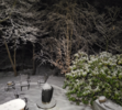
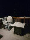
I fell asleep on the couch and just woke up to 1/2”. Not bad.
Showmeyourtds
Member
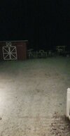
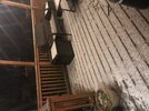
Snow stopped at the airport! Wow that was amazing!!View attachment 111502
Ripping here
Flurries have begun
You look to have some lighter stuff inbound still. I'm watching to your east as is, as usual, they dry up before they can make it here.Snow stopped at the airport! Wow that was amazing!!
I hope it stays together just for you buddy!You look to have some lighter stuff inbound still. I'm watching to your east as is, as usual, they dry up before they can make it here.
Snowflowxxl
Member
Fun little event. I stayed up till 4 am for a week straight 2 weeks ago and got no accumulating snow. This event I I watched about 3 model runs total and got 0.5 an inch ?

