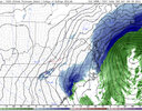
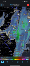
Yep, I’m moving to Roanoke Rapids so I can see huge snows!Things to note .. with these events no one should want to be in the bullseye 12-48 hours out I guess
-
Hello, please take a minute to check out our awesome content, contributed by the wonderful members of our community. We hope you'll add your own thoughts and opinions by making a free account!
You are using an out of date browser. It may not display this or other websites correctly.
You should upgrade or use an alternative browser.
You should upgrade or use an alternative browser.
Wintry 01/28-29/2022 Winter Weather Potential
- Thread starter weather nerd
- Start date
No one should want to be in the snow 12-48 hours outThings to note .. with these events no one should want to be in the bullseye 12-48 hours out I guess
HSVweather
Member
Dunkman
Member
I’m like 10 miles to the SE and it’s still more rain than anything.Pretty good rates despite the poor radar presentation. Solid dusting now and beginning to stick to the sidewalk/driveways.
Heelyes
Member
36 and light rain
34, all snow, pretty sure .5 has fallen, got about an hour left
Fallen, not accumulating in case anyone was confused
Next
Fallen, not accumulating in case anyone was confused
Next
SimeonNC
Member
Nothing is falling in Huntersville
Sent from my LM-Q730 using Tapatalk
Sent from my LM-Q730 using Tapatalk
boobear
Member
33 and snowing in Woodstock , Ga. My deck has a dusting
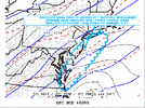
Mesoscale Discussion 0095
NWS Storm Prediction Center Norman OK
0744 PM CST Fri Jan 28 2022
Areas affected...Parts of northeastern North Carolina...southeastern
Virginia...southern Maryland...Delaware...coastal New Jersey and
eastern Long Island
Concerning...Heavy snow
Valid 290144Z - 290445Z
SUMMARY...Heavy snow appears likely to develop near northern Mid
Atlantic coastal areas through late evening. This may include
increasingly sustained rates in excess of 1 inch per hour near
southern New Jersey coastal areas and eastern Long Island by around
midnight EST.
DISCUSSION...Consolidating, amplified mid-level troughing is
gradually turning east of the Mississippi Valley, and taking on a
more neutral tilt as it approaches the Appalachians. Large-scale
ascent beneath increasingly difluent flow downstream of this feature
is contributing to increasing precipitation near and offshore of Mid
Atlantic coastal areas, where a substantial cooling in mid-level
cloud tops is evident is latest satellite imagery. Through 03-06Z,
upper divergence is forecast to continue to intensify near or just
east of the northern Mid Atlantic region, as a smaller scale
perturbation begins to emerge from the base of the larger-scale
troughing. An already intensifying offshore cyclone may begin to
deepen more rapidly while continuing to migrate northward near the
Gulf Stream (east-northeast of the North Carolina coast).
On the northwestern periphery of the expanding and intensifying
precipitation shield, thermodynamic profiles are generally
sub-freezing and supportive of snow. While it appears that a
developing band of heavier snow will mostly remain offshore,
immediate coastal areas probably will be impacted. This may include
areas as far south as the Virginia/North Carolina Tidewater
vicinity, where low levels remain above freezing, but will fall
toward freezing during the next few hours in response to evaporation
of precipitation and cold advection.
With precipitable water near or in excess of .5 inches, and
lower/mid tropospheric frontogenesis likely to increase lift within
layers favorably cold for large dendritic ice crystal growth, snow
rates of 1/2 to 1+ inch per hour may become more common. It appears
that stronger mid-level frontogenetic forcing may begin to support
more sustained rates in excess of 1 inch per hour along New Jersey
coastal areas and across parts of eastern Long Island toward 05-06Z.
..Kerr.. 01/29/2022
Been watching it precip under floodlight for an hour. Saw some mix for a few moments early on. Just went outside and I still have dry spots on sidewalk. Lite as lite can be.
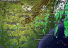
90% of the MD area is over the oceanView attachment 111442
Mesoscale Discussion 0095
NWS Storm Prediction Center Norman OK
0744 PM CST Fri Jan 28 2022
Areas affected...Parts of northeastern North Carolina...southeastern
Virginia...southern Maryland...Delaware...coastal New Jersey and
eastern Long Island
Concerning...Heavy snow
Valid 290144Z - 290445Z
SUMMARY...Heavy snow appears likely to develop near northern Mid
Atlantic coastal areas through late evening. This may include
increasingly sustained rates in excess of 1 inch per hour near
southern New Jersey coastal areas and eastern Long Island by around
midnight EST.
DISCUSSION...Consolidating, amplified mid-level troughing is
gradually turning east of the Mississippi Valley, and taking on a
more neutral tilt as it approaches the Appalachians. Large-scale
ascent beneath increasingly difluent flow downstream of this feature
is contributing to increasing precipitation near and offshore of Mid
Atlantic coastal areas, where a substantial cooling in mid-level
cloud tops is evident is latest satellite imagery. Through 03-06Z,
upper divergence is forecast to continue to intensify near or just
east of the northern Mid Atlantic region, as a smaller scale
perturbation begins to emerge from the base of the larger-scale
troughing. An already intensifying offshore cyclone may begin to
deepen more rapidly while continuing to migrate northward near the
Gulf Stream (east-northeast of the North Carolina coast).
On the northwestern periphery of the expanding and intensifying
precipitation shield, thermodynamic profiles are generally
sub-freezing and supportive of snow. While it appears that a
developing band of heavier snow will mostly remain offshore,
immediate coastal areas probably will be impacted. This may include
areas as far south as the Virginia/North Carolina Tidewater
vicinity, where low levels remain above freezing, but will fall
toward freezing during the next few hours in response to evaporation
of precipitation and cold advection.
With precipitable water near or in excess of .5 inches, and
lower/mid tropospheric frontogenesis likely to increase lift within
layers favorably cold for large dendritic ice crystal growth, snow
rates of 1/2 to 1+ inch per hour may become more common. It appears
that stronger mid-level frontogenetic forcing may begin to support
more sustained rates in excess of 1 inch per hour along New Jersey
coastal areas and across parts of eastern Long Island toward 05-06Z.
..Kerr.. 01/29/2022
ForsythSnow
Moderator
Finally, light snow at 30.9 here.
L
Logan Is An Idiot 02
Guest
Very weak looking radar.
Sounds like your typical HECS in our neck of the woods. ?34, all snow, pretty sure .5 has fallen, got about an hour left
Fallen, not accumulating in case anyone was confused
Next
- Joined
- Jan 23, 2021
- Messages
- 4,602
- Reaction score
- 15,197
- Location
- Lebanon Township, Durham County NC
Snowing upstream of you.36 and light rain
Wake County snow shield in effect. Off to bed.
wake county snow shield?? Bruh this a Carolina snow shield .. what is this ??
EastNcHeel
Member
40 getting further from 41.34 getting close to 33
All snow here 34 degrees.
- Joined
- Jan 23, 2021
- Messages
- 4,602
- Reaction score
- 15,197
- Location
- Lebanon Township, Durham County NC
We saw little if any rain hereAll snow here 34 degrees.
@EmersonGA and @J.C. I iam watching that cell in NE Alabama for you guys. That's a nice discrete cell and rather large.
I was hoping this setup would bring us something, and it has. Off and on snow showers, patching dusting on the deck so far, just enough to make it feel like winter.
32.0F
Heelyes
Member
Looks like a few flakes mixing in.
NBAcentel
Member
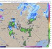
Yea you can see it forming in higher tilts alreadyLull is to be expected, gets going here in a bit clt folks
View attachment 111456
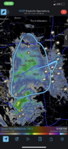
Yeah, I suppose that we should have seen the warning signs that this event was designed to fail. Usually, we don't get big snow when we're relying on individual banding within scattered snow showers.We saw little if any rain here
norcarolinian
Member
Cars, roofs, and ground are white. Still 32°
Dunkman
Member
I guess it just changes with intensity because people on all sides of me have reported all snow and I’m at a 50/50 mix now but it’s pretty light.
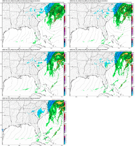
Some how the HRRR wants to right the wrong .. I’ll be up for it View attachment 111459
View attachment 111460

Bannerdude
Member
Rain/snow mix in Durham
Wow look at Eastern SC.Some how the HRRR wants to right the wrong .. I’ll be up for it View attachment 111459
View attachment 111460
L
Logan Is An Idiot 02
Guest
Do not trust the HRRR.Wow look at Eastern SC.
DadOfJax
Member
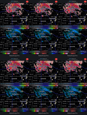
It’s doubtful it will hold together, but the half inch we just got in 15 minutes was wild!View attachment 111437Looks like some more will swing through northeast AL in a few hours.
HRRR is pretty reliable I would say depicting precip bands and meso features just have a low Qpf biasDo not trust the HRRR.
D
Deleted member 1449
Guest
Radar is beginning to fill in nicely over the NW Piedmont and snow is picking up here again. Looks like we'll make a run at 1-2".

