-
Hello, please take a minute to check out our awesome content, contributed by the wonderful members of our community. We hope you'll add your own thoughts and opinions by making a free account!
You are using an out of date browser. It may not display this or other websites correctly.
You should upgrade or use an alternative browser.
You should upgrade or use an alternative browser.
Wintry 01/28-29/2022 Winter Weather Potential
- Thread starter weather nerd
- Start date
Rain/snow mix here just now of GSO..temp 34degF
Sent from my SM-G990U using Tapatalk
Sent from my SM-G990U using Tapatalk
We are boxer owners too. Beautiful pup.My trained snow spotter seems to be losing hope.
Light snow still and 28.4
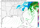
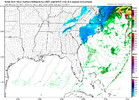
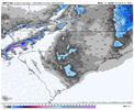
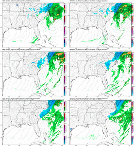
What time is this?Columbia should love the 3k!
View attachment 111406
MidnightWhat time is this?
heartbreak incoming.Columbia should love the 3k!
View attachment 111406
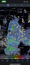
These things have some juice to make it over lookout like they are. If the wind doesn’t blow it away maybe we can pickup something. I’m down to freezing now too.@EmersonGA and @J.C. I iam watching that cell in NE Alabama for you guys. That's a nice discrete cell and rather large.
Thank you! They are awesome with a whole lot of quirks/mischief??We are boxer owners too. Beautiful pup.
Light snow still and 28.4
BelmontWX79
Member
A lot of sloppy stuff here. 36F
NBAcentel
Member
May be hallucinating, but looks like a few flakes are starting to mix?!
Honestly don’t think we’ll even see 2” here in eastern Union County. Not complaining as the past two weekends make up for it. Light rain and temp is at 39.
We’re gonna be lucky to get a dusting. Dang, things are heading south, literally. ?
Forevertothee
Member
Rain turned to snow in Clinton SC during heavy band. The deck and grill turned white. We had a dusting during the heaviest period. Temp was 37 at onset of snow. Third time I have seen snow fall this winter in the Lower Piedmont of SC. What a winter. Still combined less than 2 inches for all events. Freezing Rain and sleet took the majority in storm #1.
D
Deleted member 1449
Guest
We finally transitioned to all snow in the last 15 minutes. Temp is 32.9 and radar looks like crap...but it's snowing nonetheless.
NBAcentel
Member
definitely snowing now
norcarolinian
Member
Finally all snow. 32 degrees.
Just curious, what’s the temp in Concord?definitely snowing now
Clear skies and 37
Fountainguy97
Member
NBAcentel
Member
36F getting close to 35FJust curious, what’s the temp in Concord?
D
Deleted member 1449
Guest
We've actually picked up a light dusting so far. Still light snow and 32.5.
34 is next36F getting close to 35F
norcarolinian
Member
40 hereClear skies and 37
Flakes mixing in now. 36
Nomanslandva
Member
Saw lots of HRRR runs with near .5 qpf up here. no way we get anywhere close to that. This has busted dry in a big way. --sn at best here. maybe .25 on the deck. Maybe.
I don't think I have seen a setup like this since I have had access to models like we do now. I'll know next time not to trust this look
I don't think I have seen a setup like this since I have had access to models like we do now. I'll know next time not to trust this look
L
Logan Is An Idiot 02
Guest
Interesting maybe it's bc it's clear here?40 here
34 getting close to 33
Hrrrr seems to have a wet biasSaw lots of HRRR runs with near .5 qpf up here. no way we get anywhere close to that. This has busted dry in a big way. --sn at best here. maybe .25 on the deck. Maybe.
I don't think I have seen a setup like this since I have had access to models like we do now. I'll know next time not to trust this look
Ground white here 34degrees. Starting to stick on some roads
NCWeatherhound
Member
Temp 34/ DP 28 in central Harnett Co. ... all we need is moisture (just like everyone else!)
Things to note .. with these events no one should want to be in the bullseye 12-48 hours out I guess
D
Deleted member 1449
Guest
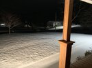
Pretty good rates despite the poor radar presentation. Solid dusting now and beginning to stick to the sidewalk/driveways.


