-
Hello, please take a minute to check out our awesome content, contributed by the wonderful members of our community. We hope you'll add your own thoughts and opinions by making a free account!
You are using an out of date browser. It may not display this or other websites correctly.
You should upgrade or use an alternative browser.
You should upgrade or use an alternative browser.
Wintry 01/28-29/2022 Winter Weather Potential
- Thread starter Shawn
- Start date
Went from suppression on the GEFS to apps rubbers lol
Z
Zander98al
Guest
Broken024
Member
NCSNOW
Member
- Joined
- Dec 2, 2016
- Messages
- 9,186
- Reaction score
- 18,036
Landmark References from past East Coast Bombogenesis. Always interesting to see these come along. Heres a few of the big daddys that affected the SE. Theres others. Lot has to do when the exact time the trough gets neutral/negative tilted. Thought the 1980 surface maps look closest to what we been seeing on models for this potential storm. Difference is 1980 flow slowed enough, Dont think we have that luxury here.
93 Superstorm: NW Central GOM-Tallahasse-Macon-Raleigh-Off to Yankee land
Carolina Crusher 2000: Shortwave trough dropped into the GOM off MS/Louisianna Coast-Amped/became negative tilt on eastern Florida gulf coast- NE off Ga coast between Sav & jax - pivoted off Wilmington - Out to Sea
1980 ENC Beast: Had to dig this one up
Figure 2. Surface Analysis at 12Z March 1, 1980 showing strong Arctic high pressure covering much of the eastern U.S.
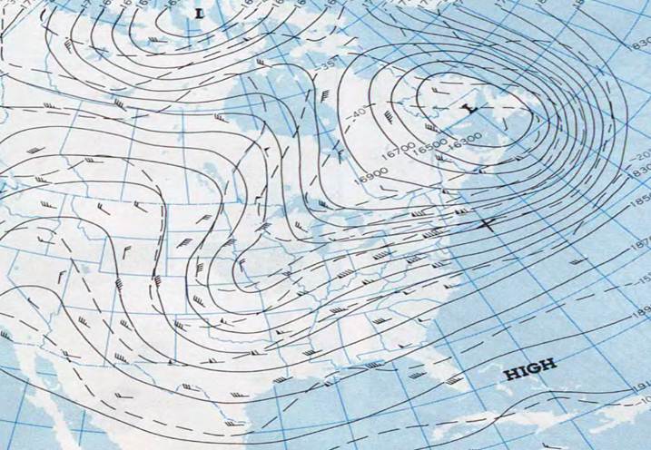
Figure 3. 500 mb Heights at 00Z March 1, 1980 showing cold polar vortex over eastern Canada.
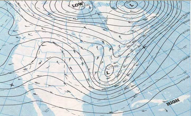
Figure 4. 500 mb Heights/Vorticity at 12Z March 2, 1980 showing shortwave digging across the southern states.
As the shortwave continued to strengthen, the overall system slowed and became neutrally tilted by the afternoon of March 2 with the 500 mb low cutting off over Georgia (Figure 5). By late afternoon on March 2, the system intensifies and becomes negatively tilted with cyclogenesis off the South Carolina coast (Figure 6).
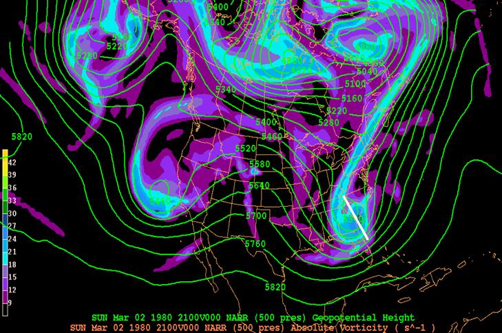
Figure 5. 500 mb Heights/Vorticity at 21Z March 2, 1980 showing upper low becoming negatively tilted and cutting off.
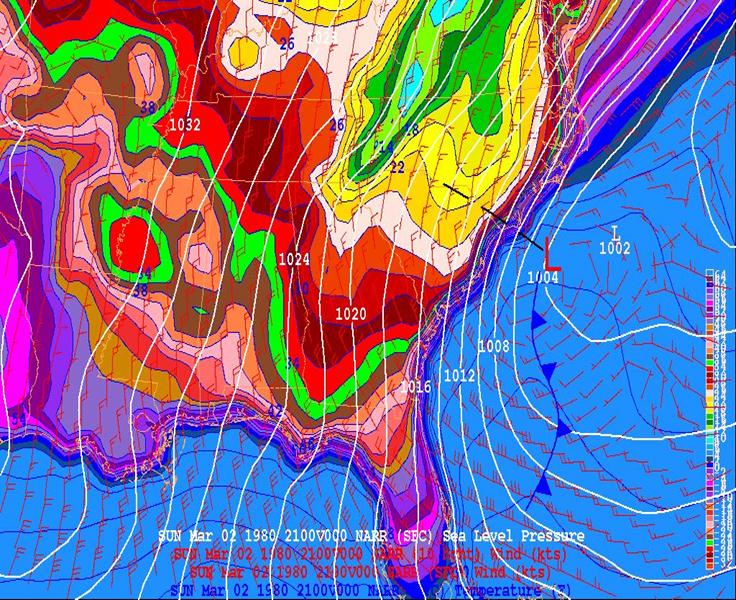
Figure 6. Surface low pressure deepening o
93 Superstorm: NW Central GOM-Tallahasse-Macon-Raleigh-Off to Yankee land
Carolina Crusher 2000: Shortwave trough dropped into the GOM off MS/Louisianna Coast-Amped/became negative tilt on eastern Florida gulf coast- NE off Ga coast between Sav & jax - pivoted off Wilmington - Out to Sea
1980 ENC Beast: Had to dig this one up
Figure 2. Surface Analysis at 12Z March 1, 1980 showing strong Arctic high pressure covering much of the eastern U.S.

Figure 3. 500 mb Heights at 00Z March 1, 1980 showing cold polar vortex over eastern Canada.

Figure 4. 500 mb Heights/Vorticity at 12Z March 2, 1980 showing shortwave digging across the southern states.
As the shortwave continued to strengthen, the overall system slowed and became neutrally tilted by the afternoon of March 2 with the 500 mb low cutting off over Georgia (Figure 5). By late afternoon on March 2, the system intensifies and becomes negatively tilted with cyclogenesis off the South Carolina coast (Figure 6).

Figure 5. 500 mb Heights/Vorticity at 21Z March 2, 1980 showing upper low becoming negatively tilted and cutting off.

Figure 6. Surface low pressure deepening o
ajr
Member
A little stronger and further SW, right? Tilt seems about the same.
iGRXY
Member
TPV lifting to the NE as well on the Euro at 90
lexxnchloe
Member
Is that good or bad?TPV lifting to the NE as well on the Euro at 90
NEGaweather
Member
Is that good or bad?
Yes will allow storm to tilt
Sent from my iPhone using Tapatalk
LukeBarrette
im north of 90% of people on here so yeah
Meteorology Student
Member
2024 Supporter
2017-2023 Supporter
iGRXY
Member
Personally I think we are shifting too far west too soon. Without any blocking and this thing digging further and further west there’s really not a lot from this thing going further inland IMO. We are on a thin thin line here between suppressed and OTS before turning into a bomb for the NE, potentially overrunning setup, and a potential Apps runner.
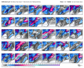
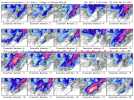
Step in the right direction for sure, as expected. I still favor areas west of here. Assuming I'm wrong about that though, we're still going to need for this things to get going quickly off the coast of SC, as we'll be dealing with marginal temps.Just looking at models from last night...wow, I guess they were good. 6z EPS slp trend
View attachment 110112
Step in the right direction for sure, as expected. I still favor areas west of here. Assuming I'm wrong about that though, we're still going to need for this things to get going quickly off the coast of SC, as we'll be dealing with marginal temps.
Yeah, we need a perfectly time ull going negative and perfectly tracked SLP to hit backside snow. We don't have a HP to our north so we need a lot more luck than usual. I am rooting for a big bomb even if it means we rain...be fun to watch unfold.
packfan98
Moderator
My gut tells me that because of the trough orientation the system won't go negative far enough west to be an apps runner. I may be wrong. Even if it does come further west, as long as the system has enough time to develop and blossom, someone in the SE could get a wallop with dynamic cooling snow. It might be the Tennessee, Northern Mississippi, Northern Alabama region, or it could be the same area along the coast that received snow. Time will tell. At least we are in the game. It might be the last big opportunity this season.Personally I think we are shifting too far west too soon. Without any blocking and this thing digging further and further west there’s really not a lot from this thing going further inland IMO. We are on a thin thin line here between suppressed and OTS before turning into a bomb for the NE, potentially overrunning setup, and a potential Apps runner.
KILM AFD.
A new shortwave trough will dive southeastward across the
Rockies Thursday and move across Texas on Friday. Surface low
pressure will likely develop out ahead of this trough along the
Southeast coast Friday. The 00z Canadian is considerably faster
than the 00z ECWMF or GFS with the eastward extent of both the
surface and upper level features. A slower solution is
preferred which spreads clouds across the area Thursday night
with rain chances developing Friday...especially near the
coast.
Surface low pressure should deepen as it moves northeastward
Friday night and away from the Carolinas. The upper level trough
will move overhead later Friday night, and there appears to be
some potential for a period of wintry weather as low level cold
air deepens while lift and considerable moisture and some lift
continues aloft above the 700 mb level. A mix of rain and snow
remains in the forecast. Forecast PoPs are currently 20-40
percent, highest at the NC beaches, but may need to be adjusted
higher if later model runs show any consistency with this
system.
Personally I think we are shifting too far west too soon. Without any blocking and this thing digging further and further west there’s really not a lot from this thing going further inland IMO. We are on a thin thin line here between suppressed and OTS before turning into a bomb for the NE, potentially overrunning setup, and a potential Apps runner.
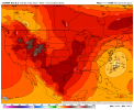
I don't see how the EPS is going to go from this cluster to running way inland. Once the EPS gets inside day 4 it's going to be in the ballpark of where the SLP will track.
ForsythSnow
Moderator
Or it can be an AL and N GA storm as well. Miller A style storms tend to be the best chance at big snows out this way as well and it shows on some ensemble members. Could also be a N GA through most of NC storm as well. Too many solutions with a lot of time to fluctuate 3 very key pieces of energy. The trends I say are in a fair position at the moment.My gut tells me that because of the trough orientation the system won't go negative far enough west to be an apps runner. I may be wrong. Even if it does come further west, as long as the system has enough time to develop and blossom, someone in the SE could get a wallop with dynamic cooling snow. It might be the Tennessee, Northern Mississippi, Northern Alabama region, or it could be the same area along the coast that received snow. Time will tell. At least we are in the game. It might be the last big opportunity this season.

