It started as rain for me probably the first hour or soSome of y’all who were out here at the time can correct me if I’m wrong:
Wasn’t most of 1/25/2000 occurring during marginal temps?
-
Hello, please take a minute to check out our awesome content, contributed by the wonderful members of our community. We hope you'll add your own thoughts and opinions by making a free account!
You are using an out of date browser. It may not display this or other websites correctly.
You should upgrade or use an alternative browser.
You should upgrade or use an alternative browser.
Wintry 01/28-29/2022 Winter Weather Potential
- Thread starter weather nerd
- Start date
NBAcentel
Member
- Joined
- Jan 23, 2021
- Messages
- 4,602
- Reaction score
- 15,197
- Location
- Lebanon Township, Durham County NC
I remember the snow that I saw in that storm was right at 32.It started as rain for me probably the first hour or so
2010 Christmas was the same .. started as rain for most of the day .. storm cranked 850s crashed and we got 10 inches of pasteSome of y’all who were out here at the time can correct me if I’m wrong:
Wasn’t most of 1/25/2000 occurring during marginal temps?
I think the dupage page is missing some of the new GEFS members versus other sources since the upgrade btw.
Yep, only has 20 out of the 30I think the dupage page is missing some of the new GEFS members versus other sources since the upgrade btw.
Blue_Ridge_Escarpment
Member
It rained all day here up until 3pm and it didn't take long at all for the flakes to go and interchange between moderate and heavy once the transition occurred.It started as rain for me probably the first hour or so
NBAcentel
Member
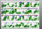
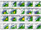
Haven’t seen that many big dogs on so many gefs for the same time period .. the mean will be a juicy increase I believe
- Joined
- Jan 23, 2021
- Messages
- 4,602
- Reaction score
- 15,197
- Location
- Lebanon Township, Durham County NC
packfan98
Moderator
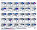
Man, some of those GEFS members are lighting up the scoreboard. A couple get GA and SC in the mix. It all depends on how fast the storm starts to bomb. Great looking tracks at the moment for sure.
KyloG thats 1003 prob very close to my amateur ideal location, looks a smidge east for my taste. Need, prefer sub 1000mb, deepening off GA,SC coast . Thanks for B and W maps
packfan98
Moderator
Ron Burgundy
Member
More than half for NGA, with several others very close.Man, some of those GEFS members are lighting up the scoreboard. A couple get GA and SC in the mix. It all depends on how fast the storm starts to bomb. Great looking tracks at the moment for sure.
Yeap I guess if we are moving away from the OTS option and more toward a light event or monster storm we can't be complaining at the moment. Just sit back enjoy the ride and see where it goes from here.More than half for NGA, with several others very close.
NBAcentel
Member
- Joined
- Jan 23, 2021
- Messages
- 4,602
- Reaction score
- 15,197
- Location
- Lebanon Township, Durham County NC
Looks like the best means run along and north of a line from Burlington to Oxford
packfan98
Moderator
Does WeatherBell have all 30 GEFS members?
NBAcentel
Member
YesDoes WeatherBell have all 30 GEFS members?
packfan98
Moderator
Awesome. Can't wait to see them later. Thanks!
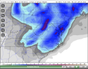
Wow, lots of light members for us in Alabama and a few nice ones. This keeps my interestI think a lot of people would be happy if member 9 verified.View attachment 110150
- Joined
- Jan 23, 2021
- Messages
- 4,602
- Reaction score
- 15,197
- Location
- Lebanon Township, Durham County NC
Just speaking for our area up to Roxboro, it seems like the good hits are fairly spaced out. Doesn’t seem outweighed by a few.
I think a lot of people would be happy if member 9 verified.View attachment 110150
ajr
Member
Stalled by what, can you tell? Thought lack of 50/50 or -NAO means there isn't anything preventing the storm from quickly going up the coast/OTSOne of the members shows the storm getting captured and stalling on Cape Hatteras...
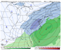
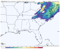
View attachment 110147
UKMet run


I can only speak for my area, but my temps in southern Cabarrus County were in the 32-35 degree range for most of the storm… as the low really started bombing out during the overnight hours was when temperatures crashed to 26-28, but at that point the snow starting to lighten upSome of y’all who were out here at the time can correct me if I’m wrong:
Wasn’t most of 1/25/2000 occurring during marginal temps?
NCWeatherhound
Member
We had rain and ZR in FAY before the 850s crashed.Some of y’all who were out here at the time can correct me if I’m wrong:
Wasn’t most of 1/25/2000 occurring during marginal temps?
Also, IIRC, there was a weak system that slipped through beforehand that helped prime the pump to overcome mid-level warmth.
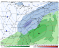
Looks ok. I can't remember how the previous version looked. Cyclogenesis starts off the coast of NC, it looks like. It really needs to get cranking about the latitude of the GA coast or somewhere in there if anybody is in the SE is going to see a big snowstorm.UKMet run

WEATHERBOYROY
Member
Seeing that weak low forming in the gulf really makes me think of January 2018. Too bad the temp profiles aren’t good or else I could feel good about a 2-3” snow across AL/GA.
I wouldn' t put too much stock in the temperature profiles yet, I'm more excited for the western trend.....much more potential now than last 4hr. the location and intensity of the storm is gonna make a huge difference.Seeing that weak low forming in the gulf really makes me think of January 2018. Too bad the temp profiles aren’t good or else I could feel good about a 2-3” snow across AL/GA.
packfan98
Moderator
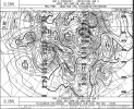
Sometimes the process of the trough going neutral to negative and the phasing process slows a system down as it goes under cyclogenesis. I imagine that's what's happening here. Who has the link to Tomer Berg's GEFS 500mb plots? I can't find it. @iGRXY, was it you who posted that a day or two ago?Stalled by what, can you tell? Thought lack of 50/50 or -NAO means there isn't anything preventing the storm from quickly going up the coast/OTS
- Joined
- Jan 23, 2021
- Messages
- 4,602
- Reaction score
- 15,197
- Location
- Lebanon Township, Durham County NC
Sometimes the process of the trough going neutral to negative and the phasing process slows a system down as it goes under cyclogenesis. I imagine that's what's happening here. Who has the link to Tomer Berg's GEFS 500mb plots? I can't find it. @iGRXY, was it you who posted that a day or two ago?
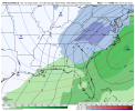
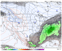
CMC Run


