NCHighCountryWX
Member
- Joined
- Dec 28, 2016
- Messages
- 699
- Reaction score
- 1,918
RGEM is king. Very impressiveLooks like I need to adjust totals higher east

Definitely looks convective. This kind of setup will give a person 2" but his neighbor 10 miles away a half inch. We'll just have to wait until tonight to see how the larger band develops and then how the sub-bands set up.@KyloG @SD and @Rain Cold could all chase one of these bands in Wake Co. Y'all could do a snow starved anonymous meet up

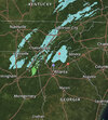
Yeh, I looked at the radar and was like…wut? I know we’re out of the game but still didn’t expect to see even light returns today. Hope it bodes well for y’all later on.Watch this area here today. Nothing should be going on here. If the radar starts to light up, head to the store.
View attachment 111211

You are going to absolutely love it. I was lucky enough to be in Boston (I guess technically Newton) for the 17 inches back in Jan 2018 during the blizzard. Just awesome. These videos were from my walkabout early in the storm. As usual, doesn't do it justice compared to being there in person. I had icicles growing on my eyelashes, eyebrows and beard after only a few minutes.Yes sir! Prob will post some videos as well. First time being in a nor easter so should be quite the experience
I hate to ask and get in trouble. I cant find the RGEM can any post the map? Thanks very much

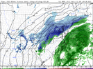
I noticed most of the short range models (HRRR/NAM/RGEM/RAP) bring some snow showers down to ATL tonight. 9z RAP is the most robust out of all of them. I guess it’s worth keeping an eye on.Yeh, I looked at the radar and was like…wut? I know we’re out of the game but still didn’t expect to see even light returns today. Hope it bodes well for y’all later on.View attachment 111216
Ive noticed they seem to be a bit further west with more precip as well.I noticed most of the short range models (HRRR/NAM/RGEM/RAP) bring some snow showers down to ATL tonight. 9z RAP is the most robust out of all of them. I guess it’s worth keeping an eye on.
That's the weirdest thing I've seen in a while@KyloG @SD and @Rain Cold could all chase one of these bands in Wake Co. Y'all could do a snow starved anonymous meet up

If we get below freezing fast enough, and there are some snow showers, we could get a car topper in some areas... maybe.I noticed most of the short range models (HRRR/NAM/RGEM/RAP) bring some snow showers down to ATL tonight. 9z RAP is the most robust out of all of them. I guess it’s worth keeping an eye on.
Any flakes would be a win for us with this system. I’m all in on next weekend tho. ?I noticed most of the short range models (HRRR/NAM/RGEM/RAP) bring some snow showers down to ATL tonight. 9z RAP is the most robust out of all of them. I guess it’s worth keeping an eye on.

I noticed that walking in to work this morning. The ground is frozen solid. That should help with sticking tonight.Surprised how thick the clouds are right out of the gate this morning. Help slow the thawing of the frozen ground. Speaking of frozen ground its been almost 2 weeks since that big storm and up in NW NC the yards still have a foot plus of packed ice in them.
Gale & (Possible) WWA's here on the coast here shortly..Watch this area here today. Nothing should be going on here. If the radar starts to light up, head to the store.
View attachment 111211
One good trend on that is extreme NE NC is doing better.

is that reaching the ground in Georgia
Yeah that was a really bad bust by all short range models that setup. It is pretty typical for those to over perform. I press the doubt button on 50F today like many models show IF cloud cover holdsFWIW upper level systems are typically under modeled. Like 2 weeks ago when CLT got an extra inch. Wasn’t even showing up on models until it was happening
I agree. The facts that the models are even showing something is encouraging. Like on the HRRR here. I think the green areas are snow across the Piedmont IMOYeah that was a really bad bust by all short range models that setup. It is pretty typical for those to over perform. I press the doubt button on 50F today like many models show IF cloud cover holds

No...too dryis that reaching the ground in Georgia
