-
Hello, please take a minute to check out our awesome content, contributed by the wonderful members of our community. We hope you'll add your own thoughts and opinions by making a free account!
You are using an out of date browser. It may not display this or other websites correctly.
You should upgrade or use an alternative browser.
You should upgrade or use an alternative browser.
Wintry 01/28-29/2022 Winter Weather Potential
- Thread starter weather nerd
- Start date
NBAcentel
Member
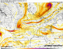
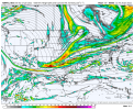
NAM looks faster with the SS energy…
iGRXY
Member
NAM is definitely pushing the SW further east this run. Could be a decent run here shortly
The fact that it already had a good look .. could only mean 1 thing for this runNAM looks faster with the SS energy…
The NAM is apart of the sref family so if they were showing a big hit I assume it would follow
NBAcentel
Member
This nam run is about to do some loco stuff it looks better at H5 then the last couple of runs
iGRXY
Member
Come on Kylo, you can’t bash members of your own family, right?
Plus, who the heck knows. This could dry up over the next 2 days or zero in on somewhere else. Should be another chance for Columbia to get some snow
D
Deleted member 1449
Guest
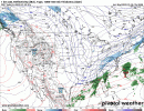
Coastal low is forming much closer to the FL coast this run. Don't know if that will make a difference.
iGRXY
Member
Nam really elongated that low E of Florida vs consolidating it way east like 18z
Eyeballing H5 I think this run splits the difference between 12 and 18z.
D
Deleted member 1449
Guest
Definately more interaction with the surface low this time.


Correct me if I’m wrong, but isn’t this the first model to run with pieces of energy sampled over land?
The surface differences between 18z and 00z at hr 45 Is pretty stupid lol
iGRXY
Member
A lot more precip breaking out this run
wow
Member
This is gonna be it
Just like last weds night, when we started the big shifts back to a hit.
I was about to post same gif, just minor adjustments pfft
wow
Member
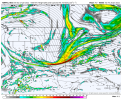
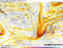
500mb ht crashes further west
Yeah as it turns out when the cyclogenesis ramps up along the climatologically favored Gulf Stream instead of ramping up along the complex of thunderstorms that may or may not exist in the Bermuda Triangle, the difference in moisture transport is palpable
For coastal areas, this is pretty ideal, SLP pulled back as the mid level turns right, this should be a good run.
Close your eyes and pretend the rest of this run doesn't happen probably going to be huge. Phaser is coming down through wisky and the base of the trough is fairly loaded
51 boom
Yeah as it turns out when the cyclogenesis ramps up along the climatologically favored Gulf Stream instead of ramping up along the complex of thunderstorms that may or may not exist in the Bermuda Triangle, the difference in moisture transport is palpable
With the draped front it’s an enhanced baroclinic zone, bonus points for natural climo favored.
D
Deleted member 609
Guest
HaHa, NAM you sneaky little devil you


Totals are probably gonna look similar to that SREF run
At 54 ripping fatties throughout the Carolinas my god
L
Logan Is An Idiot 02
Guest
That dry slot is brutal on the NAM for the foothills
Sent from my iPhone using Tapatalk
Sent from my iPhone using Tapatalk
Jon
Member
Best case scenario for Central NC. Tons of QPF at 54hr 995mb off ilm
Sent from my iPhone using Tapatalk
Sent from my iPhone using Tapatalk
D
Deleted member 609
Guest
iGRXY
Member
What’s funny is the NAM is probably under selling how fast the column would crash again too lolol
Down East getting crushed


Jessy89
Member
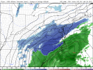
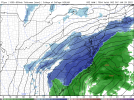
That latest nam run gives about everyone in both Carolinas some snow. Just more the further east you go.
Sent from my iPhone using Tapatalk
Sent from my iPhone using Tapatalk
Hypsometric
Member
I'll join. Should I repost that SREF run lol? FWIW I did read a paper that said the WRF-NMB was the best-performing control run of the SREF.

