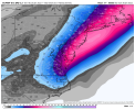
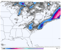
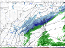
-
Hello, please take a minute to check out our awesome content, contributed by the wonderful members of our community. We hope you'll add your own thoughts and opinions by making a free account!
You are using an out of date browser. It may not display this or other websites correctly.
You should upgrade or use an alternative browser.
You should upgrade or use an alternative browser.
Wintry 01/28-29/2022 Winter Weather Potential
- Thread starter weather nerd
- Start date
NBAcentel
Member
NBAcentel
Member
Rosie
Member
Slow!Mods , You can hang me or tie me to the whippping post for placing this here, but at least it may get noticed ... is the site terribly slow? All other websites are zipping along nicely; here is taking forever to load ... "just asking for a friend" ...
Maybe you can get some good lightning pics at night in the snowDude.. that’s epic View attachment 110771
NBAcentel
Member
iGRXY
Member
NBAcentel
Member
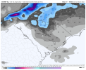
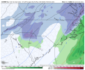
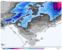
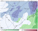
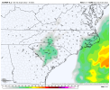
Looks similar to the 12z run, although the snow is a bit more widespread. The coastal low precip also ticked a bit west. It gets some 0.5” totals across the sounds now onto the mainland.
Looks quite exciting for the CLT area, IMO. Not as enthused over here in the Triangle, but we’ll see…
Looks quite exciting for the CLT area, IMO. Not as enthused over here in the Triangle, but we’ll see…
iGRXY
Member
I think we’re going to start seeing precip flourish more the closer we get as the dynamics of the ULL take over. The trough is actually in a really good spot for the upstate and Piedmont to get a decent clip of snow for 4-6 hours and could really drop a solid widespread 1-4”
Right now I see a bombing mid latitude cyclone off the east coast, specifics for the southern Mid Atlantic coastal plain are TBD.
Upstate usually in a favorable spot for Lee side convection. Seen it a time or two. Cant rule it out entirely but Charlotte and central NC seem to be the early model favorites. Worth watching at least.I think we’re going to start seeing precip flourish more the closer we get as the dynamics of the ULL take over. The trough is actually in a really good spot for the upstate and Piedmont to get a decent clip of snow for 4-6 hours and could really drop a solid widespread 1-4”
I’m flying to Boston
certainly feels like there's a little more to be written here. can't wait to see the 3km take a crack at all of thisRight now I see a bombing mid latitude cyclone off the east coast, specifics for the southern Mid Atlantic coastal plain are TBD.
NBAcentel
Member
NBAcentel
Member
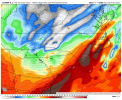
Here’s what the K index is
The K-Index or George's Index is a measure of thunderstorm potential in meteorology. According to the National Weather Service, the index harnesses measurements such as "vertical temperature lapse rate, moisture content of the lower atmosphere, and the vertical extent of the moist layer."[1] It was developed by the American meteorologist Joseph J. George, and published in the 1960 book Weather Forecasting for Aeronautics.[2]
Site : https://en.m.wikipedia.org/wiki/K-index_(meteorology)
Hypsometric
Member
iGRXY
Member
Exactly why the SREF is awful. The plumes suck too
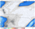
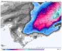
Total Precip on 18z Euro


Clem282340
Member
Is the western part of the upstate such as Anderson Pickens and Greenville are not going to see any thing for this stormI think we’re going to start seeing precip flourish more the closer we get as the dynamics of the ULL take over. The trough is actually in a really good spot for the upstate and Piedmont to get a decent clip of snow for 4-6 hours and could really drop a solid widespread 1-4”
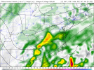
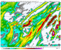
I’ve never seen models really latch onto this sort of thing this far out .. especially as strong as they show it now.. this may be a tremendous band come go time.. time will be the only limiting factor here .. key is what kind of snow rates can we get under this bandWe was about to get a weenie RAP run lol…. Look at that convective death band forming in the mountainsView attachment 110770
NBAcentel
Member
The precip tends to last longer than you might expect in these setups. It will form and expand in the lee of the apps, then be a bit slow to move off to the east. Euro is showing some 8-9 hours of precip in the Hickory to Charlotte to N SC corridor. We’ll see how it trends going forwardI’ve never seen models really latch onto this sort of thing this far out .. especially as strong as they show it now.. this may be a tremendous band come go time.. time will be the only limiting factor here .. key is what kind of snow rates can we get under this band
Jessy89
Member
Is the western part of the upstate such as Anderson Pickens and Greenville are not going to see any thing for this storm
I could be wrong. These lows sometimes can bring surprises. But I really don’t see the western upstate seeing much from this. We might see some flakes but im really expecting the eastern upstate to see 1-3 type snow event
Sent from my iPhone using Tapatalk
NBAcentel
Member
Also tends to be heavier then what global NWP show, the intense 700mb vertical velocity/moist column/steep mid level lapse rates argues for scattered but heavy bandingThe precip tends to last longer than you might expect in these setups. It will form and expand in the lee of the apps, then be a bit slow to move off to the east. Euro is showing some 8-9 hours of precip in the Hickory to Charlotte to N SC corridor. We’ll see how it trends going forward
Clem282340
Member
I think the 18z 3k nam show a little something for our area I’m hoping it show it on tonight’s run againI could be wrong. These lows sometimes can bring surprises. But I really don’t see the western upstate seeing much from this. We might see some flakes but im really expecting the eastern upstate to see 1-3 type snow event
Sent from my iPhone using Tapatalk
This is very true. Like I said earlier this is the type of set were widespread 1-3” is certainly possible, but for those that get under one those intense bands…it could very easily balloon into 4-5”+Also tends to be heavier then what global NWP show, the intense 700mb vertical velocity/moist column/steep mid level lapse rates argues for scattered but heavy banding
Jessy89
Member
I think the 18z 3k nam show a little something for our area I’m hoping it show it on tonight’s run again
I want us to see snow here in Pickens county. You live right down the road from me. I live off breazeale Rd close to Pickens airport. But I’m not getting my expectations of this event to high. That way if we do see a surprise I would really be excited even if it’s just a inch.
Sent from my iPhone using Tapatalk
L
Logan Is An Idiot 02
Guest
Euro is reminding me of how the RGEM was last week. Was the first to latch onto the ULT and hadn’t looked back. Got to love the consistency
Sent from my iPhone using Tapatalk
Sent from my iPhone using Tapatalk
iGRXY
Member
Way too soon to say yes or no. More and more precip continues to trend further and further west. I will say the gradient would probably be really sharp as the mountains of SC can really hurt places like Oconee, Pickens, and Anderson counties. Those areas could see a dusting where DT Greenville might see an inch or 2 and then places like Spartanburg, Cherokee, Union, back towards Charlotte and the 77 corridor might get 2-4”. Precip is usually underdone with these ULL and rates are very hard if you get under those bands. Right now I still say areas along and east of highway 25 that runs through Greenville county stand the best shot to seeing some real accumulation.Is the western part of the upstate such as Anderson Pickens and Greenville are not going to see any thing for this storm
January’03 style? For GSP area. Started snowing and called for 1-3”, kept snowing and Gaffney to Gastonia got about 10” as the temps crashed? Remember that one?The precip tends to last longer than you might expect in these setups. It will form and expand in the lee of the apps, then be a bit slow to move off to the east. Euro is showing some 8-9 hours of precip in the Hickory to Charlotte to N SC corridor. We’ll see how it trends going forward
Best porn around!! I hope that materializes for me and you I'll barley catch it as it forms as depicted but nice to see for sure thanks for posting that broDude.. that’s epic View attachment 110771
Yes though I mentioned earlier that I don’t see this one being near as dynamic as that one which is a high barJanuary’03 style? For GSP area. Started snowing and called for 1-3”, kept snowing and Gaffney to Gastonia got about 10” as the temps crashed? Remember that one?
LukeBarrette
im north of 90% of people on here so yeah
Meteorology Student
Member
2024 Supporter
2017-2023 Supporter
The NE cryingCount me inView attachment 110790
BelmontWX79
Member
These bands can cool the surface off really quickly too. In 2013 it was near 40 at my house when it began if memory serves. Started pretty much as all snow and it took 10-15 minutes to fall to freezing.
NBAcentel
Member
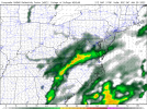
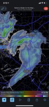
HRRR about to light up that band
NBAcentel
Member
@griteater saw something similar 2 weeks ago as the northern stream Upper level trough/low passed over from SW > NE, pretty cool stuff, I picked up 1 inch of snow in 45 minutes. Models were very bleak what that and only showed 0.1-0.3 with that backside stuff, with some HRRR runs actually showing nill. I find this setup very interesting to how similar it was to feb 2013 wrt the mesolow feature. 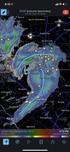


Last edited:
NBAcentel
Member
iGRXY
Member
Honestly looking at the soundings I think most of that would be snowHrrr looked nice and juicy with the band moving SE, and crashing sfc temps, can’t wait for the runs tomorrow View attachment 110802

