-
Hello, please take a minute to check out our awesome content, contributed by the wonderful members of our community. We hope you'll add your own thoughts and opinions by making a free account!
You are using an out of date browser. It may not display this or other websites correctly.
You should upgrade or use an alternative browser.
You should upgrade or use an alternative browser.
Wintry 01/28-29/2022 Winter Weather Potential
- Thread starter weather nerd
- Start date
NBAcentel
Member
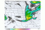
Wish the rgem didn’t look like dogcrap
lexxnchloe
Member
The last storm had ups and downs. Thats to be expected. This could easily move back west a bit. Go chase in Elizabeth city for now.
stephend122080
Member
EPS still making westward adjustments with the trough

Sent from my SM-A115U1 using Tapatalk

Sent from my SM-A115U1 using Tapatalk
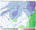
6z GEFS. How does this not result in a moderate event. ?
Haven’t looked at the other overnight runs but hoping it’s close to this.
View attachment 110573
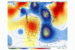
Here's why. Look close at 18z run last night in southern Mississippi and see how sharper the trough is and just a hair tick further west. Then look at same frame for 0z and 6z. Couple hours latter sharpening up and more positive tilt. Barely noticeable, but makes all the difference in the world. The sensible wx for our micro climate/back yards has a long way to go on this one before we iron it out.
18z last night

6z most recent

Actually thought the rgem looked a lot better at h5 than 00z. Lp placement got hijacked by a northern cluster of storms off the VA coast that I haven’t really seen in any other model. It would of had better surface reflection if that stuff wasn’t thereWish the rgem didn’t look like dogcrap
NBAcentel
Member
The EURO has been very consistent with backside stuff for several days now.
Yeah I agree. This is so close to our benchmark for the Carolinas and eastern Georgia, as in just a few mm pressure lower and we have a raging snowstorm. Just need to find a little more energy in the next 72 hours at the base of the trough
L
Logan Is An Idiot 02
Guest
Does anyone have the 06z EURO?
Sent from my iPhone using Tapatalk
Sent from my iPhone using Tapatalk
It's posted about 5 posts before thisDoes anyone have the 06z EURO?
Sent from my iPhone using Tapatalk
ajr
Member
L
Logan Is An Idiot 02
Guest
It's posted about 5 posts before this
Thanks. Sorry I thought that was the 0z
Sent from my iPhone using Tapatalk
D
Deleted member 1449
Guest
I only have the free data from TD at 72 hours.Does anyone have the 06z EURO?
Sent from my iPhone using Tapatalk

NBAcentel
Member
06z eps still decent and tbh in a great spot at this range


Yes I am, KIXA is less than 5 miles from mby as the crow flies and it looked decent on the GEFS

smast16
Member
So, is it still too early to complain about 2m temps?
- Joined
- Jan 23, 2021
- Messages
- 4,569
- Reaction score
- 15,091
- Location
- Lebanon Township, Durham County NC
Station ID: KIGX Lat: 35.76 Long: -79.06So, is it still too early to complain about 2m temps?
NAM Model Run: 6Z 26JAN 2022 Cloud base and tops are now agl
HR Valid 2m Tmp 2m Dpt 10m Dir 10m Spd TPrcp CPrcp 1000-500 500mb 850mb 500mb MSLP TCC PRS WX Tot Snowfall Vis
Deg F Deg F deg kt in. in. Thk GPH Tmp Tmp mb % TEXT Clouds in SM
69 01/29 03Z 34 31 19 6 0.03 0.00 534 546 -4.8 -22.9 1015 100 -SN 045OVC294 0.1 7.5
72 01/29 06Z 30 29 12 10 0.15 0.00 532 543 -6.0 -22.8 1013 100 -SN 030OVC318 1.3 0.5
75 01/29 09Z 27 25 355 11 0.13 0.00 527 537 -8.8 -24.9 1012 100 -SN 054OVC177 1.3 1.2
78 01/29 12Z 27 23 345 12 0.03 0.00 520 532 -11.7 -30.5 1014 100 097OVC164 0.3 7.2
81 01/29 15Z 29 17 329 13 0.00 0.00 518 530 -12.2 -32.9 1016 84 034BKN049 0.0 15.0
84 01/29 18Z 29 7 317 13 0.00 0.00 516 529 -11.9 -32.4 1016 7 053FEW061 0.0 15.0
Where's the issue?
Cary_Snow95
Member
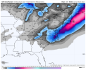
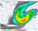
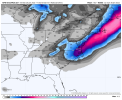
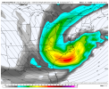
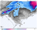
Based on early maps, NAM is gonna be slightly worse
Need that trough to go negative tilt faster than advertised. That Hudson Bay energy ticks north, the southern stream energy ticks south.
Probably a nothing burger but at least there is some support for Gilmer County to pick up around an inch n the EURO and EPS. At least something to look at if it happens.
Probably a nothing burger but at least there is some support for Gilmer County to pick up around an inch n the EURO and EPS. At least something to look at if it happens.
Backside energy looking a little better thoughBased on early maps, NAM is gonna be slightly worse
packfan98
Moderator
I was thinking that too. Looks to be diving down a little stronger and further west than 6z. Let's see how the surface looks in a few frames.Backside energy looking a little better though
Cary_Snow95
Member
At 39 it’s a little better than 06z but a little worse than 00z
iGRXY
Member
Looks better so far through 45
Keep in mind NAM is our best solution so far, holding serve is good, any improvements start getting into “playing with house money” territory
So far, so good.


Cary_Snow95
Member
Not close to 00z thoSo far, so good.

Im flipping back and forth from 18z yesterday. Its turning neutral quicker, Should be a great run here coming up
0z was a shade better, but its better than the 18z that started the fireworks yesterday
0z was a shade better, but its better than the 18z that started the fireworks yesterday
D
Deleted member 609
Guest
Boom, here go again.... NAM why??!!


NBAcentel
Member
lol these NAMings have been consistent
that a dry slot? lol

