MichaelJ
Member
This looks like a carbon copy of the last storm, ENC jackpots and WNC is looking for a dusting. While it may come back to the NW a little, with no strong high to our North, probably not.


Alot of people seem negative on this but i like where the low is on most of the models. Could it still miss? Sure, but at the same time we dont need any huge shifts for this to be a goos storm, just minor changes.12z RGEM says the game is still on.


Also, Stop reading into most of these maps as their 10:1 ratios. And this ain't about to be anything close to 10:1Y'all ease up on the "what did it look like for my area", "got a map of this" comments/questions please. Maps will get posted and we still have days to go, gonna be a long week like this. Lol
It's a pay subscription service - https://maps.weatherbell.com/Where can I get that for KECG or KORF?
It's a pay subscription service - https://maps.weatherbell.com/
Could be the end result is what was showing early on with the last one. North central Ga being on the northern edge of a precip shield from a suppressed system, and getting the sleet and snow we so richly deserveThe problem you have tho is there is nothing to hold this back toward the coast in a flow like that. I am not saying it won't happen, or be like the EURO, but you have to play catch the vort pieces at the right time and that is not going to be easy. If there was some blocking out ahead.....well...then..
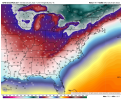
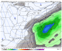
Mean temps on the GEFS is in the upper 20s/ around 30 when it’s snowing, it would probably be close or at 10:1 during the peak of the event if it happens, esp with favorable diurnal timingAlso, Stop reading into most of these maps as their 10:1 ratios. And this ain't about to be anything close to 10:1


Isn’t the snow being shown in the eastern areas though which aren’t in the 20s?Mean temps on the GEFS is in the upper 20s/ around 30 when it’s snowing, it would probably be close or at 10:1 during the peak of the event if it happens, esp with favorable diurnal timing View attachment 110326View attachment 110327
Right now your in a pretty good spot but you really can't afford to much more westward shiftWhere can I get that for KECG or KORF?


Mean temps around Raleigh is around 30Fduring the peak, for areas east as usual it’s warmer around 31-33Isn’t the snow being shown in the eastern areas though which aren’t in the 20s?
10-4 on that. As long as we continue or improve on ensemble trends is all that I care about until Wednesday Night.I'd be surprised if any of the ops show any widespread 4"+ snowfall amounts west of 95 and south of Greenville today. We'll probably have to wait until tomorrow for that. Positive trends and baby steps are what we're looking for att.

Right now your in a pretty good spot but you really can't afford to much more westward shift

The silence from my local Met (Chris Justus) tells me either this storm is a big nothing Burger for us, or he has no clue what’s gonna happen. I’m hoping it’s the second one.
We need THAT much of a shift for our area to get a decent snow here? Thats quite a lot. Wowjust a little 250 mile jog west and i'm good. easy, right!?!?
Slowly working western areas back in. Not giving up yet.Lots of possibilities View attachment 110337
