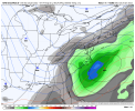
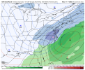
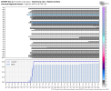
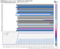
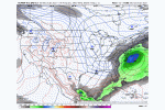
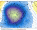
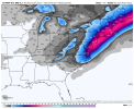
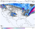
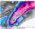
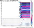
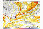
Well dang, honestly iirc it wasn't that bad for the last system hmmm
-
Hello, please take a minute to check out our awesome content, contributed by the wonderful members of our community. We hope you'll add your own thoughts and opinions by making a free account!
You are using an out of date browser. It may not display this or other websites correctly.
You should upgrade or use an alternative browser.
You should upgrade or use an alternative browser.
Wintry 01/28-29/2022 Winter Weather Potential
- Thread starter weather nerd
- Start date
iGRXY
Member
Earlier phase near the gulf coast around LA/Miss would really help the upstate and NE GA. Right now it looks like we could get some backside snow showers. Still got time to see where this goes as the energies in question haven’t really been sampled yet. That’ll start to happen today and tomorrow.What does Alabama Georgia and the upstate need to happen to get in on this storm or are we pretty much out of the game
EPS trolling hard


NBAcentel
Member
NBAcentel
Member
I mean if you live in NC. You can’t help but love the consensus right now. Almost every ensemble member of both euro and Gfs are giving at least light snow events to central and eastern NC with many giving winter storm criteria snows as well .. the ones that really have us scoring I’ve noticed even take the NE out of the game .. looks like we are close enough to the phase for magic at this range .. now can we hold this look for multiple days until go time? Probably not lol
I'll take one of the two: Earlier phase in the GOM or just a Tighter Tuck to the NC Coast. The Tighter tuck by 50-100 miles would really beef up accums by itself off the euro and ens suite. If we get an earlier phase back toward Louisianna, even if it doesnt make it all the way back to LA per say. It still will mean a stronger storm as it passes our zipcodes riding up the coast. No gurantees, but 1 or both are easily doable.
Hopefully the GFs at some point Today/Tonight gets back on board and quits holding energy back. usual day 3-5 model handicap appears to be in play once again.
No doubt there's gonna be one more seismic bump as we draw closer to Thursday when all the players start appearing on the field of play ( conus)
L
Logan Is An Idiot 02
Guest
The 6z euro was gonna be nice. Phased further west than 0z even. The eps/control run should be good.
Sent from my iPhone using Tapatalk
That’s exactly what areas back west need.
Sent from my iPhone using Tapatalk
NBAcentel
Member
bingcrosbyb
Member
A couple of more trends west today on Euro and this could get very interesting. Could look like GFS bomb from Saturday.
Congrats everyone. After some solid 0z and 6z runs, we have regained about 90% of the ground we lost with that 18z suite. Lol. I know i was pretty adamant it was a blip and I still kind of think that but it’s taking a bit for the models to recover
Sometimes we get a blip even when coming back west #neverforgetCongrats everyone. After some solid 0z and 6z runs, we have regained about 90% of the ground we lost with that 18z suite. Lol. I know i was pretty adamant it was a blip and I still kind of think that but it’s taking a bit for the models to recover
- Joined
- Jan 23, 2021
- Messages
- 4,602
- Reaction score
- 15,197
- Location
- Lebanon Township, Durham County NC
If we see what we saw in the last event, euro is going to be much closer to the coast eventually.
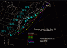
Just like this system, the Boxing Day storm, as I recall, also relied on a piece of northern stream energy that dived into the trough, therefore amping and pulling it to the west. Models lost it as well before correcting just before go time.Sometimes we get a blip even when coming back west #neverforget
View attachment 110304
BHS1975
Member
Just like this system, the Boxing Day storm, as I recall, also relied on a piece of northern stream energy that dived into the trough, therefore amping and pulling it to the west. Models lost it as well before correcting just before go time.
Models have come a long was since then due too massive computing power but the data coming in is the same or worse due to COVID.
Sent from my iPhone using Tapatalk
smast16
Member
So, are we just gonna not talk about the GFS and ride the Euro till death do us part?
smast16
Member
I think this statement applied for the 1st 6 months, but air travel is pretty much back to normal levels. +/- 15%Models have come a long was since then due too massive computing power but the data coming in is the same or worse due to COVID.
Sent from my iPhone using Tapatalk
NBAcentel
Member
GFS has been trending back the past 2 runs, and it’s ensemble looks goodSo, are we just gonna not talk about the GFS and ride the Euro till death do us part?
lexxnchloe
Member
Interesting that the timing on this will be very similar to last week. I think most of NC will see at least a coating with Raleigh east doing as well as the last low.
I'm good if it stays right there on modeling until Thurs nightThe EPS/GEFS are on top of each other...but I want to see these tick west a 100 miles the next 48 hours. When has these not shifted west and flipped us to rain.
View attachment 110301
smast16
Member
And they looked great up to 48 / 72 hours out on the Big sunday storm with the consensus showing the low still off the coast vs the Op's showing them inland.GFS has been trending back the past 2 runs, and it’s ensemble looks good
And even then, we're still talking about 33 and 34 degree snows.
ATLwxfan
Member
Barring a miracle after sampling tomorrow we are out of it. And unfortunately looks like for a while.
For us to score would be an unprecedented failure of modern weather forecasting. The models aren’t perfect but they are pretty darn good.
Sent from my iPhone using Tapatalk
I mean some of us don't really want this to come to much further west lol. All joking aside, this really is close to being the bomb first advertised, next day or so of models after all data is sampled going to be fun


ForsythSnow
Moderator
And then there's us over here who want this to charge west and get in on a big storm after so many fails this season. The coming days will tell what the answer is as the energy get better sampled and we verify different aspects that would make it one or the other, or a flop for both.I mean some of us don't really want this to come to much further west lol. All joking aside, this really is close to being the bomb first advertised, next day or so of models after all data is sampled going to be fun

You want to trade spots for this one?I mean some of us don't really want this to come to much further west lol. All joking aside, this really is close to being the bomb first advertised, next day or so of models after all data is sampled going to be fun

NBAcentel
Member
packfan98
Moderator
Man, this 500mb map looks complicated with all of the energy. The western energy is split on this run of the NAM compared to the last run. Makes me think there will be some different looking outcomes before we lock in on a final result.


- Joined
- Jan 23, 2021
- Messages
- 4,602
- Reaction score
- 15,197
- Location
- Lebanon Township, Durham County NC
The NBM basically doubled for most of NE NC but quadrupled for hampton roads.
lexxnchloe
Member
Do you have a map of that? How far south in NC does the snow get?The NBM basically doubled for most of NE NC but quadrupled for hampton roads.
- Joined
- Jan 23, 2021
- Messages
- 4,602
- Reaction score
- 15,197
- Location
- Lebanon Township, Durham County NC
Prestige Worldwide
Member
brendan123
Member
packfan98
Moderator
FYI for everyone. The NBM seems to be heavily weighted with the GFS. After the Huge GFS run the other day the model was showing 6+ inches for the same areas that was slammed by the GFS run.
Y'all ease up on the "what did it look like for my area", "got a map of this" comments/questions please. Maps will get posted and we still have days to go, gonna be a long week like this. Lol
- Joined
- Jan 23, 2021
- Messages
- 4,602
- Reaction score
- 15,197
- Location
- Lebanon Township, Durham County NC
Energy looks more consolidated this run on the NAM this run. It is slightly further east however. You're only talking Vegas at 6z and the Grand Canyon at 12z.

