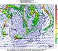
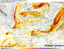
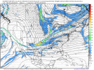
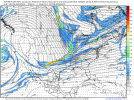
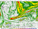
Big dogs are usually defined by a long wave trough axis, full latitude upper air with hard right at base, vs shortwave.
-
Hello, please take a minute to check out our awesome content, contributed by the wonderful members of our community. We hope you'll add your own thoughts and opinions by making a free account!
You are using an out of date browser. It may not display this or other websites correctly.
You should upgrade or use an alternative browser.
You should upgrade or use an alternative browser.
Wintry 01/28-29/2022 Winter Weather Potential
- Thread starter weather nerd
- Start date
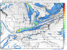
Yeah, we really need the energy to be consolidated at the south, which the GFS has but then lost.Big dogs are usually defined by a long wave trough axis, full latitude upper air with hard right at base, vs shortwave.
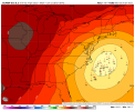
I'm procrastinating on leg day by overanalyzing the 18z and it just feels really blippy. It took a weird jolt. 30 hours in on the GFS and there's nothing that makes me say "hey thats IT!", if anything I thought our s/w (east of that little tail on Alaska) actually looked a little better and primed to take a dive.
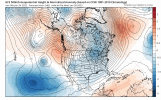
It just completely diverges around hour 78 and by hour 90 it looks a lot different from the previous few runs. I mean it just jolts to a worse solution.
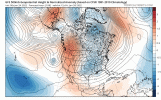
Our s/w splits some and wants to go way further south west into Mexico. I think the GFS also ran this play with the southern energy some last week. It completely corrodes the southern end of our shortwave and no serious cyclogenesis occurs south of the mason dixon line. Is it right? Don't know but this run feels like a good "it's a blip" candidate.
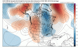
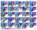
When you zoom out on the GEFS ensembles here, there was a slight nudge towards a worse solution but it looked better than I thought.
Overall think this is a pretty blippy run, but we'll see if the 00zs keep it, which not gonna lie, would suck a lot!

It just completely diverges around hour 78 and by hour 90 it looks a lot different from the previous few runs. I mean it just jolts to a worse solution.

Our s/w splits some and wants to go way further south west into Mexico. I think the GFS also ran this play with the southern energy some last week. It completely corrodes the southern end of our shortwave and no serious cyclogenesis occurs south of the mason dixon line. Is it right? Don't know but this run feels like a good "it's a blip" candidate.

When you zoom out on the GEFS ensembles here, there was a slight nudge towards a worse solution but it looked better than I thought.
Overall think this is a pretty blippy run, but we'll see if the 00zs keep it, which not gonna lie, would suck a lot!
wow
Member
Blippi..B L I P P I
Who has the 18z Canadian. Fact 12z. What happened? It won last battle, high res at least did.
I'm procrastinating on leg day by overanalyzing the 18z and it just feels really blippy. It took a weird jolt. 30 hours in on the GFS and there's nothing that makes me say "hey thats IT!", if anything I thought our s/w (east of that little tail on Alaska) actually looked a little better and primed to take a dive.
Not deep diving at this point (no pun) but I see some limitations in the northern Great Lakes preventing the long wave from dropping down wholesale.
NBAcentel
Member
Yikes
If, and its a big if, recent examples are an indicator of future performance, more energy will eject than currently advertised.
lexxnchloe
Member
OK, the 18gfs wasnt awesome but at the same time there is a rather strong low se of hatteras. I will take that 4 days out.


lexxnchloe
Member
Better how? Do you have a different map?
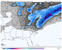
It held less of the energy.Better how? Do you have a different map?
The bottom was the 12z runBetter how? Do you have a different map?
NBAcentel
Member
NBAcentel
Member
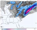
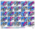
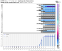
In fact, 42/50 members have a light event here, that’s pretty solid
packfan98
Moderator
Nice. Thanks for posting. I’ve been excited for the possibilities with this storm, especially since you posted the CIPS analogs earlier. Seems like most of the time they show systems that miss us to the north with the dreaded NW trend for potential events we track. The one you posted today hit NC flush. Do you find the CIPS to be accurate?
Clem282340
Member
how did it look in scIn fact, 42/50 members have a light event here, that’s pretty solid
DC all in on HECS ticket #48 at the meat counter.
I find when the majority of CIPS analogs are high it does correlate. But, would rather see them tomorrow back it up.Nice. Thanks for posting. I’ve been excited for the possibilities with this storm, especially since you posted the CIPS analogs earlier. Seems like most of the time they show systems that miss us to the north with the dreaded NW trend for potential events we track. The one you posted today hit NC flush. Do you find the CIPS to be accurate?
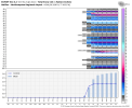
You can’t live in NC right now and look at these and think “this one looks over for us, rip, out to sea, not going to work” .. let’s remember were 5 days away and we are NW trend magnets inside 2 days .. scrumptious to say the leastThat’s a lot of light members for most of NC and some big members in ENCView attachment 110241View attachment 110242
Pretty classic look for the MA crew at day 4, I would be prepping the clearing equipment 95 north of Richmond to NYC, particularly areas east of the Interstate. While we like Central FL or even GA, this is textbook with near term correction for those areas. Inside the benchmark with occlusion still on the table. Chase watch hoisted.
lexxnchloe
Member
Here is WXrisks ideas
"Scenario #2 is a glancing blow. That is to say, the large powerful LOW pressure area tracks fairly close to the coast so that the western fringes of the LOW pressure area brings accumulating snow to the eastern portions of North Carolina, the Southeastern of Virginia, perhaps the coast of Delmarva, eastern Long Island and southeastern New England. There would be strong winds, coastal flooding, and this could be significant winter event for only those areas. But this outcome would NOT be a direct hit or eastern Mid Atlantic as most of the heavy snow would stay off the coast to the east, this outcome would still be a major hit for New England. This is what WxRisk favors right now.
To the north, this Trough will drive a new strong cold front Across the middle Atlantic and New England regions. this font will reinforce the cold air on the East Coast for the weekend Nor’easter/ East Coast winter storm. This means that whatever develops along the East Coast on Friday and Saturday, the atmosphere will be cold enough to support mainly snow as far south as southern portions of North Carolina and northwest portions of South Carolina."
He doesnt think temps will be an issue for most of NC.
A lot of details to be sorted out, I am at about 10% feeling as it stands for my back yard. Marginal temps and the low looks strung out.
If this comes back and slams the East Coast can we put the 4-7 day dead zone, lack of sampling argument to rest with affirmation, once and for all?
I personally think the sampling argument is more valid in a set up like this when we’re completely needing phasing to develop the storm.If this comes back and slams the East Coast can we put the 4-7 day dead zone, lack of sampling argument to rest with affirmation, once and for all?
Flotown
Member
For us dummies...meaning??
iGRXY
Member
It definitely is. Trying to guess what these pieces of energy are going to do without adequate sampling of them is almost pointless.I personally think the sampling argument is more valid in a set up like this when we’re completely needing phasing to develop the storm.
iGRXY
Member
GFS continues to underperform on the strength of the western ridge. We want it tall and sharp so that our energy can’t hopefully continue to dig as far south as possible.For us dummies...meaning??
Fountainguy97
Member
Agreed. I've been looking at this too.I think I am reading this differently than most. That lead wave that gets buried is not really the "storm". It's the trailing wave. The initial wave is basically carving the trough for the trailing wave.
In fact, in the 18z run from Saturday that went bonkers, the lead wave did exactly the same thing as it did on the 18z run today. The difference as I've been saying is that the trailing wave was tugged west by it, whereas on more recent runs it's maintained more separation and doesn't drive south but instead southeast, not allowing enough space and time to amplify.
Frankly, I think we should be rooting for the 18z GFS trend to continue, but pulling in the trailing wave(s)/trough. Maybe I missing something.
View attachment 110248
View attachment 110247
The position of that vort max off the California and its influence on the PNA ridge amplitude and orientation are key IMO.

