GeorgiaGirl
Member
Hour 270 is still not WAY out there though, but it'll be 500+ miles east or west of this at 18Z. Or as likely as not, completely gone.If this weren't essentially kicks and giggles land, I would be full on loathing where this run seems to be headed...
View attachment 174318
Yes this is true. Guess I’ll wait and see how this plays out.EURO and AI still have nothing
0Z UK is similar to the 12Z with a TS N of the Leewards moving WNW:
NEW TROPICAL CYCLONE FORECAST TO DEVELOP AFTER 132 HOURS
FORECAST POSITION AT T+132 : 15.6N 56.6W
LEAD CENTRAL MAXIMUM WIND
VERIFYING TIME TIME POSITION PRESSURE (MB) SPEED (KNOTS)
-------------- ---- -------- ------------- -------------
1200UTC 21.08.2025 132 15.6N 56.6W 1009 26
0000UTC 22.08.2025 144 16.3N 58.8W 1007 32
1200UTC 22.08.2025 156 18.1N 60.9W 1006 37
0000UTC 23.08.2025 168 19.4N 63.3W 1005 38
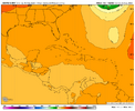
Starting to take off in the BahamasGFS haha all the other runs were a head fake. It makes a late attempt but much weaker than 18Z
View attachment 174336
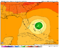
Starting to take off in the Bahamas
View attachment 174337
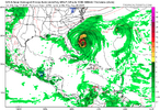
I will say upfront that some of the EPS members either follow Erin out or struggle to develop behind it(shear from it?) but there's definitely more support for a threat than I thought
ICON is also picking up on the threat.I will say upfront that some of the EPS members either follow Erin out or struggle to develop behind it(shear from it?) but there's definitely more support for a threat than I thought
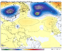
12Z GFS Hour 252:
View attachment 174354
Agreed! Cool we have something to track next after Erin.Yeah. Takes a super long time this run to get going, but it survives into the ever potent gulf and is a problem for someone. Long way to go here, but we probably have a good idea of what the deal is. Stronger earlier, probably OTS, weaker and it likely goes on to be a problem for someone in the gulf coast states 10+ days from here.
Biggest thing I see is Erin has to go away quickly once it clears the Carolinas or this probably isnt that interesting
That seems to be the key difference in whether it actually becomes a threat or just follows it out
12Z UKMET: recurve with it moving NNW at end and aiming toward area around Bermuda:
NEW TROPICAL CYCLONE FORECAST TO DEVELOP AFTER 96 HOURS
FORECAST POSITION AT T+ 96 : 15.7N 54.7W
LEAD CENTRAL MAXIMUM WIND
VERIFYING TIME TIME POSITION PRESSURE (MB) SPEED (KNOTS)
-------------- ---- -------- ------------- -------------
1200UTC 21.08.2025 96 15.7N 54.7W 1009 28
0000UTC 22.08.2025 108 17.2N 57.2W 1007 28
1200UTC 22.08.2025 120 19.3N 60.2W 1006 30
0000UTC 23.08.2025 132 20.8N 61.9W 1006 32
1200UTC 23.08.2025 144 22.4N 63.8W 1005 35
0000UTC 24.08.2025 156 25.0N 64.5W 1005 41
1200UTC 24.08.2025 168 27.9N 65.8W 1005 43
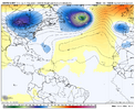
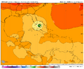
Then don't look at the 18z gfs lolThis is the 12Z UKMET hour 168 H5 map showing recurve near Bermuda even with Erin far away by this time:
View attachment 174369
Meanwhile, the lone highly threatening model hangs onto it at Happy Hour:
View attachment 174370
GaWx did post the 18z gfs, saying it was the only threatening model.Then don't look at the 18z gfs lol
Right and as it finished its run it gives hurricane conditions from Florida to NCGaWx did post the 18z gfs, saying it was the only threatening model.
