Btownheel
Member
Man, my belly is full. You can miss me with some zr bullsh*t this week, lol.
Sent from my iPhone using Tapatalk
All in
I really do wonder how cold we could get tonight in CLT metro with basically 10-15” of snow blanketing the area. Skies should be clear and light winds. I have a feeling some outlying areas will make a run at 0Low of 10.7 this morning
The monthly version for Feb ran yesterday was pretty eye-candy-ish. It bounces a lot...as does the long range pattern representation.We laugh at the CFS but what I've heard it's ok with pattern recognition. It shows a lot of troughing out west which would support what Kylog stated above. It also shows highs moving across the north US and signs of possible CAD events. So that may be what winter storms we might be dealing with this month.
I would be surprised if there aren't some 0-5 degree temperatures in the outlying areas, which should be single digits in a lot of areas. And congratulations on a BIG SNOW.I really do wonder how cold we could get tonight in CLT metro with basically 10-15” of snow blanketing the area. Skies should be clear and light winds. I have a feeling some outlying areas will make a run at 0
Oh yeah. Lock it in

Time for RDU to get back to winning.... the daily high temperature competition!!!
It doesn’t really see the heat dome well but you can kinda tell that it recognizes it somewhat and breaks it up prior to getting to the Carolina’s.
I think another CAD ice storm is in the cards. Pattern just screams itYou guys in the western NC got a long ways to go this winter. It's been an active winter and I can't imagine it just dying today for places like western NC.
It’s honestly something that’s not far off from a quick incher for someone if you hold back the back end of the vort more and tilt it a bit moreInteresting that both AI gfs and euro hold precip over the longer on Thursday while the ops are more progressive
Looks like we have a legit shot at a novelty event with a small chance at a nuisance event later this week. All depends on how much we can sharpen the trough and still leave behind the base. Looks better for Raleigh vs CLT this time, for at least something small anyways View attachment 193234View attachment 193235View attachment 193236
At least soil temps will be cold, which will help provided we get some snow to actually fall. Warm soil temps + 32-34 degree temps makes it hard to get accumulations without heavy rates, but give us cold soil and maybe we can work with that, even if rates aren't great.One thing to think about is the surface temps for this next event. They will be marginal for many areas (much different from yesterday). But the snow coverage to the north, may help make this a little more interesting. A rain turning to snow event, which normally is not as doable. So not excited about a big event, but some could see a couple of inches.
Pre-emergent was dropped 2 weeks ago by my yard guy. Dormantly sitting snug under a blanket of soft snow awaiting to attack that first warm attempt at weed germinationAhhhh...let the warmth envelop us. Pre-emergent time around Valentines...
Don’t forget the coastal plain, they got another one footer left this winter too!You guys in the western NC got a long ways to go this winter. It's been an active winter and I can't imagine it just dying today for places like western NC.
I'm still hesitant to believe this is going to materialize. It just hasn't so far this winter. There might be a thaw but pattern keeps on repeating.How you get out of this mess before March...going to take a lot of that Charlotte/Greensboro/PGV luck...but they can do it if anyone.
Time to tune up the lawn mowers and get the fertilizer ready to go.
View attachment 193260View attachment 193261
Slider in the worksthoughts?View attachment 193259
We got down to 7 in Matthews last night, would love to make a run at 0 with the snow coverThe EURO now has the low for Monroe dropping to -1. Tonight. Just curious to see the mets on here opinion of just how low it could go to over the snow pack
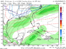
I’m facilitating something hereYall got any of them weathernext images for Thursday View attachment 193286

You need 2 inches of sleet. Cause we still got it from 8 days ago underneath all that snow. Ive never seen ice harden , and refuse to melt,let go like that stuff. Been so cold , so long , so that plays a big role. This snow will just evaporate in sun, regardless how cold it is.We had 5 inches of snow and it’s basically gone. And it’s still pretty dang cold. What does it take to get snow to stick around. A cloudy day maybe?
It doesn’t depict any snow accum from this though
Yeah. We got down to 8 here just from getting about 2 hours of clear skies and the breeze was still up. A very solid snow pack with no bare ground here. If the wind stays calm, I think it could really bottom out tonight. Full moon tonight too, so I encourage anyone to go out and see just how bright it is outside tonight and here that distinct crunch of the packed powderWe got down to 7 in Matthews last night, would love to make a run at 0 with the snow cover
