• Hello, please take a minute to check out our awesome content, contributed by the wonderful members of our community. We hope you'll add your own thoughts and opinions by making a free account!

Misc General Banter Thread

It was absolutely adorable seeing some of yall trust the long range NAM yesterday
There is a reason its called getting nammed

im of the belief im going to be one county inside the back end of the precip or one county out of it. Im guessing I'll end up the one out of it because of course I will.
 
I am back everyone. @SD I am trying to reset my password for my old snowc account. I have not received a response from any of the weather folks here about how to reset my password. So, I have created a new account due to these circumstances.

whats the account; ill just give you a temporary password you can change from
 
Dude, go somewhere else for a while. A break might do you some good. The constant barrage of posts like this sucks more than the weather.
Actually if you look back iv been pretty quiet lately haven’t even said much. But it’s the truth what im saying right now. Just use the ignore feature. Idk why thats so hard.
 
Actually if you look back iv been pretty quiet lately haven’t even said much. But it’s the truth what im saying right now. Just use the ignore feature. Idk why thats so hard.
I don't ignore people. I can't do my job if I can't see posts. Maybe I grouped you in with the other whiners and the cumulative effect skewed my judgement. I'll make sure to spread the message to the others. Cheers.
 
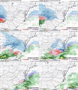
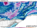
Correct me if I’m wrong but doesn’t these maps look a lot like the AI models showed about 3-5 days ago. It’s come a little NW but it seems like they know what they’re doing and the gfs can pound sand.
 
I know the mountains help us get a cold rain cad instead of warm rain but man. I wish they weren’t there lol


Sent from my iPhone using Tapatalk
 
Book it. Euro AI Witt a cad storm on Jan 28. It better not be wrong since it nailed sundays storm from 200 hours out
b634c49f5e1360cf8121c8d52e3cee9e.jpg


Sent from my iPhone using Tapatalk
 
yeah, lets only follow the models that have the conus and nothing else going on outside it as the ones we trust over 500mb 24 hour charts from high resolution globals since they can't "see" the snow or something
 
Sorry DS, I had a brain malfunction. Didn’t mean to not include you in the list. Yeah, you’re near ground zero potentially!

With what some of the models were showing in Atlanta a few days ago, I thought about coming down this weekend to see my family and a chase the snow!!


Sent from my iPhone using Tapatalk
 
Thanks. The 12Z UKMET has a 2” max in far SW GA, which is quite a ways W of other model maxes in S GA. @accu35 you chasing if this were to verify? What about @deltadog03 , @GeorgiaGirl and others?

View attachment 184224

SW GA is probably too ambitious of a drive for me unless I evaluate the road map. SE really isn't, especially since I was around Savannah twice last summer.

*Edit* I'd only have to take a couple of turns and just push for a bit.

I'm just not sure if worth it or not and if I decided yes, I'm going to get some funny questions as I'm not on my own.
Maybe a Snow Chase to Statesboro ?
 
48 hours out and still have no idea of what will happen in CLT lol


I mean a foot of snow is out of the question but NAM going back and forth between a decent storm and nothing, other models that were previously dry now inching NW, the RRFS pretty much keep us rainy. This might be the most nowcast event in history for this neck of the woods
 
Gonna be historical to see south GA pull off back to back snow storms. Hoping I can pull out an inch with a few more ticks north but we all have to admit this is pretty cool.
I agree, if Macon area and then i20 from Augusta to Columbia could somehow thread the needle on this one.... it would be a miracle.. but I think it's still the best chance at SOMEONE getting a minor snow event out of it
 
It's what I should've done in 2018 lol, but while it seems like they're near 2", my thinking is that if another tick north doesn't get me, on that tick, I might be taking a Sunday morning drive to the end of the county to my south.
Take your snow chains!
 
Might be a WILDLY dumb question, but is it even at all possible to have something like a “live” vort or H5 map? Or is that purely just something that a model can depict as a product because the only thing “live” we have to physically look at is what can be picked up on a radar? (Outside of a dropsonde, weather balloon data, etc.)

I almost wonder, assuming it is impossible, if some of it is because it’s not *currently* possible to process everything quickly enough? Does that even make sense? Is this whole discussion absurd?
 
Back
Top