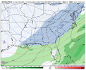
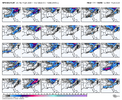
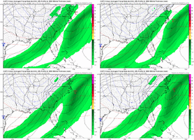
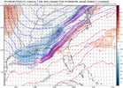
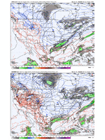
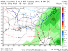
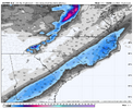
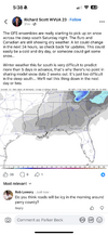
2 inch mean here (eastern Triad) on GEFS.
-
Hello, please take a minute to check out our awesome content, contributed by the wonderful members of our community. We hope you'll add your own thoughts and opinions by making a free account!
You are using an out of date browser. It may not display this or other websites correctly.
You should upgrade or use an alternative browser.
You should upgrade or use an alternative browser.
Jan. 17-18, 2026 SE Winter Weather Threat
- Thread starter RBR71
- Start date
Just go w ol’ faithful: broad swath of T-6”The Euro camp has to show me something tbh. It would not take much from where it is right now to give a more exciting solution, but personally, as someone who has to create a public forecast that includes the Foothills of NC tomorrow, I'm not sure it would be something I'd explicitly forecast yet. 0z euro/eps could at least make me think twice about that.
Too easy for it to vanish east at this range or end up too fast to do anything wintry over here. May end up conservative, but that's where I'm at right now
That last NW shift was significant and keeps the NW trend going. More NW shifts are expected. 1/21/25 and 1/28/14 shifted NW almost to the time of the storms.
The GFS did well with one of this past December events continuing to show snow when the other models had nothing for days. Let's hope it is on to something again.18z GFS holds. Some differences with the energy as it bottoms out and doesn't phase in as well as the 12z but at this range it's good to go.
We have the initial overrunning precip when the trough is still pos tilted, then the question is if/when does it wrap up and tilt to bomb out a coastal.. that'll determine if there will be much higher amounts on the northern end.
trackersacker
Member
packfan98
Moderator
ha, that's a forecast practice I will never be in the business of. if i don't know with decent confidence, you aren't getting a map out of me until the bitter end. i'd rather wait till 18 hours before go time to put out one forecast than put out more than 2 mapsJust go w ol’ faithful: broad swath of T-6”
broken025
Member
bncho
Member
Webberweather53
Meteorologist
broken025
Member
Just find the craziest GEFS member and roll with it as a forecastha, that's a forecast practice I will never be in the business of. if i don't know with decent confidence, you aren't getting a map out of me until the bitter end. i'd rather wait till 18 hours before go time to put out one forecast than put out more than 2 maps
SnowNiner
Member
That would look really great if it wasn’t completely on its own. Everything else is on the coast and progressive.
Webberweather53
Meteorologist
If we continue to do the usual NW trend as we often see w/ these overrunning style events, I'd almost rather be in MS-AL-GA than the east-central portion of the Carolinas for this one.
Aside from the stronger warm advection, poorer diurnal timing of the arctic front, and potential slowing of said boundary by the mountains in NC & SC, I really don't like the lack of a cold surface high to the north for the Carolinas. It's not the end of the world of course, but just another thing I'm not a huge fan of w/ this.
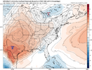
Aside from the stronger warm advection, poorer diurnal timing of the arctic front, and potential slowing of said boundary by the mountains in NC & SC, I really don't like the lack of a cold surface high to the north for the Carolinas. It's not the end of the world of course, but just another thing I'm not a huge fan of w/ this.

NCWeatherNow
Member
Im not expecting the 18z euro to be much different than the 12z, there isnt much additional data added to them in those update times.
Survive and advance. Need to see somebody else drop the ink soon, though.
bncho
Member
Do you think DC is in a good spot for this, or are they too far NW?If we continue to do the usual NW trend as we often see w/ these overrunning style events, I'd almost rather be in MS-AL-GA than the east-central portion of the Carolinas for this one.
Aside from the stronger warm advection, poorer diurnal timing of the arctic front, and potential slowing of said boundary by the mountains in NC & SC, I really don't like the lack of a cold surface high to the north for the Carolinas. It's not the end of the world of course, but just another thing I'm not a huge fan of w/ this.
View attachment 183468
My original ‘hope’ was that the wave running into TN Saturday would press the thermal boundary and cold air to the coast, then we’d have a bit of wave spacing before our storm wave drops into the trough. We’ve lost a bit of that initial press east on some model runs. But regardless, we still have an issue with pinning our hopes to the GFS suite. Majority of the other suites are moreso coastal scrapers (which could work out well for some)If we continue to do the usual NW trend as we often see w/ these overrunning style events, I'd almost rather be in MS-AL-GA than the east-central portion of the Carolinas for this one.
Aside from the stronger warm advection, poorer diurnal timing of the arctic front, and potential slowing of said boundary by the mountains in NC & SC, I really don't like the lack of a cold surface high to the north for the Carolinas. It's not the end of the world of course, but just another thing I'm not a huge fan of w/ this.
View attachment 183468
LukeBarrette
im north of 90% of people on here so yeah
Meteorology Student
Member
2024 Supporter
2017-2023 Supporter
Really good test for this model. We will see how this pans outAI GFS seems locked in
View attachment 183461
Webberweather53
Meteorologist
My original ‘hope’ was that the wave running into TN Saturday would press the thermal boundary and cold air to the coast, then we’d have a bit of wave spacing before our storm wave drops into the trough. We’ve lost a bit of that initial press east on some model runs. But regardless, we still have an issue with pinning our hopes to the GFS suite. Majority of the other suites are moreso coastal scrapers (which could work out well for some)
I personally don’t buy the eastern solutions
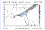
I feel like this is gonna be one of those rare instances when the GFS wins. We will seeDay 3-4 and this big a difference between the Euro/GFS. Probably a blend coming but would think GFS doing GFS things
View attachment 183469
SimeonNC
Member
This is based on no knowledge what so ever, only gut feeling. But, I honestly don't like going from being fringed to the SE to being in the jackpot on the GFS in a few runs, with still multiple days to go.
Webberweather53
Meteorologist
I personally don’t buy the eastern solutions
Just about everything I see screams northwest trend down to the last minute.
Whether that be the forcing mechanisms for the precip (warm advection/isentropic upglide), the diurnal timing of the cold advection and the fact that most of our cold air has to come from the west over the mtns to get here in time (it usually ends up a bit slower which also forces things NW), the lack of a cold high to the north to suppress the baroclinic zone to the south, etc.
SnowNiner
Member
Just about everything I see screams northwest trend down to the last minute.
Whether that be the forcing mechanisms for the precip (warm advection/isentropic upglide), the diurnal timing of the cold advection and the fact that most of our cold air has to come from the west over the mtns to get here in time (it usually ends up a bit slower which also forces things NW), the lack of a cold high to the north to suppress the baroclinic zone to the south, etc.
So…..you’re thinking rain for the piedmont?
SegTindo
Member
Depends on where you are. For instance the chance of its trending NW too much from say Dothan, AL to Macon,GA and northwest of there are about nill.
Good cold air feed and location will just yield more precip to cool the column if it does go crazy and amp.
So you’re saying that it can still snow in those areas?
Sent from my iPhone using Tapatalk
ducketta27
Member
If we continue to do the usual NW trend as we often see w/ these overrunning style events, I'd almost rather be in MS-AL-GA than the east-central portion of the Carolinas for this one.
Aside from the stronger warm advection, poorer diurnal timing of the arctic front, and potential slowing of said boundary by the mountains in NC & SC, I really don't like the lack of a cold surface high to the north for the Carolinas. It's not the end of the world of course, but just another thing I'm not a huge fan of w/ this.
View attachment 183468
Wow, was not expecting that big of a NW trend…Maybe central SC out of it.
Sent from my iPhone using Tapatalk
Maybe I should have waited 5 mins for the 18z runDay 3-4 and this big a difference between the Euro/GFS. Probably a blend coming but would think GFS doing GFS things
View attachment 183469
rburrel2
Member
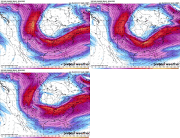
I think the 18z ukmet was good. Check out how much less that first trough has dug down compared to 12z run.
Also… our wave is clearly further west, but also looks like it’s making more progress towards tilting compared to 12z.
Honestly, it looks like an even better version of the 00z bomb run.
Also you can clearly see the 12z run was ruined by Lower heights/first shortwave pressing down more.
Also… our wave is clearly further west, but also looks like it’s making more progress towards tilting compared to 12z.
Honestly, it looks like an even better version of the 00z bomb run.
Also you can clearly see the 12z run was ruined by Lower heights/first shortwave pressing down more.

iwantsouthernsnow123
Member
What about for northeast georgia? Are the looks of that decent to you?I personally don’t buy the eastern solutions
Quite the nod to the GFS here with 4-6" in FL/GA verbatim. Obviously only one run, but glad to see some beefing up in general
A possible way to get around what Webb has pointed out with waiting on cold air to get over the Appalachians (which yeah, when does it ever drop as quick as modeled with fronts?) would be if you could keep slowing precip down to the point where it is Sunday evening... still not great diurnal timing.
SegTindo
Member
All it would take is the precipitation being forced by warm advection & isentropic upglide aloft to end up a bit stronger than modeled and this latent heat release/-PVa aloft would feedback onto the synoptic pattern a bit and shift things NW even further from here.
View attachment 183462
What does that mean for South MS/AL/GA?
Sent from my iPhone using Tapatalk
NWG_WX14
Member
Nice shift towards the Gfs from the euro at 18z.
SimeonNC
Member
Now this is a good place to be four days out for those in the NC/SC Piedmont given Webber's statements about overrunning
NW Trend is happeningHere’s the map from WxBell for the 18z Euro. Great run for trends
View attachment 183473
Webberweather53
Meteorologist
This setup looks like a significantly warmer version of Jan 2014 essentially.
a_gilmore88
Member
This setup looks like a significantly warmer version of Jan 2014 essentially.
With that in mind, is a good guess at this range the January 2014 precip shield shifted NW?

