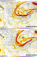
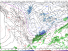
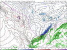
-
Hello, please take a minute to check out our awesome content, contributed by the wonderful members of our community. We hope you'll add your own thoughts and opinions by making a free account!
You are using an out of date browser. It may not display this or other websites correctly.
You should upgrade or use an alternative browser.
You should upgrade or use an alternative browser.
Jan. 17-18, 2026 SE Winter Weather Threat
- Thread starter RBR71
- Start date
Speaking of snowfall forecasts, are we going to have any contests this year like we did last year if this potential event looks more likely?1st call snowfall forecast:
Raleigh, NC: 8-12"
Charlotte, NC: 5-7"
Atlanta, GA: 3-5"
Stay tuned for more updates!!
- Joined
- Jan 23, 2021
- Messages
- 4,602
- Reaction score
- 15,197
- Location
- Lebanon Township, Durham County NC
I give him a lot of leeway for all of the lives he has saved and I think others should as well.Especially 'met bashing' a legend like James Spann. I agree, it's poor taste. No question, some of you need to check your pride at the door.
LukeBarrette
im north of 90% of people on here so yeah
Meteorology Student
Member
2024 Supporter
2017-2023 Supporter
its's still east. I will take ICON with a gain and salt at this point!It's like the ICON and the GFS are on different planets 66 hours out - View attachment 183427
NCHighCountryWX
Member
- Joined
- Dec 28, 2016
- Messages
- 699
- Reaction score
- 1,918
NWS GSP Official Guidance
KEY MESSAGE 4: LIGHT SNOW ACCUMULATIONS OVER THE NORTH CAROLINA MOUNTAINS
AND EXTREME NORTHEAST GEORGIA FRIDAY NIGHT THROUGH EARLY SATURDAY COULD
RESULT IN MINOR TRAVEL ISSUES.
ON FRIDAY, ANOTHER UPPER LOW IS EXPECTED TO DIVE SOUTHWARD FROM CANADA
AND MOVE ACROSS THE GREAT LAKES REGION. A BROAD BUT DEEP MID/UPPER TROF
WILL REMAIN TO OUR WEST THRU THE BULK OF THE WEEKEND. A LEADING UPPER
SHORTWAVE ROUNDING THE BASE OF THE TROF MAY BRING SOME AMOUNT DPVA AND
MID-LVL ISENTROPIC LIFT ACROSS THE MTNS FRIDAY NIGHT AND EARLY SATURDAY
MORNING, HOWEVER THE MOISTURE RETURN AHEAD OF THE TROF STILL APPEARS
MINIMAL OVERALL. LOW-LVL FLOW WILL REMAIN W TO WSW DUE TO THE ORIENTA-
TION OF THE TROF AXIS. SOME AMOUNT OF LIGHT PRECIPITATION FROM HIGHER-
BASED CLOUD COVER WILL PROBABLY MATERIALIZE, BUT MUCH OF IT COULD EVA-
PORATE BEFORE REACHING THE GROUND. SOME OF THE MODEL PROFILES SUGGEST
A WEAK, LOW-LVL WARM NOSE COULD BE IN PLACE DURING THE ONSET OF PRECIP.
HOWEVER, WITH RELATIVELY DRY LOW-LVL AIR IN PLACE, IT'S LIKELY THAT
TEMPERATURES WILL WET-BULB DOWN TO BELOW FREEZING AND ERODE ANY WARM
NOSE FAIRLY QUICKLY. TOTAL QPF IS STILL EXPECTED TO BE NO MORE THAN
0.1 TO 0.2 INCHES OF LIQUID. THIS TRANSLATES TO ROUGHLY AN INCH OF
SNOW OVER THE TN BORDER ZONES AND SOUTHWEST NC MTNS BY DAYBREAK SAT.
SOME OF THE MORE FAVORED AREAS COULD SEE CLOSER TO 2 INCHES, BUT THOSE
AREAS WILL LIKELY BE ISOLATED. A LIGHT DUSTING IS POSSIBLE OVER THE
MTNS OF NORTHEAST GA AND THE FAR NORTHWESTERN UPSTATE, BUT ANY ACCUMS
SHOULD REMAIN UNDER AN INCH.
OTHERWISE, TEMPERATURES WILL REBOUND TO NEAR-NORMAL ON SAT AS SFC HIGH
PRESSURE GETS PUSHED OFFSHORE AND THE STRENGTHENING W/SW FLOW PROVIDES
SOME AMOUNT OF DOWNSLOPE WARMING EAST OF THE MTNS.
KEY MESSAGE 5: WINTER PRECIPITATION IS POSSIBLE EAST OF THE MOUNTAINS
EARLY SUNDAY, HOWEVER CONFIDENCE WITH RESPECT TO TIMING AND AMOUNTS
REMAINS RELATIVELY LOW.
THE SYNOPTIC PATTERN WILL REMAIN PROGRESSIVE THRU THE LATTER HALF
OF THE WEEKEND AND INTO EARLY NEXT WEEK. A DEEPENING UPPER TROF WILL
PUSH A COLD FRONT THRU THE REGION LATE SAT WITH COLDER AIR RETURNING
SAT NIGHT INTO EARLY SUN. THE ASSOCIATED DIGGING UPPER SHORTWAVE COULD
INDUCE SOME ROBUST FRONTOGENESIS AND ISENTROPIC UPGLIDE BACK OVER THE
COLD AIR EAST OF THE MTNS SUNDAY MORNING. AS SUCH, IF PRECIP DOES DEVE-
LOP OVER OUR EASTERN ZONES ON SUNDAY IT WOULD LIKELY BE MOSTLY SNOW.
THE CURRENT FCST STILL ONLY HAS A SLIGHT CHANCE FOR PRECIP AND ONLY A
FEW HUNDRETHS OF AN INCH OF QPF DURING THIS TIME FRAME. IF PRECIP
CHANCES AND/OR AMOUNTS TREND HIGHER GOING FORWARD, IT'S MORE LIKELY
THAT THESE AREAS COULD GET SOME AMOUNT OF SNOW. OTHERWISE, TEMPERA-
TURES ARE EXPECTED TO COOL WELL-BELOW NORMAL FOR SUNDAY AND REMAIN
BELOW NORMAL THRU EARLY NEXT WEEK.
accu35
Member
When does the Nam start getting into range?
iGRXY
Member
ICON looked better to me. It looked like it dug a little better and it definitely wasn't as positively tilted
Tsappfrog20
Member
Jonathan Wall…
Sent from my iPhone using Tapatalk
Sent from my iPhone using Tapatalk
rburrel2
Member
It might snow in Oconee/Pickens/Greenville counties in SC early Saturday morning and here's why.... Even with the southerly surface winds... the models have a pocket of calm air as those winds approach the mountain slopes, and all the hi'res models have that pocket staying much colder as a result... low to mid 30's instead of 38-42 at the surface. Probably doesn't hurt that there's some adiabatic cooling too i'd imagine just off the surface.
long story short... there is a brief window for moderate snow in this small area(and in to far north Georgia, for early Saturday morning.
This is all assuming there is that band of precip from the tiny lead shortwave.
Potential fail point is we are really close to freezing at around 850mb Saturday morning. Could get warm-nosed.
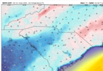
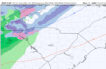
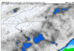


Everybody always says this and it usually ends up with the GFS folding to the models that show the least impactful outcome. If the ICON was alone, I'd agree, but most of the guidance is still pretty far east for a widespread snow event.its's still east. I will take ICON with a gain and salt at this point!
A trough with a tilt from Los Angeles to Charleston is not going to get the job done any more than a big bowl trough dropping down from Lake Erie will. This situation really does have to evolve perfectly to get more than a flake floating through the air. The GFS (and previously the UK) are the only deterministic models showing that. That's not the best island to live on, IMO.
Blue_Ridge_Escarpment
Member
The 18Z icon run just showed this same band FWIWIt might snow in Oconee/Pickens/Greenville counties in SC early Saturday morning and here's why.... Even with the southerly surface winds... the models have a pocket of calm air as those winds approach the mountain slopes, and all the hi'res models have that pocket staying much colder as a result... low to mid 30's instead of 38-42 at the surface. Probably doesn't hurt that there's some adiabatic cooling too i'd imagine just off the surface.
long story short... there is a brief window for moderate snow in this small area(and in to far north Georgia, for early Saturday morning.
This is all assuming there is that band of precip from the tiny lead shortwave.
Potential fail point is we are really close to freezing at around 850mb Saturday morning. Could get warm-nosed.
View attachment 183428View attachment 183430View attachment 183431
It in fact looked neutral tilted by 09z/12z!ICON looked better to me. It looked like it dug a little better and it definitely wasn't as positively tilted
18z RGEM ain’t great
SnowNiner
Member
What's going to help this vort get stronger and tilt sooner? Separation? Stronger west atlantic ridge? Need something to root for now that we've already got the western dig. Need to finalize that last step.
Blue_Ridge_Escarpment
Member
I thought the trough orientation looked better18z RGEM ain’t great
accu35
Member
It’s not as west as the Nam for sure. I’ll favor the Nam over the RGEM18z RGEM ain’t great
SnowNiner
Member
Jonathan Wall…
Sent from my iPhone using Tapatalk
Is that vort north of Dakotas the "kicker" that's making our shortwave too progressive and positive?
jetstream30
Member
What are everyone’s thoughts on the potential storm 4 days out? Appreciate the forum.
Everything from a board wide hit to a coastal slammer is on the table.What are everyone’s thoughts on the potential storm 4 days out? Appreciate the forum.
wow
Member
18z GFS about the same with the s/w but the PNA ridge is still trending west at 36
That’s what this entire thread is about. Really weird questionWhat are everyone’s thoughts on the potential storm 4 days out? Appreciate the forum.
jetstream30
Member
What’s your gut telling you snowfan with the current pattern on this storm?
uninteresting run that shouldn't bring worry to anybodyICON looked better to me. It looked like it dug a little better and it definitely wasn't as positively tilted
jetstream30
Member
Just catching up on model runs. Sorry about that.
18z gfs first run in a long time with no discernable push west with our trough compared to previous runs. i'm out until hr 54
iwantsouthernsnow123
Member
Not exactly a bad thing though, I feel like18z gfs first run in a long time with no discernable push west with our trough compared to previous runs. i'm out until hr 54
wow
Member
By 63 there's a bit of one.. or it's just slower with the s/w18z gfs first run in a long time with no discernable push west with our trough compared to previous runs. i'm out until hr 54
EDIT: yep, it's further west
Bigedd09
Member
Through 75 hours

Sent from my iPhone using Tapatalk

Sent from my iPhone using Tapatalk
accu35
Member
Gfs doing it again
NWG_WX14
Member
Through 66 looks pretty similar to 12z, probably another big run incoming
Bigedd09
Member

Sent from my iPhone using Tapatalk
BKWRN29
Member
Is that not better for a board wide hit? Looks like more moistureThrough 75 hours
Sent from my iPhone using Tapatalk
wow
Member
Hold on to something
Believe she’s gonna go for it again, perhaps a bit less exciting?
yup, noticing that now at 72. decent movement similar to the euroBy 63 there's a bit of one.. or it's just slower with the s/w
EDIT: yep, it's further west
BKWRN29
Member
Is anyone else concerned about how much this thing is shifting NW each run? I’m getting nervous.

