-
Hello, please take a minute to check out our awesome content, contributed by the wonderful members of our community. We hope you'll add your own thoughts and opinions by making a free account!
You are using an out of date browser. It may not display this or other websites correctly.
You should upgrade or use an alternative browser.
You should upgrade or use an alternative browser.
Jan. 17-18, 2026 SE Winter Weather Threat
- Thread starter RBR71
- Start date
SnowNiner
Member
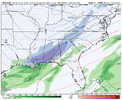
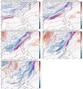
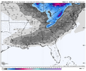
Through 75 hours
Sent from my iPhone using Tapatalk
Pretty classic early footprint right there. And at a classic location.
Only if the euro does it tooIs anyone else concerned about how much this thing is shifting NW each run? I’m getting nervous.
ChattaVOL
Member
great run. Need that NW shift for us in East Tennessee.
solid look at h5. should still be a nice hit with a haircut on 12z's totals
Is anyone else concerned about how much this thing is shifting NW each run? I’m getting nervous.
Depends on where you are. For instance the chance of its trending NW too much from say Dothan, AL to Macon,GA and northwest of there are about nill.
Good cold air feed and location will just yield more precip to cool the column if it does go crazy and amp.
Bigedd09
Member
I still think GFS was a slight nod to the euro. Not as strong and a little flatter
Sent from my iPhone using Tapatalk
Sent from my iPhone using Tapatalk
BKWRN29
Member
I am on the northern fringe on this in central Alabama. I’m alittle north of the “sweet spot”. Been bit by this many times and it scared me being this far out from the even.Depends on where you are. For instance the chance of its trending NW too much from say Dothan, AL to Macon,GA and northwest of there are about nill.
Good cold air feed and location will just yield more precip to cool the column if it does go crazy and amp.
Hoping euro is not capturing the precip field as well but we shall seeI still think GFS was a slight nod to the euro. Not as strong and a little flatter
Sent from my iPhone using Tapatalk
Bigedd09
Member
Hoping euro is not capturing the precip field as well but we shall see
Well it’s unfortunate because the euro Canadian and icon isn’t capturing the precip field. It could go either way. Hopefully they start trending toward gfs soon
Sent from my iPhone using Tapatalk
wow
Member
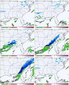
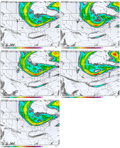
18z GFS holds. Some differences with the energy as it bottoms out and doesn't phase in as well as the 12z but at this range it's good to go.
We have the initial overrunning precip when the trough is still pos tilted, then the question is if/when does it wrap up and tilt to bomb out a coastal.. that'll determine if there will be much higher amounts on the northern end.
We have the initial overrunning precip when the trough is still pos tilted, then the question is if/when does it wrap up and tilt to bomb out a coastal.. that'll determine if there will be much higher amounts on the northern end.
I am on the northern fringe on this in central Alabama. I’m alittle north of the “sweet spot”. Been bit by this many times and it scared me being this far out from the evAmp.
Yeah, you want this thing to amp like the rest of us do in the west. We have a lot more margin of error as far as cold goes unlike say North Carolina. On the flip side, we have less margin of error with precip.
accu35
Member
Notice snow trending further west in areas towards west Louisiana and Arkansas
not a precip field issue, it's a flattening/shortwave getting strung out issue as that lobe digs over the plains/SW. it comes in less robust through our neck of the woodsHoping euro is not capturing the precip field as well but we shall see
Euro has sucked this year!Only if the euro does it too
GFS has lead the way with snow storms up here! The Euro WILL cave
Webberweather53
Meteorologist
The one thing I don’t like about this system for the eastern-central portion of the Carolinas is the fact that the Arctic cold front is driving thru during the middle of the day while being slowed more by the apps. Definitely the kind of recipe that can lead to a last second NW shift in wintry precip, aside from the warm advection
accu35
Member
That was 12zToto warm on Ukie for snow… but plenty of QPF? One would think if snowing in South GA, it’s snowing in midlands of SC…

Sent from my iPhone using Tapatalk
accu35
Member
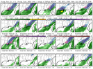
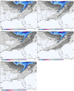
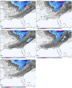
18z gefs members looks better from what I see
We live to 00z!
WOW! Now that is significant
WOW! Now that is significant
GeorgiaGirl
Member
That was 12z
Whenever the 18z Ukie runs, it won't span the entire timeframe of this potential system.
The answer though is yes; it literally is too warm. In the meantime, the 18z GEFS looks fine. I again only see a couple whiffs.
GeorgiaGirl
Member
packfan98
Moderator
accu35
Member
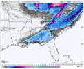
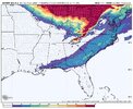
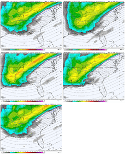
Notice how the footprint is stretching further west areas?GEFS looks to have a similar footprint to the 12z op run. Looks to go up the eastern seaboard.
View attachment 183454
From CHS for S SC/SE GA: downplaying it, which makes sense due to borderline temps and limited qpf:
KEY MESSAGE 3: ARCTIC COLD FRONT ARRIVING ON SUNDAY WILL USHER BELOW
NORMAL TEMPERATURES, ALONG WITH THE POSSIBILITY OF FLURRIES SATURDAY
NIGHT INTO SUNDAY MORNING.
IT'S IMPORTANT TO NOTE THE MOST RECENT
12Z GFS HINTS AT THE POTENTIAL FOR A COASTAL LOW DEVELOPING
OFFSHORE OF THE CAROLINAS AHEAD OF THE APPROACHING SHORTWAVE,
AND THIS SETUP WOULD FAVOR HIGHER PRECIP. AMOUNTS. HOWEVER,
TEMPERATURES WILL BE BORDERLINE ALONG THE COASTLINE ON SATURDAY
NIGHT INTO SUNDAY MORNING, THUS IT'LL BE HARD TO SUPPORT PURE
SNOW AND IT'S MORE LIKELY A RAIN/SNOW MIX WILL APPARENT NEAR THE
COASTLINE. THE PROBABILISTIC WINTER STORM SEVERITY INDEX
(WSSI-P) CONTINUES TO SHOW A 5-10% CHANCE FOR A TRACE OF
SNOWFALL FROM THE COLDER SOLUTIONS. AGAIN, CAUTION SHOULD BE
EXERCISED HERE AS THE FORECAST CAN CHANGE, AND WILL LIKELY
CHANGE OVER THE NEXT COUPLE DAYS. IT'S TOO FAR OUT IN THE
FORECAST TO TALK ABOUT EXACT SNOW ACCUMULATIONS AND ANY SMALL
CHANGE IN THE FORECAST COULD MOVE THE PRECIP. OFF THE COAST AND
KEEP THE REGION DRY.
First Call:
Norfolk, VA: 1-2”
Raleigh, NC: 1-1.5”
Charlotte, NC: 1”
Atlanta, GA: 0.5”
Birmingham, AL: Dusting
Norfolk, VA: 1-2”
Raleigh, NC: 1-1.5”
Charlotte, NC: 1”
Atlanta, GA: 0.5”
Birmingham, AL: Dusting
LongRanger
Member
Left out GSPFirst Call:
Norfolk, VA: 1-2”
Raleigh, NC: 1-1.5”
Charlotte, NC: 1”
Atlanta, GA: 0.5”
Birmingham, AL: Dusting
The Euro camp has to show me something tbh. It would not take much from where it is right now to give a more exciting solution, but personally, as someone who has to create a public forecast that includes the Foothills of NC tomorrow, I'm not sure it would be something I'd explicitly forecast yet. 0z euro/eps could at least make me think twice about that.
Too easy for it to vanish east at this range or end up too fast to do anything wintry over here. May end up conservative, but that's where I'm at right now
Too easy for it to vanish east at this range or end up too fast to do anything wintry over here. May end up conservative, but that's where I'm at right now
.03Left out GSP


