ChattaVOL
Member
This setup looks like a significantly warmer version of Jan 2014 essentially.
The storm that caused the traffic nightmare?
Sent from my iPhone using Tapatalk
This setup looks like a significantly warmer version of Jan 2014 essentially.
I’m with ya on an earlier post you made, if NW trend does continue then MS/AL/GA will be the sweet spot. Honestly even if we don’t NW I’m still looking goodThis setup looks like a significantly warmer version of Jan 2014 essentially.
What's crazy I just saw a video on YouTube of that storm the most famous image from that day? Downtown Raleigh in utter gridlockThis setup looks like a significantly warmer version of Jan 2014 essentially.

Do you think even the Triad will get warm nosed?Just about everything I see screams northwest trend down to the last minute.
Whether that be the forcing mechanisms for the precip (warm advection/isentropic upglide), the diurnal timing of the cold advection and the fact that most of our cold air has to come from the west over the mtns to get here in time (it usually ends up a bit slower which also forces things NW), the lack of a cold high to the north to suppress the baroclinic zone to the south, etc.
Need more neg tilt, means stronger more coldJust my opinion but I think this ends up being an 85 NW snow potential here. I get nervous when there’s not a true HP locked in over the NE and you’re dealing with WAA driven precip. I think it’ll be cold enough for those with elevation along and north of 85. But that’s also dependent on your energy digging correctly and it being oriented correctly by not being too positively tilted
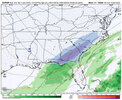
Only need a 75 to 100 mile shift nw for a good event for many in north ga into the upstate...needless to say that's very doable at this time range. Indeed i dont want to be in the bullseye this far out. Seeing this from the euro is very encouragingHere’s the map from WxBell for the 18z Euro. Great run for trends
View attachment 183473
Do you think even the Triad will get warm nosed?
So 12/7/17 basicallyThis setup looks like a significantly warmer version of Jan 2014 essentially.
I guess it only took 12 hours to see this…


So 12/7/17 basically

It's hard to get super specific like that but seems very possible given the way this is headed.
Can you back that map up please ?
I don’t see a blizzard, winds no where close to that criteria.Is FLorida about to get another blizzard before we all get 1 inch of snow

18z EPS. Similar to 12z. Little less on the western edge.
View attachment 183477

yes there will probably be more warm air advection. some areas would rain over it.If this thing continues to NW trend, does that mean there will be more moisture? What determines how much moisture is available?


18z GEFS for MGM, DHN, BHM

What could go wrong?
View attachment 183488View attachment 183489View attachment 183490
Short lived my friend....patienceIt’s kinda cursed that Dothan got more members than BHAM like that’s some twilight zone stuff
Sent from my iPhone using Tapatalk
Short lived my friend....patience
Yeah one mans trash is another mans treasure I suppose.Oh know it’s gonna trend towards BHAM/ATL like it always do not even getting my hopes up lol
Sent from my iPhone using Tapatalk
Yeah one mans trash is another mans treasure I suppose.
I've been doing some analog visits using meso anylasis recaps. I've seen a lot of similarities to December 8-9th 2017. Southern Jet ripping and the 500mb is almost the exact same which came as a huge surprise when i investigated it.I mean there’s still like 3-4 days left so anything can happen I just don’t see a back to back for areas that got it last year but hey I’ve crazier things happen before so anything is possible just don’t get your hopes up
Sent from my iPhone using Tapatalk
I've been doing some analog visits using meso anylasis recaps. I've seen a lot of similarities to December 8-9th 2017. Southern Jet ripping and the 500mb is almost the exact same which came as a huge surprise when i investigated it.
Not at all what I'm saying. Wherever that southwest side is is probably going to see snow. Possibly even along the gulf coast. The #1 question is where. Mountains often slow down cold air. So it is likely to be more amped up which does leave me to believe a benji like scenerio could potentially be trying to unfold. This is on the more extreme side of things but I'd keep an eye on the trend.So basically saying the southern areas aren’t getting anything?
Sent from my iPhone using Tapatalk
Not at all what I'm saying. Wherever that southwest side is is probably going to see snow. Possibly even along the gulf coast. The #1 question is where. Mountains often slow down cold air. So it is likely to be more amped up which does leave me to believe a benji like scenerio could potentially be trying to unfold. This is on the more extreme side of things but I'd keep an eye on the trend.


I just have a Gut feeling The Nam is gonna come in lock step with the GFS.Sref mean has some noise at the end of its run. Could mean we’re about to get nam’ed.
View attachment 183501View attachment 183502
Y’all have fun with this and hope you all can land it.
Chattanooga will be waiting for the next one.
Sent from my iPhone using Tapatalk