-
Hello, please take a minute to check out our awesome content, contributed by the wonderful members of our community. We hope you'll add your own thoughts and opinions by making a free account!
You are using an out of date browser. It may not display this or other websites correctly.
You should upgrade or use an alternative browser.
You should upgrade or use an alternative browser.
Pattern January Joke
- Thread starter SD
- Start date
NBAcentel
Member
That's good to read. I closed my laptop for a bit after looking at the 18z Euro dumpster.Both the euro EPS and AI EPS looks better at H5 to me so far late this weekend
Definitely a signal there that kinda matches up to the footprint of the UKMET.
Y
That screams a sudden, eventual uptick from nothng to 2-4".
That screams a sudden, eventual uptick from nothng to 2-4".
CNCsnwfan1210
Member
Gulf coast starting to get moist, like what I see here.
Sent from my iPhone using Tapatalk
NBAcentel
Member
rburrel2
Member
We probably won’t get anything… but if we do get .10-.15 of liquid up here and in central NC… I think we would be looking at 20:1+ ratios or better. The lift is pretty high up and it’s cold. I think we could see ratios like central nc saw last year from that very light 700mb fronto band that moved through and dropped 1-1.5 inches of snow from .05 liquid.
CNCsnwfan1210
Member
Welp, it was nice while it lasted. Things don’t trend our way and that’s just how it is View attachment 182812
Wonder if it’s weeding out the big dogs?
Sent from my iPhone using Tapatalk
- Joined
- Jan 2, 2017
- Messages
- 1,566
- Reaction score
- 4,279
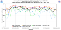
Dude the UKMET ranks 2nd to the Euro inthe 5-7 day range. Id advise you to ignore the GFS before the ukie at that range. You can check those verification scores at 500mb at that range. Now is it right today for this event, most likely not. Likely a blend of the euro/ukie is more likely the outcome.Thats why I ignore the UKMET, a very unreliable model.
Last edited:
- Joined
- Jan 23, 2021
- Messages
- 4,602
- Reaction score
- 15,197
- Location
- Lebanon Township, Durham County NC
Can you not read and interpret graphs? Jesus.Thats why I ignore the UKMET, a very unreliable model.
- Joined
- Jan 2, 2017
- Messages
- 1,566
- Reaction score
- 4,279
I definitely do not think we will see a 3 plus inch snow out of this but can believe a widespread yard coater in our parts. Now is the time where the trends should all start lining up..from today till Wednesday. Still has potential to be better but sampling over the next 48hrs will tell alot.We probably won’t get anything… but if we do get .10-.15 of liquid up here and in central NC… I think we would be looking at 20:1+ ratios or better. The lift is pretty high up and it’s cold. I think we could see ratios like central nc saw last year from that very light 700mb fronto band that moved through and dropped 1-1.5 inches of snow from .05 liquid.
LongRanger
Member
I've been saying this will end up giving the upstate 1" of snowI definitely do not think we will see a 3 plus inch snow out of this but can believe a widespread yard coater in our parts. Now is the time where the trends should all start lining up..from today till Wednesday. Still has potential to be better but sampling over the next 48hrs will tell alot.
CNCsnwfan1210
Member
I definitely do not think we will see a 3 plus inch snow out of this but can believe a widespread yard coater in our parts. Now is the time where the trends should all start lining up..from today till Wednesday. Still has potential to be better but sampling over the next 48hrs will tell alot.
I was about to say the next couple of days should narrow things down a bit.
Sent from my iPhone using Tapatalk
WolfpackHomer91
Member
Welp, it was nice while it lasted. Things don’t trend our way and that’s just how it is View attachment 182812
I thought I posted this here and not banter…. This is a wash, footprint stayed the same. Yea amounts changed but it didn’t jump 100 miles North or South or East ect….. footprint looks equivalent …. Onward
Sent from my iPhone using Tapatalk
NBAcentel
Member
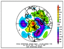
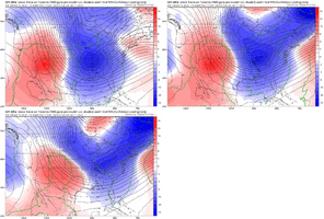
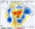
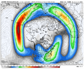
This smells like a brutal shot of Arctic air down the line. -AO/artic ridging. The Arctic ridging coupled to the strat. The main cold lobe is sitting in Canada. MJO heading for the Americas. Pacific jet heading back towards and breaking around Hawaii. The stars are aligning pattern wise. But the hurdle is capitalizing on smaller scale features and scoring. That’s the part we just can’t seem to get past 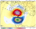


NBAcentel
Member
NCHighCountryWX
Member
- Joined
- Dec 28, 2016
- Messages
- 699
- Reaction score
- 1,918
GAweather
Member
Well I will say this. If we miss out on the opportunity for this weekend storm, I like where we maybe heading for the 22 to 25 time frame for the CAD regions.
CNCsnwfan1210
Member
This smells like a brutal shot of Arctic air down the line. -AO/artic ridging. The Arctic ridging coupled to the strat. The main cold lobe is sitting in Canada. MJO heading for the Americas. Pacific jet heading back towards and breaking around Hawaii. The stars are aligning pattern wise. But the hurdle is capitalizing on smaller scale features and scoring. That’s the part we just can’t seem to get past View attachment 182822View attachment 182825View attachment 182824
Yeah you can’t ask for a better setup for cold. If we catch the full brunt of one of those arctic shots/PV lobes, it’s going to be pipe burst material.
Sent from my iPhone using Tapatalk
LongRanger
Member
Not sure I do that'd likely lead to Ice!Well I will say this. If we miss out on the opportunity for this weekend storm, I like where we maybe heading for the 22 to 25 time frame for the CAD regions.
accu35
Member
When the short range models start keying in on the late weekend storm will they have a better chance handling the moisture?
Sure...if there actually IS moisture. Ain't gonna get a lot of moisture with a cold front. Hopefully, we can see better trends with mid level energy.When the short range models start keying in on the late weekend storm will they have a better chance handling the moisture?
trackersacker
Member
Yeah it’s too daddgum flat.The ICON still has the 3rd impulse/ull diving southward. The not-so-good news is it would be so much more intriguing at least a couple of hundred miles further west. View attachment 182832
iwantsouthernsnow123
Member
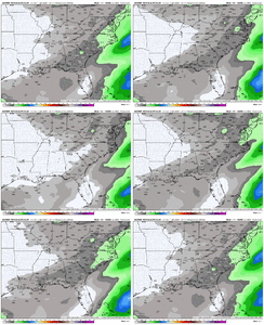
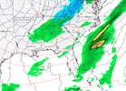
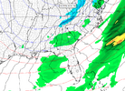
Appears like areas further south may see higher QPF totals potentially with this 1st system as the southern stream energy tries to get itself briefly involved. This does not mean snow by any means. This is purely rain, may just have some light/moderate rain bands from Central MS, AL, GA, SC
Grit/web. You have a archived 500mb vort , loop from Jan 23,2000-jan 24 2000?
Love to see it. My memory correct ns dropped down through western wisconsin, Iowa. Front was drapped across GOM coast. NC climate use to have a satelite loop. Like 36 hrs. You could see the vort coming down.
Love to see it. My memory correct ns dropped down through western wisconsin, Iowa. Front was drapped across GOM coast. NC climate use to have a satelite loop. Like 36 hrs. You could see the vort coming down.
accu35
Member
NBAcentel
Member
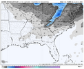
AIGFS basically lost the late weekend deal in 1 run after several small steps in the right direction
UGH! I am over the AI models all together...I think I am going with the OS and ensembles for now on.AIGFS basically lost the late weekend deal in 1 run after several small steps in the right direction
Yes, it did shift westward a good bit.View attachment 182838I could be wrong, but this seems like a west shift compared to 18z?
accu35
Member
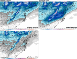
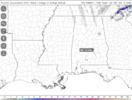
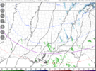
A few gefs members been showing this possibility.NAM has some streamers making it well into South Alabama late Wednesday night/early Thursday morning and even throws down nearly 1/2" near Montgomery.
View attachment 182833
View attachment 182834
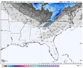
Cold and dry! UGH! maybe it will come back in two days... lets get this first mess out of the wayGFS is east of the 18z.View attachment 182842

