• Hello, please take a minute to check out our awesome content, contributed by the wonderful members of our community. We hope you'll add your own thoughts and opinions by making a free account!

Pattern January Joke

I do recall the UK leading the way for good or bad on a storm or two in the last few years, and also know that we historically trust UK/ Euro over GFS/ GEM/ ICON combo if the UK and Euro are showing the same or similar solution. They seem worlds apart in their surface depiction, but this is another one of those fickle make or break setups where a small adjustment here or there can do wonders.
 
I do recall the UK leading the way for good or bad on a storm or two in the last few years, and also know that we historically trust UK/ Euro over GFS/ GEM/ ICON combo if the UK and Euro are showing the same or similar solution. They seem worlds apart in their surface depiction, but this is another one of those fickle make or break setups where a small adjustment here or there can do wonders.
I believe the UK lead the way last year on a couple of storms whether it was them drying up or trending to the gulf coast.
 
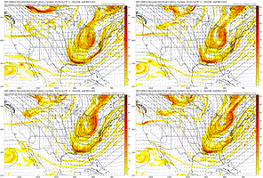
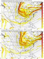
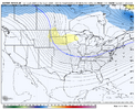
Icon did show some returns east of the mountains but off the first initial shortwave/energy, maybe might provide some flakes but the one we truly need to be paying attention to is that wound up northern stream coming out of Canada, the further west, the better. That’s the energy the UK likes IMG_2253.jpeg
 
Icon did show some returns east of the mountains but off the first initial shortwave/energy, maybe might provide some flakes but the one we truly need to be paying attention to is that wound up northern stream coming out of Canada, the further west, the better. That’s the energy the UK likes View attachment 182781

It doesn't look like it needs to shift very far west to match up with the Ukie. Middle of the dakotas should do it.

Here's the model scores link below. Looks like the Ukie does pretty well still. 🤷‍♂️

Model Scores
 
I unironically trust the GFS more than the ukmet based on its history and the fact that this weekend will be a nw flow event, its not feasible to get several inches east of the WEST facing mountains with that setup.
It may end up being flat wrong, but the last 2 hits on the UKMet had a deeper diving upper wave with a surface frontal wave / low tracking from the gulf to off the Carolina coast. Not a NW flow event
 
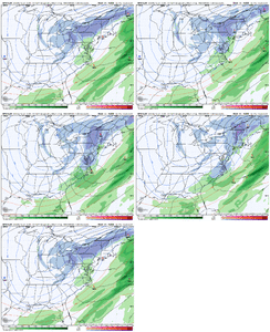
5e268de0c0b0341d9fd63677891ad10f.gif

I could be wrong, but the GFS might be making strides toward be favorable with that second wave


Sent from my iPhone using Tapatalk
 
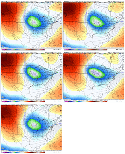
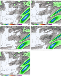
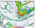
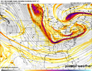
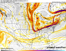
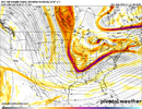
As early as day four, the stark difference between the GFS and UKMET can be seen in Canada. The UK has a stout closed ULL diving southward toward the Dakotas, while the GFS has a strung-out piece of energy that is later absorbed by the leading trough and is rather benign. Caution here, as the 12Z EMCF was more in the GFS camp than the UK.

Then there's the 18Z ICON, which is similar to the UKMET only further east. A lot can and will change, but we should have a good idea if this ULL feature has legs or not in the next 12-24 hours or so.ukmo_global-500hv-conus-2026011212-108.pnggfs-500hv-conus-2026011218-108.pngicon-500hv-conus-2026011218-108.png
 
Is it possible for the people that don’t k other they are looking at to not post a play by play as models come out? Have some people saying no and some yes………
 
Back
Top