-
Hello, please take a minute to check out our awesome content, contributed by the wonderful members of our community. We hope you'll add your own thoughts and opinions by making a free account!
You are using an out of date browser. It may not display this or other websites correctly.
You should upgrade or use an alternative browser.
You should upgrade or use an alternative browser.
Pattern January Joke
- Thread starter SD
- Start date
or very close too itGotta be phase 8 going to work
NBAcentel
Member
CNCsnwfan1210
Member

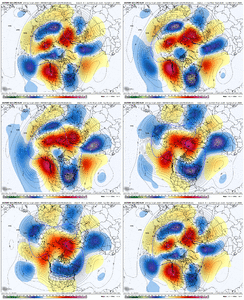
Likeable change in the 500mb in the 9-14 day on the EPS. Colder run for sure. Gas weighted demand went up too.
Sent from my iPhone using Tapatalk

Likeable change in the 500mb in the 9-14 day on the EPS. Colder run for sure. Gas weighted demand went up too.
Sent from my iPhone using Tapatalk
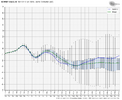
Speaking of gas-weighted, 12Z GEFS HDDs rose by 14 vs the 6Z. But the 12Z EPS rose a whole lot more than that. My guess is +24 (actual # not out yet). As a result, NG rose ~8% making it the best day for bulls since Dec 22nd. It rose steadily through the day from 9:30AM through 2:15PM (see the rare 5 hour smooth rise on the chart below):

Tsappfrog20
Member
Speaking of gas-weighted, 12Z GEFS HDDs rose by 14 vs the 6Z. But the 12Z EPS rose a whole lot more than that. My guess is +24 (actual # not out yet). As a result, NG rose ~8% making it the best day for bulls since Dec 22nd. It rose steadily through the day from 9:30AM through 2:15PM (see the rare 5 hour smooth rise on the chart below):
View attachment 182755
Don’t know if this means good news for snow or colder weather but if so then I’m happy lol
Sent from my iPhone using Tapatalk
NG goes up when there is a risk of cold weather.Don’t know if this means good news for snow or colder weather but if so then I’m happy lol
Sent from my iPhone using Tapatalk
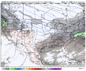
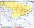
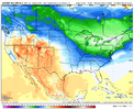
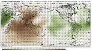
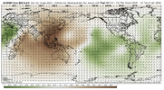
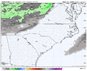
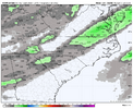
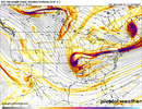
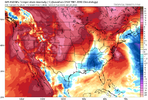
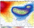
Blocking and a 50/50 would help. With the flow being so progressive, we really need a tall, well-placed western ridge or a goodly amount of well-placed blocking. Or both. I don't hate the PNA ridge for the weekend storm. The orientation could use a little work. But we almost need it to be perfect. And all that energy running over top of the ridge creates frequent kickers. You can see that here, keeping the flow very progressive.We are gonna snow or ice eventually. Can’t just stay cold/dry forever, it’s eventually gotta sync up, if it doesn’t, I give up View attachment 182748View attachment 182749View attachment 182750
If memory serves, the EPS H5 map isn't far away from some classic SE and EC winter storms, in terms of the low anomaly placement. Probably could stand to be centered over western TN. But we got a fast flow out front and behind.
I always talk about the window for winter storms in the SE. We have a very good cold source. We're essentially in peak climo. We have energy to work with. We have ridging out west. We have high pressure and pretty good thermals. The window is open, and it isn't the worst setup in the world. But it ain't open wide. It's harder than ever to snow in the Southeast. So we need to open the window as wide as possible to avoid so many thread-the-needle events.
Cold first. We have that, so CHECK. Now, let's get the stars to align. I think they will as we head through the winter. I don't see any indication that February will suck this year. IMO, the tougher path is going to be to avoid wintry weather the rest of the winter than to actually get it.
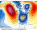
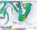
Very few longer duration cold patterns in this region that didn't produce something. A lot of activity on the eps but very few big dogs. Keep the cold in play or close by and it'll be fine
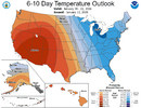
The 12Z GEFS and EPS means late in their runs both had a great combo for E US cold of a -AO, -EPO, and -WPO. The NAO is slightly negative on the EPS and ~neutral on the GEFS. The PNA rises to neutral from its prior ~7 days of being negative. Overall, that’s a combo of indices favoring cold in the E US. The MJO is then mainly in 7 and trying to go into 8. If it does, watch out! But if it stalls there and mainly avoids it, the still mainly mild Euro Weeklies for the bulk of Feb would have a better chance of being right.
Last edited:
NBAcentel
Member
CNCsnwfan1210
Member
That look has been steady since last week, correct?
Sent from my iPhone using Tapatalk
Stormlover
Member
NBAcentel
Member
CNCsnwfan1210
Member
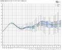
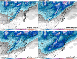
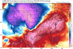
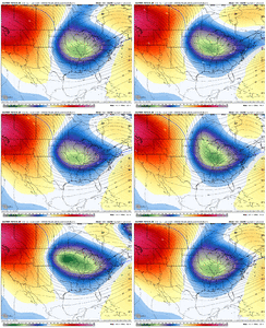
UKMET ens (MOGREPS-G) trend View attachment 182766
Man that’s a hot trend, let’s hope that model suite is on to something.
Sent from my iPhone using Tapatalk
Wish we could get that skill score chart for all the models. I see it posted from time to time, but I don't know where I comes from. Can't see it on WB, but maybe on Weather Models or something.
NCWeatherNow
Member
Same model that predicted 130-150f heat index last summer with the heat wave btwWish we could get that skill score chart for all the models. I see it posted from time to time, but I don't know where I comes from. Can't see it on WB, but maybe on Weather Models or something.
NBAcentel
Member
In the summer it has a bias of basically matching the T/D, I can recall seeing stuff like 90 with a dew of 84, has nothing to do with H5 though, that’s just a planetary boundary layer bias it has with going crazy with low level moisture during the evening hoursSame model that predicted 130-150f heat index last summer with the heat wave btw
SimeonNC
Member
If only literally any other models/ens suite followed this trend, I'd be more excited. It's hard to trust a model that's on an island with a solutionUKMET ens (MOGREPS-G) trend View attachment 182766
Last year that was the Canadian re: the big gulf storm right? It didn't pan out as crazy as the Canadian's version but eventually all the models folded into the idea of the storm at all.If only literally any other models/ens suite followed this trend, I'd be more excited. It's hard to trust a model that's on an island with a solution
not an endorsement of the model but this is likely more of an issue rendering surface dewpoint rather than real miscues on the underlying meteorologySame model that predicted 130-150f heat index last summer with the heat wave btw
CNCsnwfan1210
Member
Wish we could get that skill score chart for all the models. I see it posted from time to time, but I don't know where I comes from. Can't see it on WB, but maybe on Weather Models or something.
AI (FWIW) says it’s in the top 3 consistently highest ranked global deterministic models with an ACC >0.8
Sent from my iPhone using Tapatalk
The thing is that it’s fairly similar with its H5 depictionIf only literally any other models/ens suite followed this trend, I'd be more excited. It's hard to trust a model that's on an island with a solution
Tsappfrog20
Member
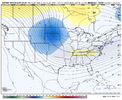
Not that I trust the ICON however there are some changes from the 12 to 18z
Sent from my iPhone using Tapatalk
Sent from my iPhone using Tapatalk
iGRXY
Member
ICON Looks improved at H5
Tsappfrog20
Member
ICON Looks improved at H5
I agree I saw that too
Sent from my iPhone using Tapatalk
iGRXY
Member
NCHighCountryWX
Member
- Joined
- Dec 28, 2016
- Messages
- 699
- Reaction score
- 1,918
Afternoon Official Guidance - NWS GSP
DISCUSSION
KEY MESSAGE 1: LOW RELATIVE HUMIDITY THROUGH THE EVENING MAINLY EAST
OF THE MOUNTAINS, BUT RELATIVELY QUIET WEATHER THROUGH TUESDAY
NIGHT.
HIGH PRESSURE BUILDS BACK INTO THE SOUTHEAST THROUGH TUESDAY,
KEEPING RAINFALL CHANCES SUPPRESSED. AS THE HIGH PRESSURE AXIS
SHIFTS EASTWARD TONIGHT, THE AIR MASS STARTS TO MODIFY AS SURFACE
WINDS TURN SW. WITH THE SOUTHWEST WINDS, MOISTURE SLOWLY ADVECTS
INTO THE AREA THROUGH TUESDAY NIGHT. THE MAIN CONCERN FOR MONDAY ARE
THE LOW RH VALUES OF 25-30% EAST OF THE MOUNTAINS AS VERY DRY AIR
MIXES INTO THE BOUNDARY LAYER. FIRE CONCERNS REMAIN EVEN WITH LIGHT
WINDS THROUGH THE EVENING, DESPITE THE LOW RH. TUESDAY AFTERNOON
LOOKS SIMILAR BUT WITH A SLIGHT INCREASE IN RH AS THE SOUTHWESTERLY
SURFACE WINDS INCREASE MOISTURE. TEMPERATURES CREEP UP INTO THE
NORMAL RANGE TODAY AND TICK UP INTO THE MID TO UPPER 50S FOR
TUESDAY. OVERNIGHT LOWS TONIGHT REMAIN JUST BELOW FREEZING, BUT
MOSTLY ABOVE FREEZING TUESDAY NIGHT.
KEY MESSAGE 2: ACCUMULATING SNOWFALL ALONG THE TN BORDER,
ESPECIALLY ABOVE 3500 FT IS EXPECTED WEDNESDAY NIGHT THROUGH
THURSDAY, WHICH MAY RESULT IN POSSIBLE IMPACTS TO ROADWAYS.
A DEEP UPPER TROUGH WILL SWING THRU THE OH/TN VALLEYS WEDNESDAY
AND EACH THE CENTRAL AND SOUTHERN APPALACHIANS ON THURSDAY. THE
LATEST GFS AND ECMWF BOTH SHOW AN UPPER LOW CLOSING OFF OVER THE
SOUTHERN GREAT LAKES WED-THU. THIS IS A LITTLE NORTH COMPARED TO
PREVIOUS RUNS. A QUICK SLUG OF MOISTURE AND DEEP SYNOPTIC FORCING
WILL ACROSS THE AREA WITH THE TROUGH LATE WEDNESDAY, WITH MOST OF
THE RESULTANT PRECIP FALLING IN THE MOUNTAINS. SPOTTY LIGHT RAIN
MAY FALL EAST OF THE MOUNTAINS AS THE WAVE PASSES, BUT IT LOOKS
TOO WARM FOR SNOW EXCEPT ABOVE ABOUT 3500 FT. THE THE FLOW WILL
TURN OUT OF THE NW, WITH UPSLOPE SHOWERS RAMPING UP OVERNIGHT THRU
DAYBREAK THURSDAY. OVERALL, THE MODEL TRENDS HAVE SHORTENED THE
DURATION OF PRECIP ACROSS THE MOUNTAINS THRU THE EVENT, AND THUS,
SNOW AMOUNTS HAVE TRENDED LOWER. WITH THAT SAID, CONFIDENCE IS STILL
PRETTY HIGH THAT ADVISORY-LEVEL SNOW ACCUMS WILL OCCUR ACROSS THE
MOUNTAINS NEAR THE TN BORDER, WITH HIGHEST AMOUNTS ALONG THE HIGH
PEAKS. BUT WARNING CRITERIA OF >4" OUTSIDE THE HIGHEST PEAKS IS
LOOKING LESS LIKELY WITH THE LATEST FORECAST. WE'LL SEE IF THIS
IS JUST A WAFFLING OF THE GUIDANCE, OR A PERSISTENT TREND.
THE BULK OF THE SNOW LOOKS TO FALL FROM EARLY WEDNESDAY EVENING
THRU EARLY THURSDAY MORNING, TAPERING OFF TO MAINLY SOME FLURRIES
THURSDAY AFTN. EARLIER MODEL RUNS HAD HINTED AT SOME SHOWERS
BREAKING CONTAINMENT THURSDAY WITH SPOTTY VERY LIGHT SNOW ACCUMS
POSSIBLE IN THE NC PIEDMONT. BUT WITH LOW PRESSURE NOW TRENDING
FURTHER NORTH AND OVERALL DRIER CONDITIONS EAST OF THE MOUNTAINS,
SNOW CHANCES HAVE ALMOST COMPLETELY DISAPPEARED OUTSIDE THE
MOUNTAINS WITH THE LATEST FORECAST. TEMPS WILL BE NEAR NORMAL
WEDNESDAY NIGHT/THURSDAY MORNING, BUT STRONG CAA WILL RESULT IN
NEAR STEADY TEMPS IN THE MOUNTAINS AND ONLY SLIGHT WARMING EAST,
RESULTING IN HIGHS WELL BELOW NORMAL. IT WILL BE WINDY ACROSS THE
MOUNTAINS WEDNESDAY NIGHT THRU THURSDAY, AND BREEZY EVERYWHERE
DURING THE DAY THURSDAY. BUT WITH THE LOW NOW LIKELY A LITTLE
FURTHER NORTH, GUSTS ARE LOOKING TO REMAIN BELOW ADVISORY CRITERIA,
EXCEPT ABOVE AROUND 5000 FT.
KEY MESSAGE 3: SIGNIFICANTLY COLDER TEMPERATURES ARRIVE THURSDAY
AND CONTINUE THROUGH THE WEEKEND. DANGEROUSLY COLD WIND CHILLS WILL
BE POSSIBLE ABOVE 3500 FT THURSDAY NIGHT THROUGH FRIDAY MORNING.
THE UPPER TROUGH WILL SWING EAST OF THE AREA BY EARLY FRIDAY,
ALLOWING WINDS TO WEAKEN AND NW FLOW UPSLOPE SHOWER ACTIVITY TO
END. TEMPS WILL PLUMMET INTO THE TEENS AND SINGLE DIGITS IN THE HIGH
TERRAIN WITH WIND CHILLS LIKELY BELOW ZERO OVERNIGHT THURSDAY NIGHT
THRU FRIDAY MORNING IN ELEVATIONS ABOVE 3500 FT. A COLD ADVISORY MAY
BE NEEDED FOR PART OF THE MOUNTAINS. IT WILL BE COLD ELSEWHERE, WITH
WIND CHILLS IN THE SINGLE DIGITS IN THE MOUNTAIN VALLEYS AND TEENS
IN THE PIEDMONT. FROM THERE, ANOTHER STRONG SHORTWAVE WILL DIVE
INTO THE MEAN EASTERN CONUS LONGWAVE TROUGH AND REINFORCE WELL-BELOW
NORMAL TEMPS FRIDAY THRU THE WEEKEND. MODELS ARE IN A LITTLE BETTER
AGREEMENT ON THIS WAVE, BUT SHOW THAT IT WILL BE MOISTURE-STARVED
AS IT CROSSES THE SOUTHEAST, AND STILL DISAGREE ON TIMING. A QUICK
SHOT OF SNOW MAY OCCUR SATURDAY NIGHT OR SUNDAY IN THE MOUNTAINS,
WITH LITTLE TO NO POPS EAST. GUSTY WINDS AND DANGEROUS WIND CHILLS
MAY OCCUR AGAIN IN THE HIGH TERRAIN WHENEVER THAT WAVE PASSES,
THOUGH NEITHER ARE EXPECTED TO REACH ADVISORY CRITERIA AT THIS TIME.
NCWeatherNow
Member
I unironically trust the GFS more than the ukmet based on its history and the fact that this weekend will be a nw flow event, its not feasible to get several inches east of the WEST facing mountains with that setup.
Go with ensembles at this range! Atmospheric chaos, op models can’t handle well!
iGRXY
Member
CNCsnwfan1210
Member
Definitely better moisture response
Sent from my iPhone using Tapatalk
RDU has about a tenth of an inch of rainfall over the last three weeks, so I wouldn’t count on that!We are gonna snow or ice eventually. Can’t just stay cold/dry forever, it’s eventually gotta sync up, if it doesn’t, I give up View attachment 182748View attachment 182749View attachment 182750
NBAcentel
Member
SnowNiner
Member
UKMET ens (MOGREPS-G) trend View attachment 182766
Thats impressive for sure. It's ensembles going that strong for a storm, plus the last two op runs tells me it's convinced . It's taking that vort right or wrong, digging, turning, and roody pooing it right over the SE.
UK against the world though.
NBAcentel
Member

