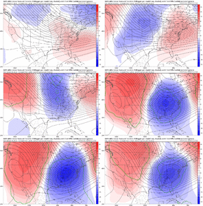
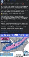
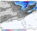
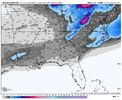
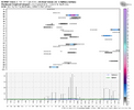
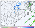
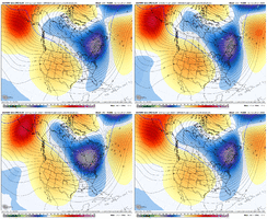
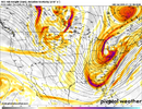
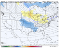
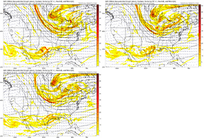
I'm hoping the latest model runs are a sign of more positive trends to come. There are many solutions that may occur for both events. We will know more about the first potential storm when the energy reaches the West Coast and it can be sampled. The next threat will still be a wait and see but it would be nice to receive a one two winter weather punch.
-
Hello, please take a minute to check out our awesome content, contributed by the wonderful members of our community. We hope you'll add your own thoughts and opinions by making a free account!
You are using an out of date browser. It may not display this or other websites correctly.
You should upgrade or use an alternative browser.
You should upgrade or use an alternative browser.
Pattern January Joke
- Thread starter SD
- Start date
Do you really want to be in the bullseye days out??????
iGRXY
Member
I like the N/S slowing down and digging west a lot. I think we aren’t far at all from an I20 north special. I still lean to the 2nd storm having the best option to score here. I also think you’ll see the flow in the northern branch slow down the closer we get IF we continue strengthening storm 1. That’s the key. You want it bombing as it goes NE. It would likely be the rare ice to snow changeover for those of us east of the apps if we can get the players on the field to cooperate
FoothillsWX
Member
I’d be worried if we lost the energy all together. I refuse to be worried this far out by Ops that have performed terribly trying to blindly throw darts on energy that isn’t even on land yet.
Mahomeless
Member
Glad the mods changed your attitudeIn my opinion.
Models are still having a hard time figuring out the next week or so.
Realistically we might start seeing model agreement by the middle to later part of this week.
We might not get a storm sure, but the ceiling is pretty high with this overall setup so if everything lines up there could easily be snowfall.
I-10 is the new I-85 and I-20 is the newSecond Jan in a row for Gulf coast snow?
View attachment 182248
I-40?
I saw a graphic a few days ago I think is was from Tim Buckley and it said that we needed just about this much rain in order to really handle our drought situation because we are at Severe Drought rnView attachment 182257
Hope those of yall to the East get something like this soon. @JHS look at this
Sent from my A600DL using Tapatalk
He misses about 90% of the timeSnowbirdBob might be putting the hex on the western storm path. Jimmy like View attachment 182268
SnowbirdBob might be putting the hex on the western storm path. Jimmy like View attachment 182268
He wants the clicks on his page. Kinda like the National Enquirer back in the day.He misses about 90% of the time
accu35
Member
Crazy thing is, he might actually be right this time lol. Seeing the models signaling a storm. We can hopeHe wants the clicks on his page. Kinda like the National Enquirer back in the day.
AKA-BAMSnowbirdBob might be putting the hex on the western storm path. Jimmy like View attachment 182268
LongRanger
Member
What does he know Besides hype?SnowbirdBob might be putting the hex on the western storm path. Jimmy like View attachment 182268
Schools being cancelled as we speakOrder the pizza. View attachment 182247
I'm telling y'all. Come up here where I'm at in Beech Mountain. 5300" elevation, right on the TN/NC line, western facing slopes, non tourist trap places like in Pigeon Forge (other than ski resort). Y'all come on up and we will have a nice ole party. I don't know if I want to see 26" like it shows here on this map though.Nashville or Gatlinburg? Where is the weenie-mobile heading?
View attachment 182217
Y’all better listen to this manI'm telling y'all. Come up here where I'm at in Beech Mountain. 5300" elevation, right on the TN/NC line, western facing slopes, non tourist trap places like in Pigeon Forge (other than ski resort). Y'all come on up and we will have a nice ole party. I don't know if I want to see 26" like it shows here on this map though.
accu35
Member
At first I though this was now lolHere was the eps and gefs snow means at roughly the same juncture before the big gulf coast blizzard. Signal, but far from dialed View attachment 182271View attachment 182272
packfan98
Moderator
Yeah, we are nowhere close to this type of signal yet. We are 1/2” for one system and 1/2” for another approximately. I’m definitely hoping we get solidly in the 1-2” mean s by Monday’s runs.Here was the eps and gefs snow means at roughly the same juncture before the big gulf coast blizzard. Signal, but far from dialed View attachment 182271View attachment 182272
packfan98
Moderator
Drizzle Snizzle
Member
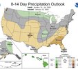
Can’t buy into them maps.Very dry in the southeast from Jan 18-24. The dry signal seems to be increasing compared to yesterday.
View attachment 182276
LongRanger
Member
That will change tomorrow, They're maps never verifyVery dry in the southeast from Jan 18-24. The dry signal seems to be increasing compared to yesterday.
View attachment 182276
NEGaweather
Member
Very dry in the southeast from Jan 18-24. The dry signal seems to be increasing compared to yesterday.
View attachment 182276
It changes everyday
Sent from my iPhone using Tapatalk
- Joined
- Jan 5, 2017
- Messages
- 3,770
- Reaction score
- 5,969
63.9 degrees, .67" total for this system.
NBAcentel
Member
NCWeatherNow
Member
Only the weekday outlooks are 100% human forecastersVery dry in the southeast from Jan 18-24. The dry signal seems to be increasing compared to yesterday.
View attachment 182276
CNCsnwfan1210
Member
Weird ob for January:76 degrees with seagulls seen in the area 125 miles inland
Sent from my iPhone using Tapatalk
Sent from my iPhone using Tapatalk
Looks like my final tally is 3.97”.
We’ve received 0.0 here in Columbia.
NCHighCountryWX
Member
- Joined
- Dec 28, 2016
- Messages
- 699
- Reaction score
- 1,918
GSP Guidance
KEY MESSAGE #1: A MORE ACTIVE PATTERN CAN BE EXPECTED THROUGH THE
LONG TERM WITH PRECIPITATION CHANCES RETURNING.
A LARGE UPPER TROUGH WILL SWING ACROSS THE EASTERN CONUS WEDNESDAY
INTO THURSDAY. THIS WILL DRAG A PAIR OF SURFACE COLD FRONTS ACROSS
THE FORECAST AREA ON WEDNESDAY BEFORE THE FRONTS PUSH EAST EARLY
THURSDAY. THE LATEST GFS APPEARS TO BE THE MOST BULLISH REGARDING
MOISTURE, SHOWING PRECIP CHANCES AREA-WIDE DURING THE MIDDLE OF THE
WEEK AS THE MODEL DEPICTS A CUT OFF LOW DEVELOPING RIGHT OVER THE
CAROLINAS. MEANWHILE, THE CANADIAN AND ECMWF KEEP MOISTURE CONFINED
TO MAINLY THE NORTH CAROLINA MOUNTAINS AS THESE MODELS DO NOT DEPICT
A CUT OFF LOW DEVELOPING. WITH MODELS STILL NOT IN AGREEMENT
REGARDING HOW MUCH MOISTURE WILL BE AVAILABLE WITH THIS SYSTEM,
CONFIDENCE ON POPS REMAINS LOW FOR NOW. TEMPERATURES SHOULD BE COLD
ENOUGH TO ALLOW NORTHWEST SNOW TO DEVELOP BEHIND THE FRONT ACROSS
THE NORTH CAROLINA MOUNTAINS WEDNESDAY NIGHT INTO EARLY THURSDAY.
LIGHT SNOW ACCUMULATIONS LOOK PLAUSIBLE FOR MOST COUNTIES ALONG THE
NC/TN BORDER BUT ELEVATIONS ABOVE 4,000 FEET COULD SEE A FEW INCHES
OF SNOW DEVELOP. AREAS ALONG AND NORTH OF I-40 COULD ALSO SEE A
BRIEF SHOT OF LIGHT SNOW EARLY THURSDAY MORNING BUT CONFIDENCE IS
VERY LOW AND WILL BE HIGHLY DEPENDENT ON HOW FAR EAST MOISTURE
DEVELOPS. ELSEWHERE, TEMPERATURES SHOULD END UP WARM ENOUGH FOR RAIN
IF PRECIP DEVELOPS. ANOTHER FRONT PUSHES ACROSS THE AREA LATE FRIDAY
INTO EARLY SATURDAY, POSSIBLY BRINGING SOME LIGHT PRECIPITATION TO
THE SPINE OF THE APPALACHIANS. ABOVE NORMAL TEMPERATURES LINGER
THROUGH WEDNESDAY NIGHT BEFORE BELOW NORMAL TEMPERATURES RETURN THE
REST OF THE PERIOD.
trackersacker
Member
I don’t wanna jinx it , but I feel like we’re already trending towards a quicker and further west phase on the 18z GFS than we had on 12z
trackersacker
Member
Here. We. Go.

